
Capital Beltway dot com
| Woodrow Wilson Bridge Project Photos - March 2008 |
The following photos show various views of the I-95/I-495 Woodrow Wilson Bridge (WWB) Project construction.
The following 25 photos were taken on March 9, 2008, by Roads to the Future. They were all taken with a 2.6x telephoto lens. This is a drive eastbound over the new Woodrow Wilson Bridge and approaches, from Virginia to Maryland.
Click on the photo to get a large version of the photo. The large photos have sizes ranging from 120 to 252 kilobytes, with most of them being under 174 kilobytes. With a broadband or network Internet connection each photo will download within seconds, but with a dial-up Internet connection it will be somewhat slower.
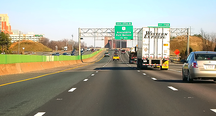 |
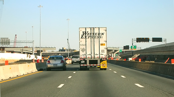
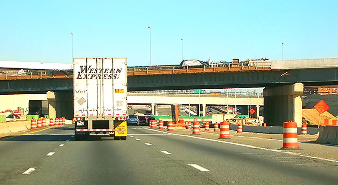
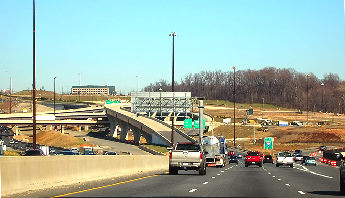
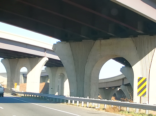
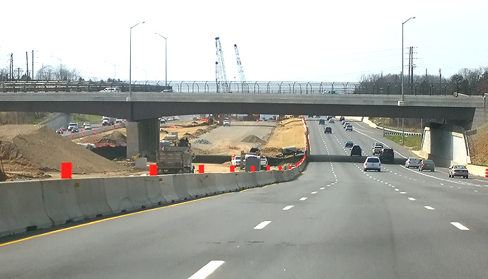
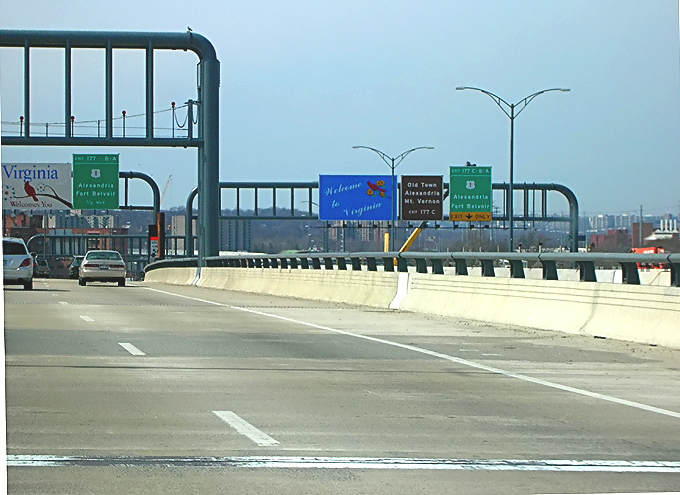
I-95/I-495 Capital Beltway, eastbound (Outer Loop,
toward WWB), approaching the VA-241 Telegraph Road interchange, Virginia Exit
176. The Beltway passes over Cameron Run on a bridge just before the upgrade
in the highway ahead, notice the expansion joints of the bridge.
This segment of the Beltway will be reconstructed in the Telegraph Road segment of the Woodrow Wilson Bridge Project, a $236 million contract which just began construction, and this contract includes raising the Beltway roadways to provide 5 feet more elevation over Cameron Run to provide a higher resistance to flooding in heavy rainstorm conditions. Per the VDOT Dashboard entry for the project on March 16, 2008, the Contract Award was $236,393,188, the Contract Execution Date was February 12, 2008, and the Original Specified Completion Date is June 30, 2013. The Contract Execution Date includes the Notice to Proceed for the contractor. The construction contractor is CK Constructors, a joint venture of Corman Construction, Inc., and Kiewit Corporation. The contract to rebuild the I-95/I-495 interchange at Telegraph Road, and the remainder of the Beltway between the US-1 Interchange project segment and the Eisenhower Avenue Connector interchange (Virginia Exit 174), will take 5 years to complete. The contract includes 11 ramps and bridges, 5 box culvert extensions, drainage improvements, retaining walls, overhead signs, noise walls, pedestrian paths, landscaping, and environmental mitigation. |
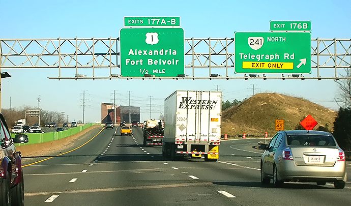 |
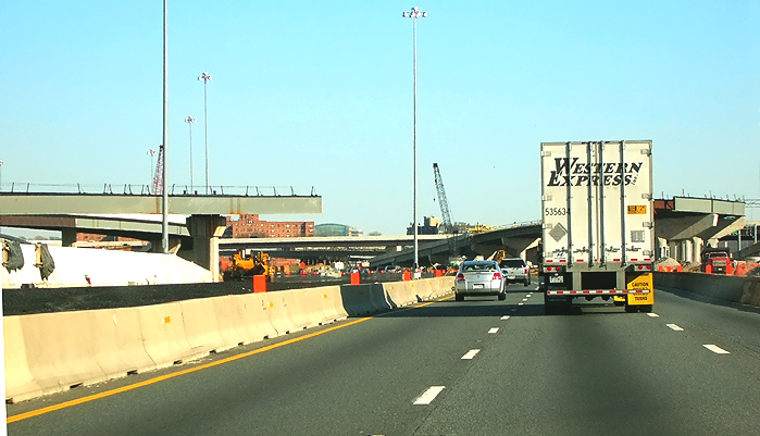
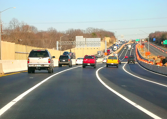
I-95/I-495 Capital Beltway, eastbound (Outer Loop), at the VA-241 Telegraph Road interchange, Virginia Exit 176. The Beltway passes over Cameron Run on a bridge just before the upgrade in the highway ahead, notice the expansion joints of the bridge. |
 |
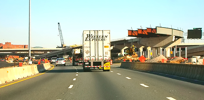
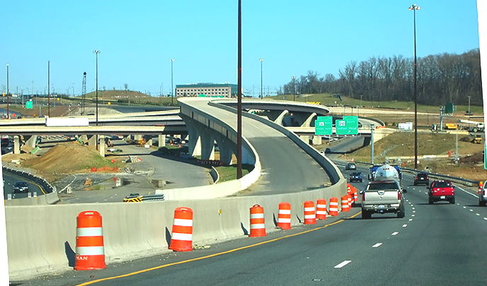
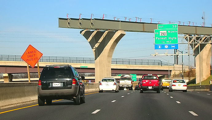
I-95/I-495 Capital Beltway, eastbound (Outer Loop), at the VA-241 Telegraph Road interchange. The bridge immediately ahead is the semi-directional ramp from the Outer Loop to northbound VA-241. The construction of the U.S. I Interchange segment of the WWB Project, is visible ahead. |
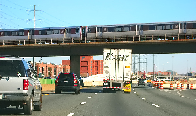 |
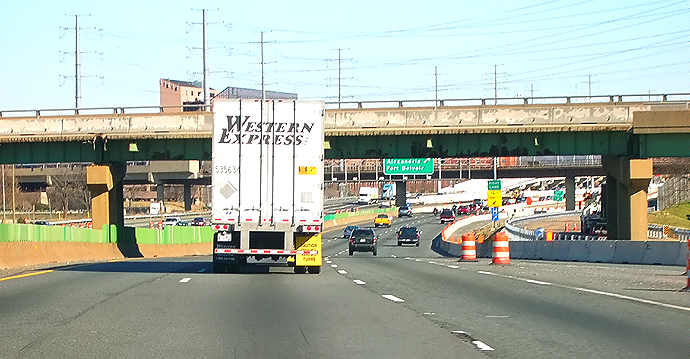
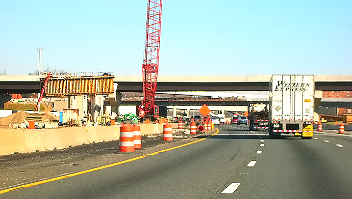
I-95/I-495 Capital Beltway, eastbound (Outer Loop), at the VA-241 Telegraph Road interchange. The construction of the U.S. I Interchange segment of the WWB Project, is visible ahead. The WMATA Metro rapid rail transit line Huntington Route (Yellow Line trains) runs on aerial structure, over the Beltway immediately ahead, notice the Metro train that is passing across the bridge. |
 |
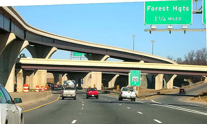
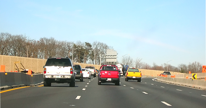
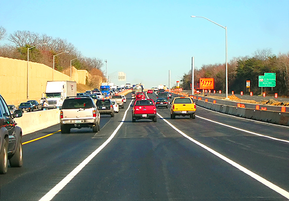
I-95/I-495 Capital Beltway, eastbound (Outer Loop), approaching the U.S. 1 interchange, Virginia Exit 177. The elevated roadway to the right, is the recently constructed Beltway Outer Loop local roadway, currently being used only for ramp access to US-1, pending completion of the Outer Loop local roadway. |
 |
I-95/I-495 Capital Beltway, eastbound (Outer Loop), approaching the U.S. 1 interchange, Virginia Exit 177. The partially completed overhead bridge ahead, will be the new ramp from the Eisenhower Valley to the Beltway Outer Loop. |
 |
I-95/I-495 Capital Beltway, eastbound (Outer Loop), approaching the U.S. 1 interchange. The partially completed overhead bridge ahead, will be the new ramp from the Eisenhower Valley to the Beltway Outer Loop. |
 |
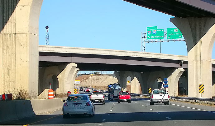
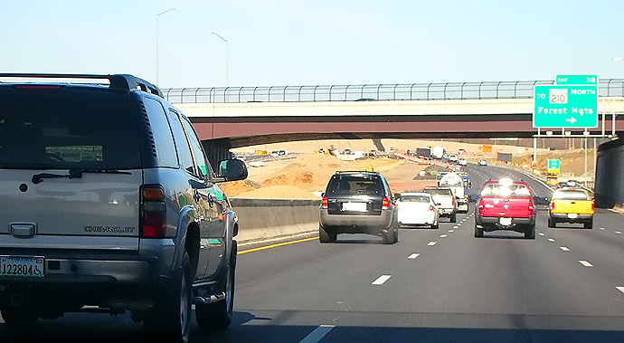
I-95/I-495 Capital Beltway, eastbound (Outer Loop), at the U.S. 1 interchange. |
 |
I-95/I-495 Capital Beltway, eastbound (Outer Loop), at the U.S. 1 interchange. The overhead bridge ahead, is US-1. Visible in the distance is the Washington Street Urban Deck, which passes over the Beltway. |
 |
New (opened mid-2006) 6-lane Outer Loop
Woodrow Wilson Bridge,
on the 3-lane roadway which will be the
Beltway Outer Loop local roadway when the WWB Project is complete, heading
eastbound toward Maryland. The bascule span has been passed, and the
roadway has a downgrade to the Maryland shore. The maximum grade on the new WWB
Maryland approach is 2.30% near the Maryland shore, and is 1.20% approaching
the high point of the bridge.
After the 6-lane Inner Loop Woodrow Wilson Bridge (nearing completion, visible to the left) opens to traffic in mid-2008, the final configuration of the new twin-span WWB will accommodate 4 separate 3-lane roadways on an express/local arrangement. |
 |
Woodrow Wilson Bridge, heading eastbound toward Maryland. The I-295 interchange construction is visible in the distance. |
 |
Woodrow Wilson Bridge, heading eastbound toward Maryland. The Maryland end of the bridge is near the overpass under construction, which is for the pedestrian and bicycle trail that will connect from the north side of the new bridge, across Rosalie Island, to Maryland. The pedestrian and bicycle trail across the new bridge will connect the system of pedestrian and bicycle trails in Maryland and Virginia. |
 |
I-95/I-495 Capital Beltway, eastbound (Outer Loop), on the 3-lane roadway which will be the Beltway Outer Loop local roadway when the WWB Project is complete, approaching the I-295 interchange. The new I-295 interchange is under construction, as part of the WWB Project. |
 |
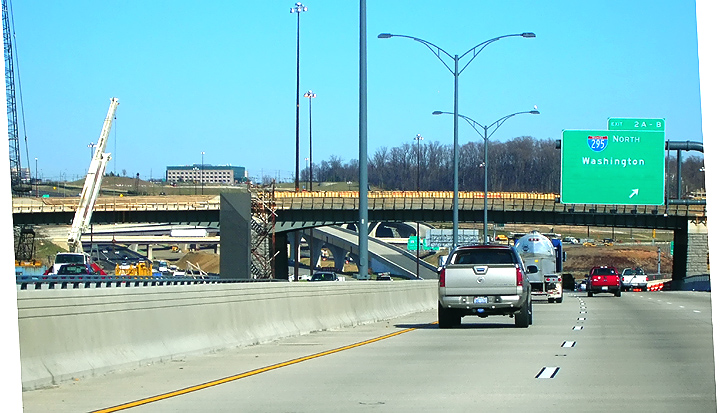
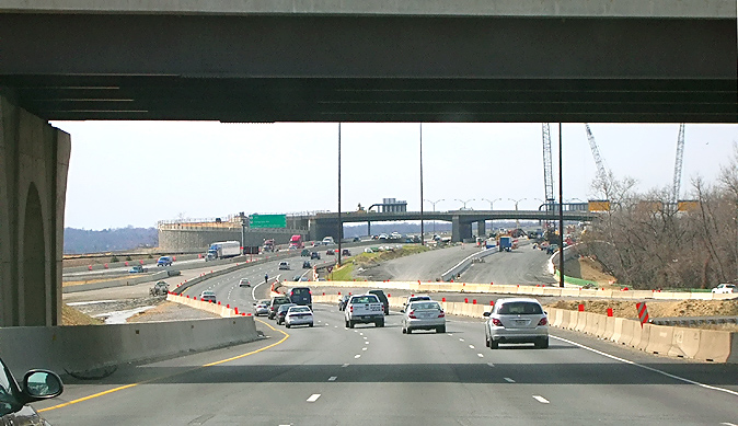
I-95/I-495 Capital Beltway, eastbound (Outer Loop), on the 3-lane roadway, approaching the I-295 interchange, Maryland Exit 2. The elevated ramp under construction is the ramp from the Beltway Outer Loop express roadway, to southbound MD-210 Indian Head Highway. Just to the left of the under construction elevated ramp, is the under construction 3-lane express roadway for the Outer Loop, and the earthen area just to the left of that, is the under construction 3-lane express roadway for the Inner Loop. |
 |
I-95/I-495 Capital Beltway, eastbound (Outer Loop), on the 3-lane roadway, at the I-295 interchange. The elevated ramp under construction is the ramp from the Beltway Outer Loop express roadway, to southbound MD-210 Indian Head Highway. The intermediate level bridge will connect I-295 to National Harbor. |
 |
I-95/I-495 Capital Beltway, eastbound (Outer Loop), on the 3-lane roadway, at the I-295 interchange. The elevated ramp under construction is the ramp from the Beltway Outer Loop express roadway, to southbound MD-210 Indian Head Highway. The more distant bridge is I-295 as it curves across the Beltway. |
 |
I-95/I-495 Capital Beltway, eastbound (Outer Loop), on the 3-lane roadway, at the I-295 interchange. The bridges are I-295 as it curves across the I-95/I-495 Beltway. |
 |
I-95/I-495 Capital Beltway, eastbound (Outer Loop), on the 3-lane roadway which will be the Beltway Outer Loop local roadway when the WWB Project is complete, approaching the MD-210 Indian Head Highway interchange, Maryland Exit 3. The new MD-210 Indian Head Highway interchange is under construction, as part of the WWB Project. |
 |
I-95/I-495 Capital Beltway, eastbound (Outer Loop), approaching the MD-210 Indian Head Highway interchange. The new MD-210 Indian Head Highway interchange is under construction, as part of the WWB Project. The partially completed high bridge, is the ramp from northbound MD-210 to the Beltway Inner Loop (toward WWB). The bridge beyond that, is the new overpass for Bald Eagle Road. |
 |
I-95/I-495 Capital Beltway, eastbound (Outer Loop), at the MD-210 Indian Head Highway interchange. The bridge ahead is the new MD-210 bridges over the Beltway, and the bridge is over 400 feet long. At this section, both the Inner Loop and the Outer Loop roadways are on their respective new local roadway, and in between them the new 3-lane express roadways are under construction. |
 |
I-95/I-495 Capital Beltway, eastbound (Outer Loop), at the MD-210 Indian Head Highway interchange. |
 |
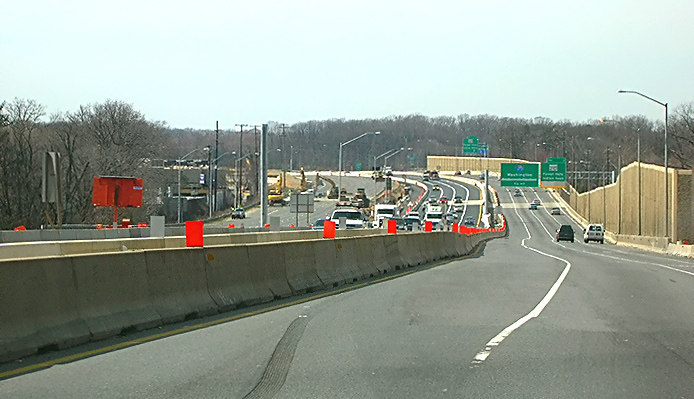
I-95/I-495 Capital Beltway, eastbound (Outer Loop), at the MD-210 Indian Head Highway interchange. Outer Loop traffic is temporarily shifted over to using the new permanent westbound (Inner Loop) express roadway, so that the eastbound (Outer Loop) roadway (visible to the right) can be reconstructed, including replacing the Beltway bridge over Livingston Road. |
 |
I-95/I-495 Capital Beltway, eastbound (Outer Loop), at the MD-210 Indian Head Highway interchange. Outer Loop traffic is temporarily shifted over to using the new permanent westbound (Inner Loop) express roadway, so that the eastbound (Outer Loop) roadway (visible to the right) can be reconstructed, including replacing the Beltway bridge over Livingston Road, and that bridge is the short tan-colored section of the highway a couple hundred yards ahead. |
 |
I-95/I-495 Capital Beltway, eastbound (Outer Loop), at the MD-210 Indian Head Highway interchange. Outer Loop traffic is temporarily shifted over to using the new permanent westbound (Inner Loop) express roadway. I-95/I-495 Capital Beltway westbound (Inner Loop) traffic is using the new permanent 3-lane local roadway for the Inner Loop. |
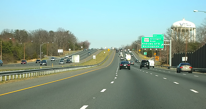 |
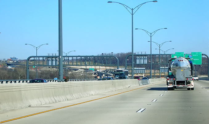
I-95/I-495 Capital Beltway, eastbound (Outer Loop), approaching the MD-337 Allentown Road / Andrews Air Force Base interchange, Maryland Exit 9. This is 5 miles beyond the limits of the WWB Project, and shows a generally typical view of the Maryland portion of the Capital Beltway. |
The following 7 photos were taken on March 10, 2008, by Roads to the Future. They were all taken with a 2.2x telephoto lens. This is a drive westbound over the new Woodrow Wilson Bridge and approaches, from Maryland to Virginia.
Click on the photo to get a large version of the photo. The large photos have sizes ranging from 138 to 201 kilobytes, with most of them being under 158 kilobytes. With a broadband or network Internet connection each photo will download within seconds, but with a dial-up Internet connection it will be somewhat slower.
 |
I-95/I-495 Capital Beltway, westbound (Inner Loop, toward WWB), on the new 3-lane roadway (temporarily 4 lanes) which will be the Beltway Inner Loop local roadway when the WWB Project is complete, approaching the MD-210 Indian Head Highway interchange, Maryland Exit 3. The new MD-210 Indian Head Highway interchange is under construction, as part of the WWB Project. |
 |
I-95/I-495 Capital Beltway, westbound (Inner Loop, toward WWB), on the new 3-lane roadway (temporarily 4 lanes) which will be the Beltway Inner Loop local roadway when the WWB Project is complete, approaching the MD-210 Indian Head Highway interchange. The new MD-210 Indian Head Highway interchange is under construction, as part of the WWB Project. Outer Loop traffic is temporarily shifted over to using the new permanent westbound (Inner Loop) express roadway, so that the eastbound (Outer Loop) roadway (visible to the far left) can be reconstructed, including replacing the Beltway bridge over Livingston Road, and that bridge is the short tan-colored section of the highway about 1/4 mile ahead. |
 |
I-95/I-495 Capital Beltway, westbound (Inner Loop, toward WWB), on the new 3-lane roadway (temporarily 4 lanes) which will be the Beltway Inner Loop local roadway when the WWB Project is complete, at the MD-210 Indian Head Highway interchange. The bridge ahead is the new MD-210 bridges over the Beltway, and the bridge is over 400 feet long. At this section, both the Inner Loop and the Outer Loop roadways are on their respective new local roadway, and in between them the new 3-lane express roadways are under construction. |
 |
I-95/I-495 Capital Beltway, westbound (Inner Loop, toward WWB), on the 3-lane roadway which will be the Beltway Inner Loop local roadway when the WWB Project is complete, at the I-295 interchange, Maryland Exit 2. The new I-295 interchange is under construction, as part of the WWB Project. The overhead bridge will connect I-295 to National Harbor. Website for National Harbor. The Maryland end of the Woodrow Wilson Bridge is near the distant overpass under construction, which is for the pedestrian and bicycle trail that will connect from the north side of the new Inner Loop WWB, across Rosalie Island, to Maryland. The pedestrian and bicycle trail across the new bridge will connect the system of pedestrian and bicycle trails in Maryland and Virginia. The traffic shift to the left, is the temporary roadway that connects the permanent Inner Loop local roadway temporarily to the new Outer Loop WWB. Visible in the center of the photo beyond the barricades, is the under construction 3-lane local and 3-lane express Inner Loop roadways. |
 |
New (opened
mid-2006) 6-lane Outer Loop Woodrow Wilson Bridge, near the Maryland end of
the bridge, heading westbound toward Virginia.
The maximum grade on the new WWB Maryland approach
is 2.30% near the Maryland shore, and is 1.20% approaching the high point
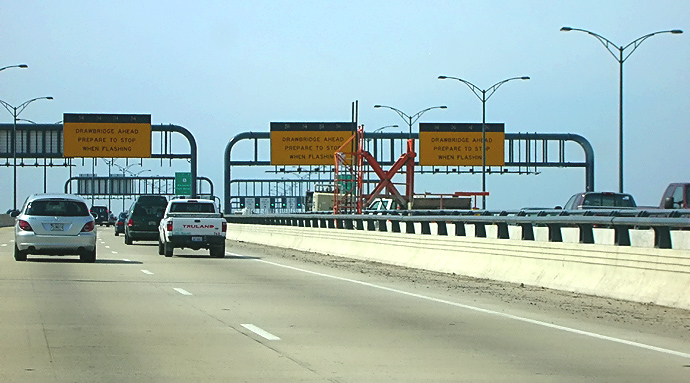
of the bridge. This photo shows the Beltway Inner Loop advance warning signs
for the drawspan of the Woodrow Wilson Bridge.
DRAWSPAN AHEAD This 3-lane roadway is temporarily being used for the Beltway Inner Loop (toward Virginia). After the 6-lane Inner Loop Woodrow Wilson Bridge (nearing completion, visible to the right) opens to traffic in mid-2008, this roadway will be reversed to be the 3-lane express roadway for the Outer Loop (toward Maryland). The final configuration of the new twin-span WWB will accommodate 4 separate 3-lane roadways on an express/local arrangement. |
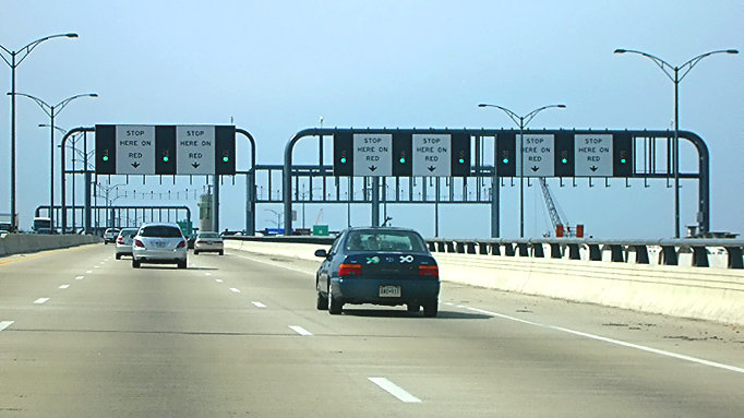 |
New (opened mid-2006) 6-lane Outer Loop Woodrow Wilson Bridge, heading westbound toward Virginia. This photo shows the Beltway Inner Loop final warning signs for the drawspan of the Woodrow Wilson Bridge, and it has green, yellow and red signals to control traffic. The 6-lane Inner Loop Woodrow Wilson Bridge, nearing completion, is visible to the right. |
 |
New 6-lane Outer Loop Woodrow Wilson Bridge, heading westbound toward Virginia. The bascule span (drawspan) and the highest point of the bridge is ahead. At the bottom of the photo, the transverse steel joint is where the two bascule leaves join. A nice feature about the drawspan on the new bridge, is that its roadway deck is made of reinforced concrete; and while it is much heavier than the original bridge's drawspan steel grid roadway deck, it won't have the problem of it being slippery when wet. |
Photos driving over the newly-opened (mid-2006) first new 6-lane Woodrow
Wilson Bridge, the detailed photo documentation of the new bridge, on the next
two Capital Beltway dot com website articles:
The following first 28 photos were taken on June 18, 2006. This is a drive
eastbound over the new Woodrow Wilson Bridge and approaches, from Virginia to
Maryland.
Woodrow Wilson Bridge Project Photos -
June 2006
The following 18 photos were taken on July 23, 2006. This is a drive westbound
over the new Woodrow Wilson Bridge and approaches, from Maryland to Virginia.
Woodrow Wilson Bridge Project Photos -
July 2006
Lead article - Woodrow Wilson Bridge Project Photos
All photos by Scott Kozel.
Copyright © 2008 by Scott Kozel. All rights reserved. Reproduction, reuse, or distribution without permission is prohibited.
By Scott M. Kozel, Capital Beltway dot com, Roads to the Future
(Created 3-17-2008)