
| Woodrow Wilson Bridge Project Photos - June 2006 |
The following photos show various views of the I-95/I-495 Woodrow Wilson Bridge (WWB) Project construction.
The following 28 photos were taken on June 18, 2006, by Roads to the Future. They were all taken with a 2.2x telephoto lens. This is a drive eastbound over the new Woodrow Wilson Bridge and approaches, from Virginia to Maryland.
The I-95/I-495 Capital Beltway 3-lane Outer Loop (Virginia to Maryland) roadway was shifted to the new bridge on the weekend of June 9-11, 2006, with all lanes opened to traffic on Sunday, June 11th.
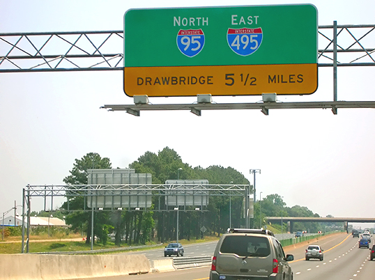 |
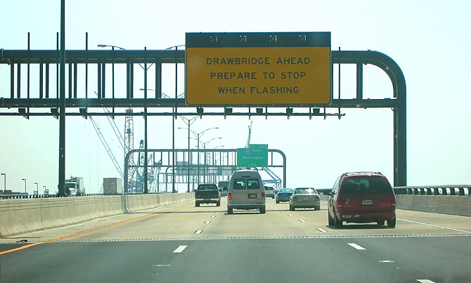
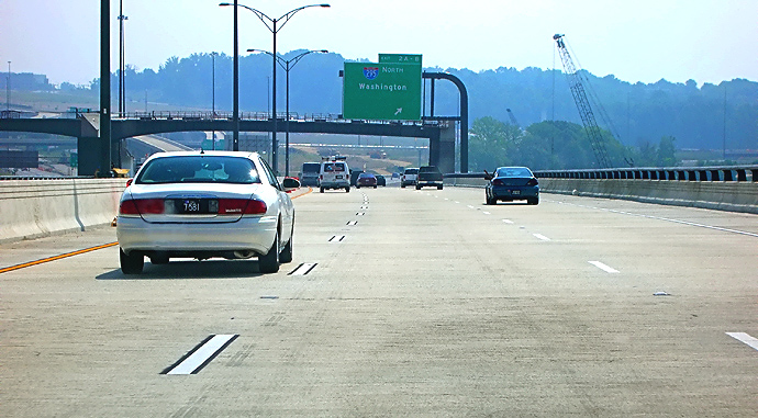
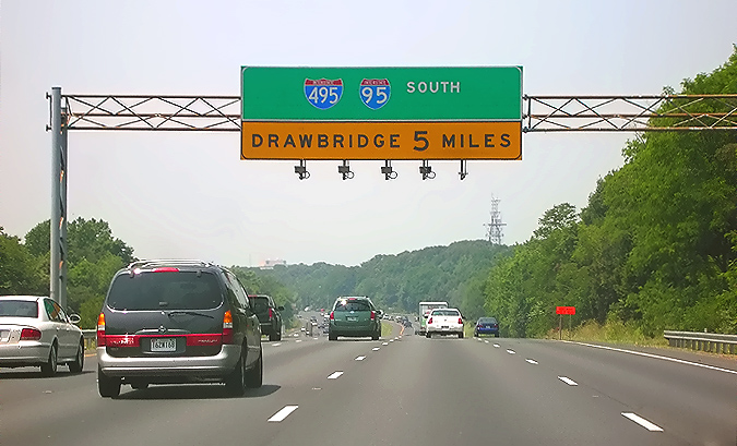
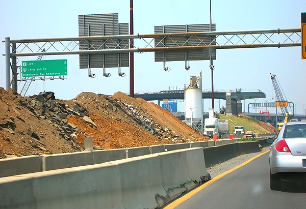
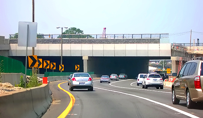
I-95/I-495 Capital Beltway, eastbound (Outer Loop), approaching the Van Dorn Street interchange, Virginia Exit 173. This photo shows the Beltway Outer Loop first advance warning sign for the drawspan of the Woodrow Wilson Bridge. |
 |
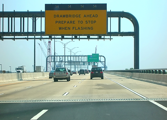
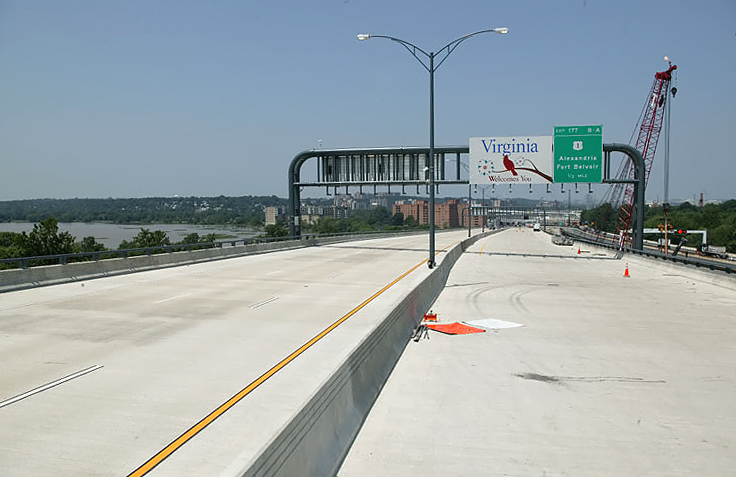
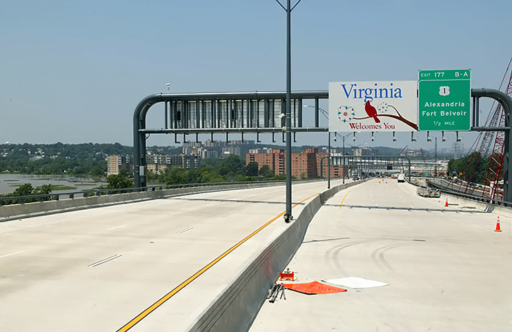
I-95/I-495 Capital Beltway, eastbound (Outer Loop), at the U.S. 1 interchange, Virginia Exit 177. This photo shows the Beltway Outer Loop second advance warning sign for the drawspan of the Woodrow Wilson Bridge. |
 |
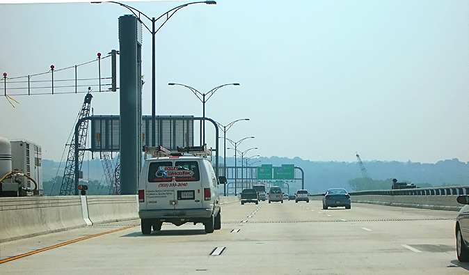
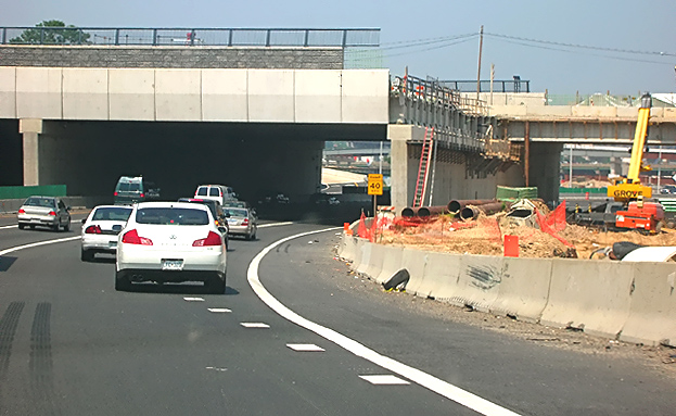
I-95/I-495 Capital Beltway, eastbound (Outer Loop), on the newly opened 3-lane roadway between the Washington Street Urban Deck and the first new 6-lane Woodrow Wilson Bridge. A retaining wall and sound barrier is to the right. Concrete median barrier construction is underway to the left. The Virginia end of the bridge is near the overhead sign gantry ahead. The 3-lane Outer Loop (Maryland-bound) roadway of the new bridge was opened to traffic on Sunday, June 11, 2006, where the 3-lane Outer Loop traffic was transferred to the new bridge. |
 |
I-95/I-495 Capital Beltway, eastbound (Outer Loop), on the newly opened 3-lane roadway between the Washington Street Urban Deck and the first new 6-lane Woodrow Wilson Bridge. The Virginia end of the bridge is near the overhead sign gantry ahead. |
 |
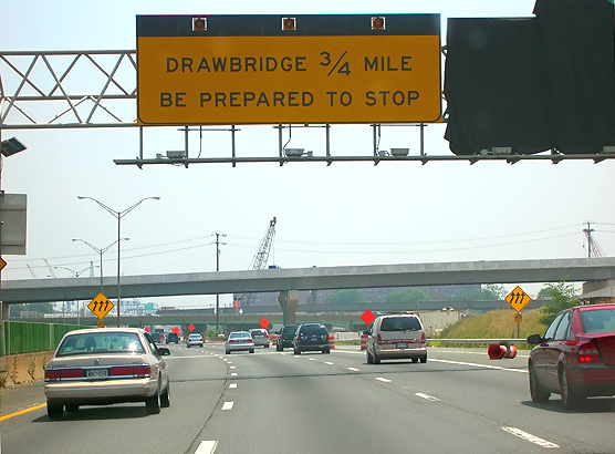
I-95/I-495 Capital Beltway, eastbound (Outer Loop), on the newly opened 3-lane roadway between the Washington Street Urban Deck and the first new 6-lane Woodrow Wilson Bridge. The Virginia end of the bridge is visible in the foreground where the asphalt (dark) pavement meets the concrete (light brown) bridge roadway deck. This photo shows the Beltway Outer Loop third advance warning sign for the drawspan of the Woodrow Wilson Bridge. |
 |
Similar vantage point as the previous photo, but taken on a different trip across the bridge, in the right lane. The Virginia end of the bridge is visible in the foreground where the asphalt (dark) pavement meets the concrete (light brown) bridge roadway deck. Notice the 10-foot-wide right emergency shoulder on the bridge, which extends across the entire new bridge. The original bridge had a 7-foot-wide right emergency shoulder on all of the bridge, except with a shoulder on the drawspan that was only about 2 feet wide. |
 |
New Woodrow Wilson Bridge, heading eastbound toward Maryland. The maximum grade on the Virginia approach of the new bridge is 3.00%. |
 |
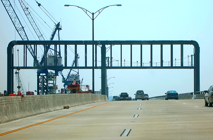
New Woodrow Wilson Bridge, heading eastbound toward Maryland. |
 |
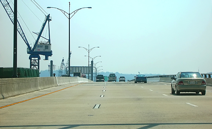
New Woodrow Wilson Bridge, heading eastbound toward Maryland. |
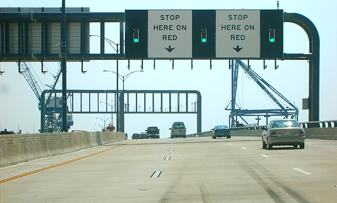 |
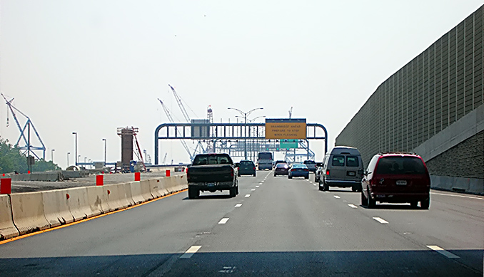
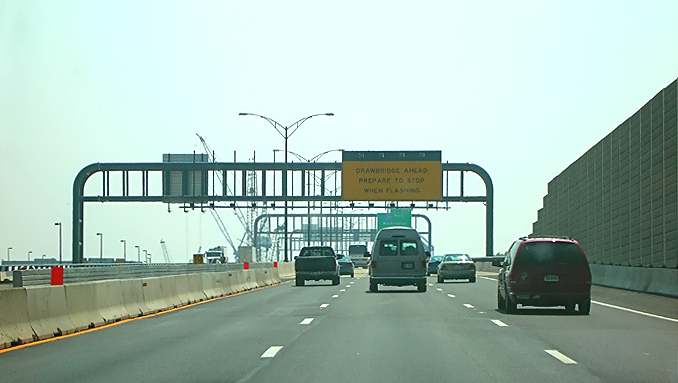
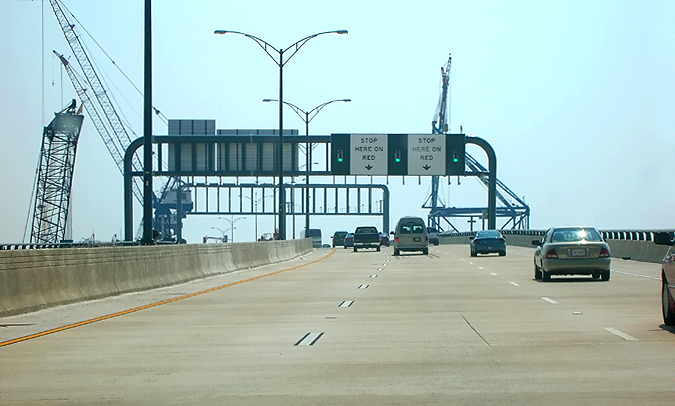
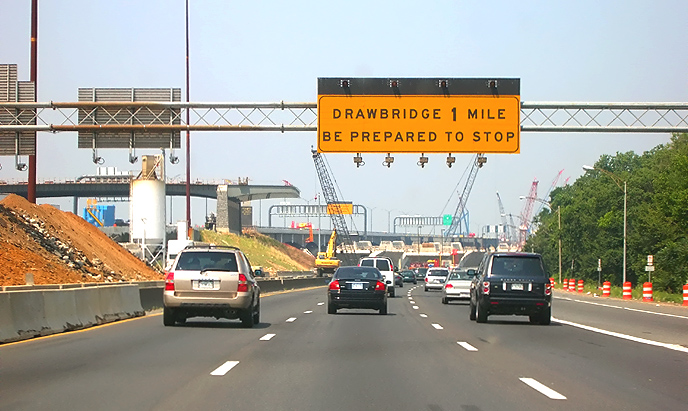
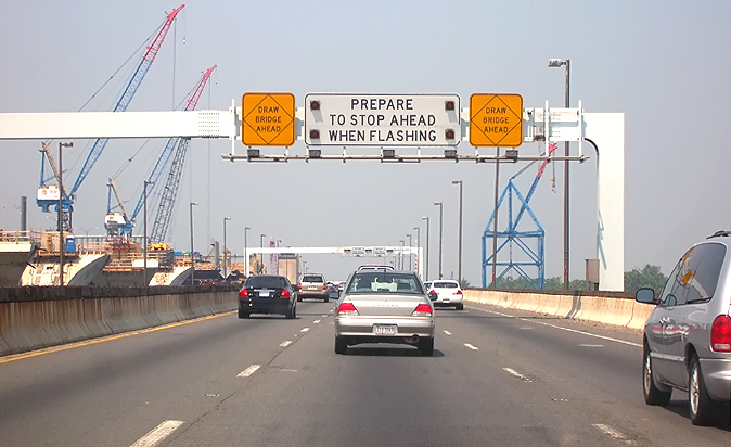
New Woodrow Wilson Bridge, heading eastbound toward Maryland. This photo shows the Beltway Outer Loop final warning sign for the drawspan of the Woodrow Wilson Bridge, and it has green, yellow and red signals to control traffic. |
 |
New Woodrow Wilson Bridge, heading eastbound toward Maryland. Notice the drawspan roadway gate that is lowered from an overhead gantry down to the roadway. The gate has steel cables over an inch in diameter, and 7 red lights on top of the barrier. |
 |
New Woodrow Wilson Bridge, heading eastbound toward Maryland. The bascule span (drawspan) and the highest point of the bridge is ahead. |
 |
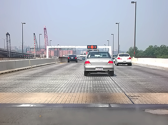
New Woodrow
Wilson Bridge, heading eastbound toward Maryland. The bascule span (drawspan)
and the highest point of the bridge is directly ahead. Notice the transverse
joints in the roadway deck, as these are the joints between the fixed portion
of the bridge and the movable (drawspan) portion of the bridge. A good feature about this drawspan is that its roadway deck is made of reinforced concrete; and while it is much heavier than the original bridge's steel grid drawspan roadway deck, it won't have the problem of it being slippery when wet. |
 |
New Woodrow Wilson Bridge, heading eastbound toward Maryland. The bascule span has been passed, and the roadway has a downgrade to the Maryland shore. The maximum grade on the new WWB Maryland approach is 2.30% near the Maryland shore, and is 1.20% approaching the high point of the bridge. |
 |
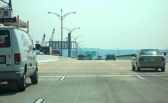
New Woodrow Wilson Bridge, heading eastbound toward Maryland. |
 |
New Woodrow Wilson Bridge, heading eastbound toward Maryland. |
 |
New Woodrow Wilson Bridge, heading eastbound toward Maryland. |
 |
New Woodrow Wilson Bridge, heading eastbound toward Maryland. |
 |
New Woodrow Wilson Bridge, heading eastbound toward Maryland. The Maryland end of the bridge is near the overpass under construction, which is for the pedestrian and bicycle trail that will connect from the north side of the new bridge, across Rosalie Island, to Maryland. The pedestrian and bicycle trail across the new bridge will connect the system of pedestrian and bicycle trails in Maryland and Virginia. |
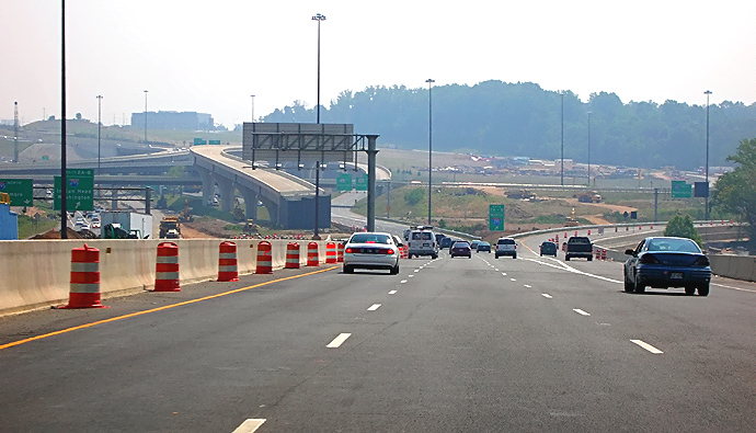 |
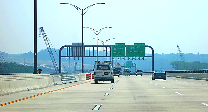
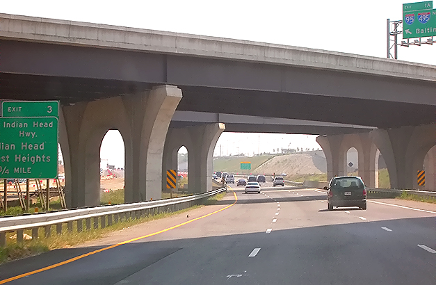
I-95/I-495 Capital Beltway, eastbound, on the newly-opened 3-lane roadway (which will be the Beltway Outer Loop local roadway when the WWB Project is complete), approaching the I-295 interchange. The new I-295 interchange is under construction, as part of the WWB Project. |
 |
I-95/I-495 Capital Beltway, eastbound, on the newly-opened 3-lane roadway, approaching the I-295 interchange. The new I-295 interchange is under construction, as part of the WWB Project. |
 |
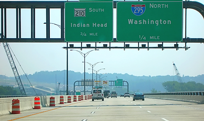
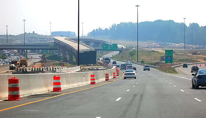
I-95/I-495 Capital Beltway, eastbound, on the newly-opened 3-lane roadway, approaching the I-295 interchange. The elevated ramp under construction is the ramp from the Beltway Outer Loop express roadway, to southbound MD-210 Indian Head Highway. |
 |
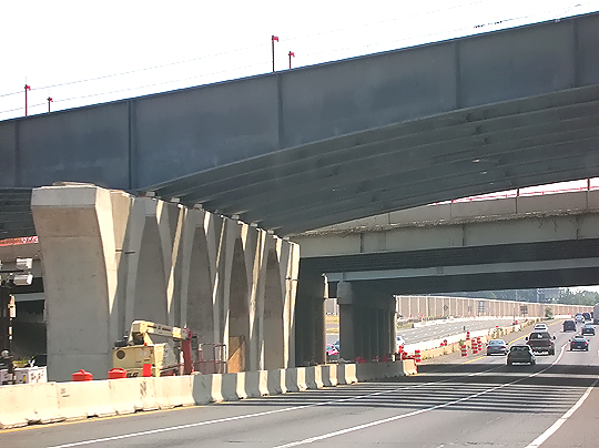
I-95/I-495 Capital Beltway, eastbound, on the newly-opened 3-lane roadway, in the I-295 interchange. The elevated ramp under construction is the ramp from the Beltway Outer Loop express roadway, to southbound MD-210 Indian Head Highway. |
 |
I-95/I-495 Capital Beltway, eastbound (Outer Loop), on the newly-opened 3-lane roadway, in the I-295 interchange. The elevated ramp under construction is the ramp from the Beltway Outer Loop express roadway, to southbound MD-210 Indian Head Highway. The intermediate level bridge will connect I-295 to National Harbor. |
 |
I-95/I-495 Capital Beltway, eastbound, on the newly-opened 3-lane roadway, in the I-295 interchange. The first bridge will connect I-295 to National Harbor. The more distant bridge is I-295 as it curves across the Beltway. |
 |
I-95/I-495 Capital Beltway, eastbound, on the newly-opened 3-lane roadway, in the I-295 interchange. The bridges are I-295 as it curves across the I-95/I-495 Beltway. |
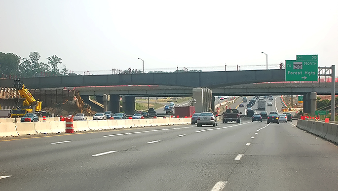 |
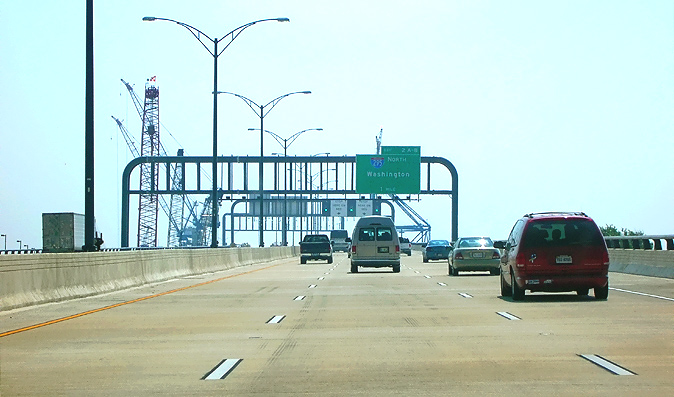
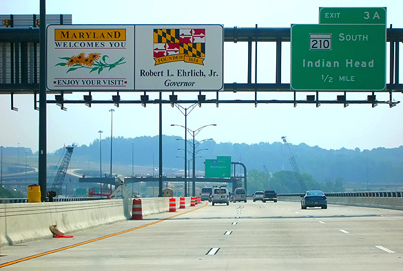
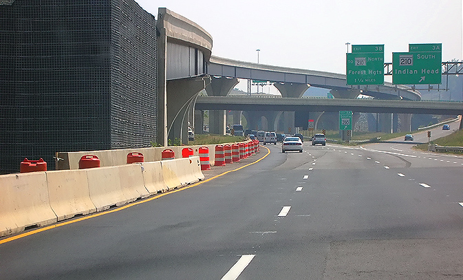
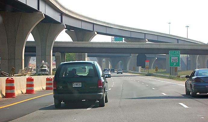
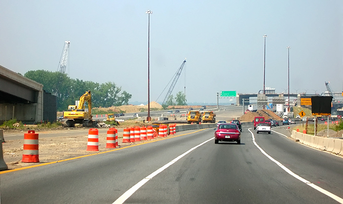
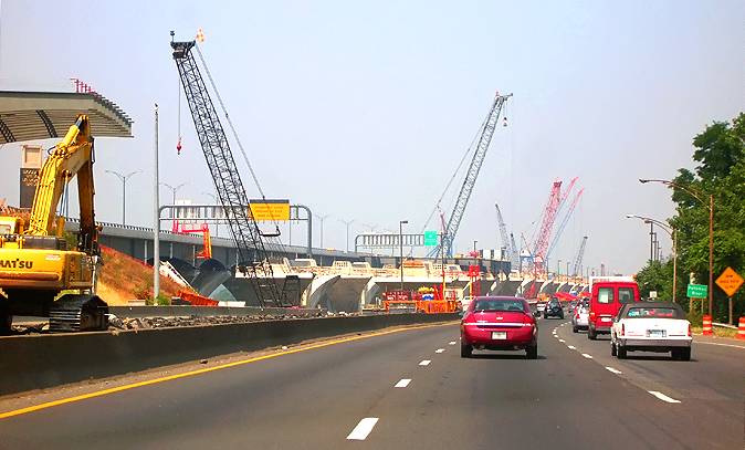
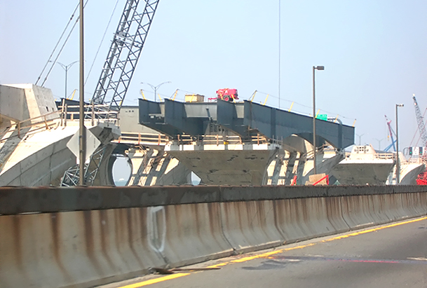
I-95/I-495 Capital Beltway, eastbound, approaching the MD-210 Indian Head Highway interchange. The new MD-210 Indian Head Highway interchange is under construction, as part of the WWB Project. Bridge girder placement is underway for the new MD-210 bridges over the Beltway, and the bridge will be over 400 feet long. |
 |
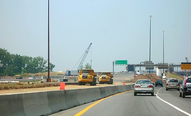
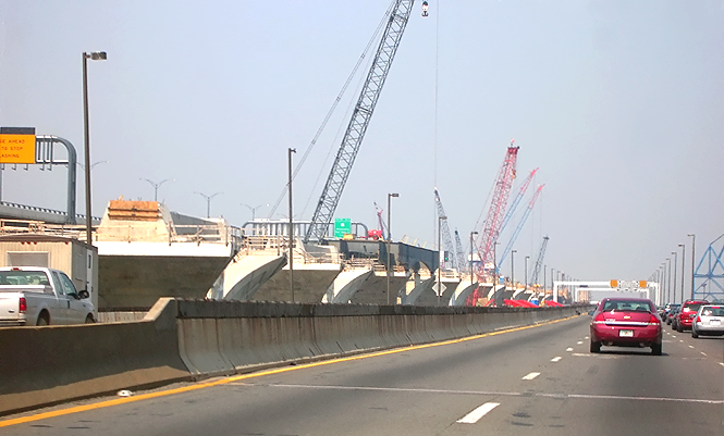
I-95/I-495 Capital Beltway, eastbound, in the MD-210 Indian Head Highway interchange. Closer view of the bridge girder placement for the new MD-210 bridges over the Beltway. |
The following 15 photos were taken on June 18, 2006, by Roads to the Future. They were all taken with a 2.2x telephoto lens. This is a drive westbound over the original Woodrow Wilson Bridge and approaches, from Maryland to Virginia.
 |
I-95/I-495 Capital Beltway, westbound (Inner Loop), approaching the St. Barnabas Road interchange, Maryland Exit 4. This photo shows the Beltway Inner Loop first advance warning sign for the drawspan of the Woodrow Wilson Bridge. |
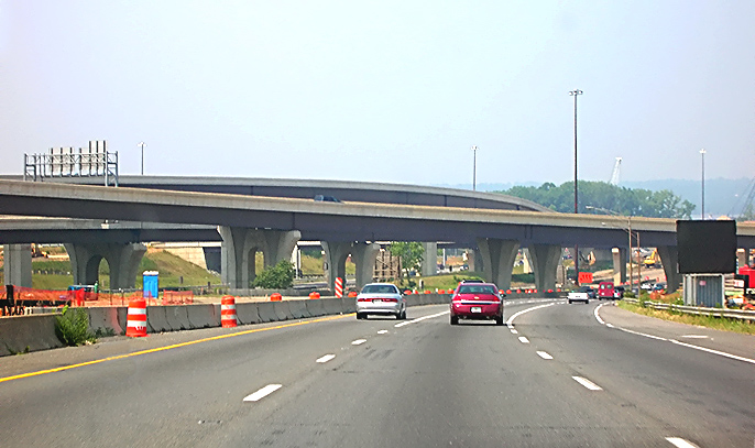 |
I-95/I-495 Capital Beltway, westbound in Maryland, approaching the I-295 interchange. The new I-295 interchange is under construction, as part of the WWB Project. The bridges are I-295 as it curves across the I-95/I-495 Beltway. |
 |
I-95/I-495 Capital Beltway, westbound in Maryland, in the I-295 interchange. The new I-295 interchange is under construction, as part of the WWB Project. |
 |
I-95/I-495 Capital Beltway, westbound in Maryland, approaching the Woodrow Wilson Bridge. |
 |
I-95/I-495 Capital Beltway, westbound in Maryland, approaching the Woodrow Wilson Bridge. The original Outer Loop roadway on the other side of the concrete median barrier has been closed, with a new Outer Loop roadway connecting to the new WWB. |
 |
I-95/I-495 Capital Beltway, westbound in Maryland, approaching the Woodrow Wilson Bridge. The overpass under construction is for the pedestrian and bicycle trail that will connect from the north side of the new bridge, across Rosalie Island, to Maryland. The pedestrian and bicycle trail across the new bridge will connect the system of pedestrian and bicycle trails in Maryland and Virginia. This photo shows the Beltway Inner Loop second advance warning sign for the drawspan of the Woodrow Wilson Bridge. |
 |
I-95/I-495 Capital Beltway, westbound in Maryland, approaching the Woodrow Wilson Bridge. Notice the new WWB Outer Loop bridge, and the new WWB Inner Loop bridge under construction, to the left. |
 |
I-95/I-495
Capital Beltway, westbound in Maryland, approaching the original Woodrow Wilson
Bridge. The Maryland end of the bridge is visible in the foreground as the
transverse steel joint.
In a few weeks the Inner Loop traffic will be shifted to the new WWB, and then the original Woodrow Wilson Bridge will pass into history. |
 |
Woodrow Wilson Bridge, heading westbound toward Virginia. The new Potomac River Bridge is under construction to the left. Notice the steel girders that have been placed on the bridge piers. |
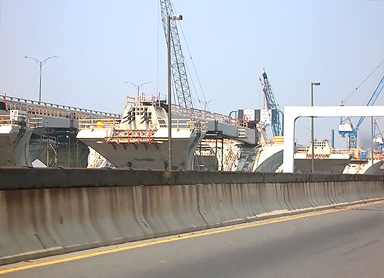 |
Woodrow Wilson Bridge, heading westbound toward Virginia. The new Potomac River Bridge is under construction to the left. Notice the delta pier construction. |
 |
Woodrow Wilson Bridge, heading westbound toward Virginia. The new Potomac River Bridge is under construction to the left. This photo shows the Beltway Inner Loop third advance warning sign for the drawspan of the Woodrow Wilson Bridge. |
 |
Woodrow Wilson Bridge, heading westbound toward Virginia. The new Potomac River Bridge is under construction to the left. Notice the existing bridge's drawspan operator's tower to the left. This photo shows the Beltway Inner Loop final warning sign for the drawspan of the Woodrow Wilson Bridge, and it has green, yellow and red signals to control traffic. |
 |
Woodrow Wilson Bridge, approaching the drawspan, heading westbound toward Virginia. Notice the steel grid roadway deck on the drawspan. A nice feature about the drawspan on the new bridge, is that its roadway deck is made of reinforced concrete; and while it is much heavier than the original bridge's drawspan steel grid roadway deck, it won't have the problem of it being slippery when wet. |
 |
I-95/I-495 Capital Beltway, westbound in Virginia, approaching the under construction Washington Street Urban Deck, on the temporary roadway that takes the Beltway under the completed southern section of the deck that, when all work is complete, will carry the local and express roadways of the Beltway Outer Loop (toward Wilson Bridge). A telephoto lens exaggerates the amount of horizontal curvature, as the roadway is comfortably drivable at 50 mph. |
 |
I-95/I-495 Capital Beltway, westbound in Virginia, approaching the under construction Washington Street Urban Deck, on the temporary roadway that takes the Beltway under the completed southern section of the deck that. |
All above photos taken by Scott Kozel.
On June 29, 2006, a nearly 30-vehicle convoy ended its cross-country trek by traversing the new Woodrow Wilson Bridge from Virginia into Maryland and on to its final destination – The Reagan Center in Washington, D.C. Its purpose was to mark the 50th anniversary of the U.S. Interstate Highway System. The convoy is a reverse of a trip taken in 1919 by young Lt. Col. Dwight D. Eisenhower, who helped staff a coast-to-coast convoy of 81 military vehicles to test whether the military was prepared to quickly mobilize the country in the event of war on U.S. soil. The arduous journey proved to him that the U.S. military was not. The 3,251-mile trip entailed 62 days of breakdowns, mud, bridgeless river-crossings, and rough roads. The Washington, D.C. to San Francisco convoy of heavy military vehicles averaged 58 miles a day at about six miles per hour.
Convoy
Reenactment – Retracing the Trip that Changed America, by
AASHTO: Interstate 50th
Anniversary, by American Association of State Highway and Transportation Officials
(AASHTO). Excerpt (in blue text):
The freedom
of the open road, as symbolized by our Interstate Highway System, is uniquely
American. It is born of a pioneer spirit, and a desire to see what lies beyond
the horizon. As the nation celebrates the 50th Anniversary of the roads that shaped
our lives and our prosperity, the American Association of State Highway and Transportation
Officials pays tribute to the men and women whose foresight changed our destiny.
In June 2006, a national convoy retraced, in reverse, the route of the 1919 First
Transcontinental Motor Train, an arduous journey of 3,250 miles from Washington,
D.C. to San Francisco which included then Lieutenant Colonel Dwight David Eisenhower.
Traveling the perilous Lincoln Highway, now the route of Interstate 80, the journey
forged in Eisenhower's mind the need for an interstate highway system. As President,
Eisenhower would sign the legislation making the Interstates a reality on June
29, 1956. Fifty years to the day later, the convoy arrived in Washington, D.C.,
where a media event took place near the very same Zero Milestone from which the
1919 convoy departed.
Celebrate the Interstate Convoy Participant Handbook, by AASHTO: Interstate 50th Anniversary, by American Association of State Highway and Transportation Officials (AASHTO). Shows the Interstate Highway System 50th Anniversary Convoy Route, June 16-29, 2006.
The following 10 photos of the convoy were taken on June 29, 2006, by the Virginia Department of Transportation, and are posted here with their permission. Roads to the Future utilized PhotoDeluxe Business Edition to sharpen and brighten and to align all of the photos. Click on the photo to get a large version of the photo. In later versions of Netscape and Internet Explorer, you probably will need to use Full Screen mode (the F11 key can be utilized to swap back and forth between Full Screen and Regular) to see the full size of the large photo without browser-induced image shrinkage. The large photos have sizes ranging from 122 to 192 kilobytes, with most of them being under 149 kilobytes. With a broadband or network Internet connection each photo will download within seconds, but with a dial-up Internet connection it will be somewhat slower.
 |
I-95/I-495 new Woodrow Wilson Bridge, looking west toward Virginia from just west of the highest point of the bridge. |
 |
New Woodrow Wilson Bridge, looking west from just west of the highest point of the bridge. At this point, the 3-lane Maryland-bound side of the new bridge was open to traffic, and the 3-lane Virginia-bound side of the new bridge was not yet open to traffic. A glimpse of the original WWB can be seen on the right edge of the photo, with Virginia-bound traffic still using that bridge. |
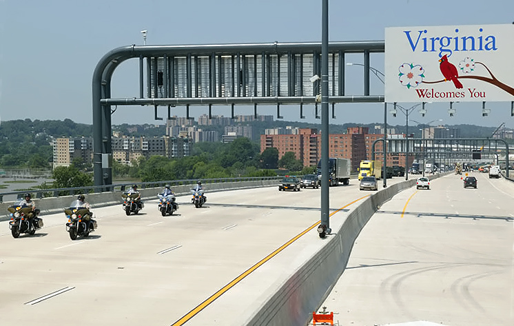 |
New Woodrow
Wilson Bridge, looking west from just west of the highest point of the bridge.
The convoy is approaching, with a group of motorcycles in the lead.
|
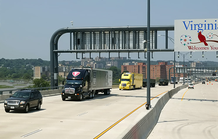 |
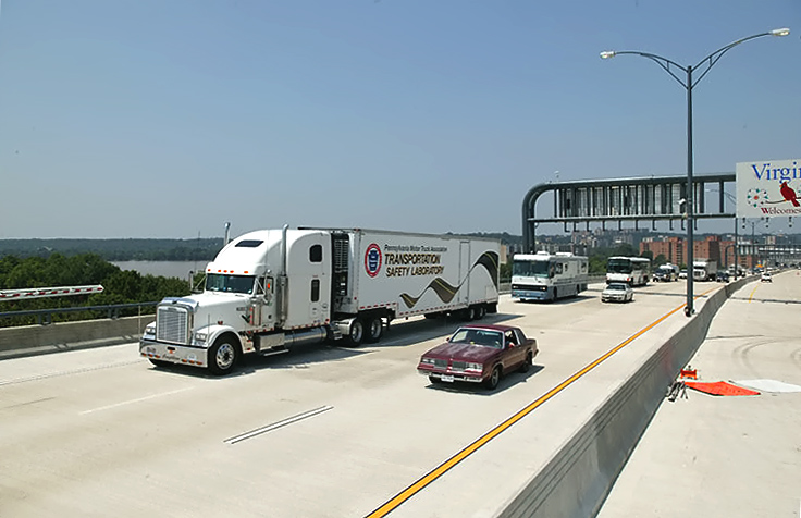
New Woodrow Wilson Bridge, looking west from just west of the highest point of the bridge. The convoy is passing, with the large commercial trucks. |
 |
New Woodrow Wilson Bridge, looking west from just west of the highest point of the bridge. The convoy is passing, with the large commercial trucks. |
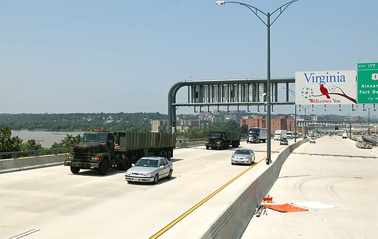 |
New Woodrow Wilson Bridge, looking west from just west of the highest point of the bridge. The convoy is passing, with the military trucks. |
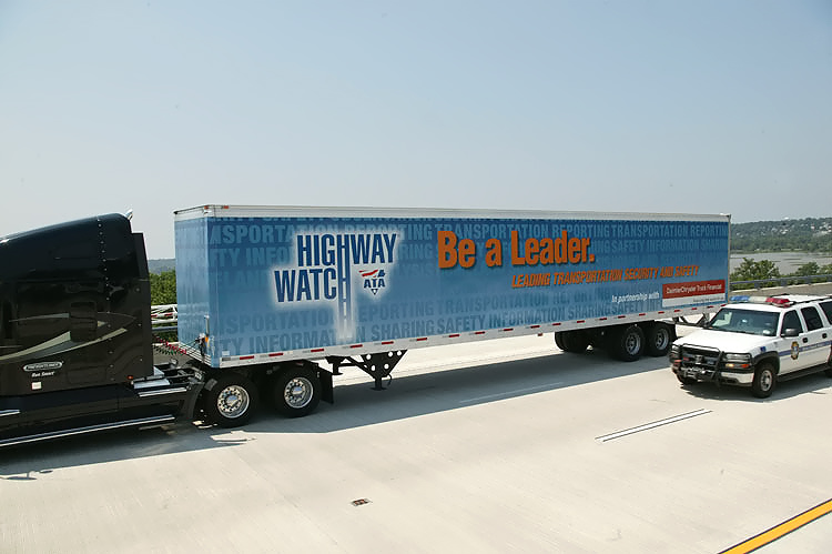 |
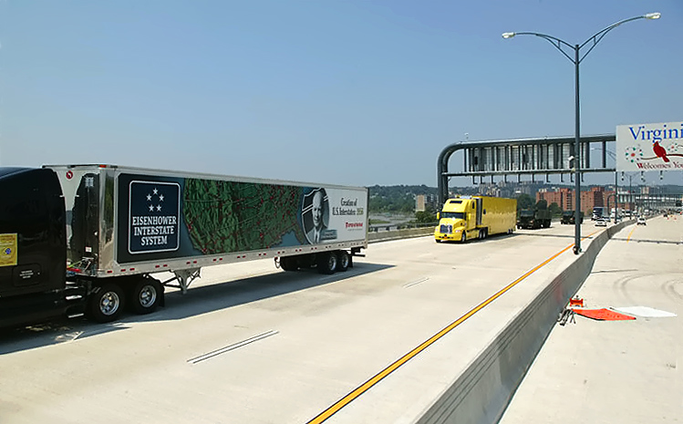
New Woodrow Wilson Bridge, looking west from just west of the highest point of the bridge. The convoy is passing, with the large commercial trucks. |
 |
New Woodrow Wilson Bridge, looking west from just west of the highest point of the bridge. The convoy is passing, with the large commercial trucks. |
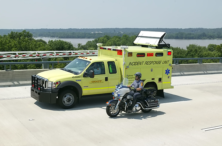 |
New Woodrow Wilson Bridge, looking south from just west of the highest point of the bridge. The convoy is passing, with state DOT incident management trucks. |
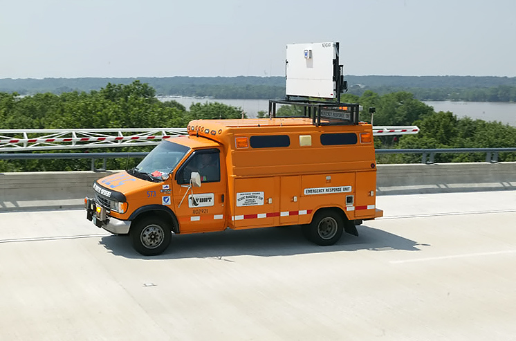 |
New Woodrow Wilson Bridge, looking south from just west of the highest point of the bridge. The convoy is passing, with state DOT incident management trucks. |
Lead article - Woodrow Wilson Bridge Project Photos
This article was released on July 1, 2006, with the 28 photos taken on June 18, 2006, and with the 15 photos were taken on June 18, 2006. The 10 photos that were taken on June 29, 2006, were added on September 1, 2006.
Copyright © 2006 by Scott Kozel. All rights reserved. Reproduction, reuse, or distribution without permission is prohibited.
By Scott M. Kozel, Capital Beltway dot com, Roads to the Future
(Created 7-1-2006, updated 9-1-2006, moved to capital-beltway.com on 3-22-2007)