
| Woodrow Wilson Bridge Project Photos - May 2008 |
The following 81 photos were taken on May 15, 2008, by Roads to the Future. This was at the dedication ceremony for the second new Woodrow Wilson Bridge. This is the 6-lane bridge for the Inner Loop of the I-95/I-495 Capital Beltway. The completed twin bridges will have a total of 12 lanes on 4 separate roadways on a 3-3-3-3 lane configuration.
The first new 6-lane Woodrow Wilson Bridge was opened to traffic in two stages. It opened to traffic in June and July of 2006, and it was configured for 3 lanes each way until the 6-lane bridge for the Inner Loop of the Beltway opened to traffic. Construction of the new 6-lane Inner Loop bridge for the Woodrow Wilson Bridge, was completed in mid-2008.
The I-95/I-495 Capital Beltway 3-lane Inner Loop (Maryland to Virginia) roadway was shifted from its temporary location on the the new Outer Loop bridge, to the 3-lane local roadway of the new Inner Loop bridge, on the weekend of May 30 to June 1, 2008, with all lanes opened to traffic on Sunday, June 1st. The express roadways on each bridge will open in late 2008, after needed approach roadway and interchange construction is completed at either end of the bridge.
The large photos in the following group of 36 photos have sizes ranging from 85 to 254 kilobytes, with most of them being under 192 kilobytes. With a broadband or network Internet connection each photo will download within seconds, but with a dial-up Internet connection it will be somewhat slower.
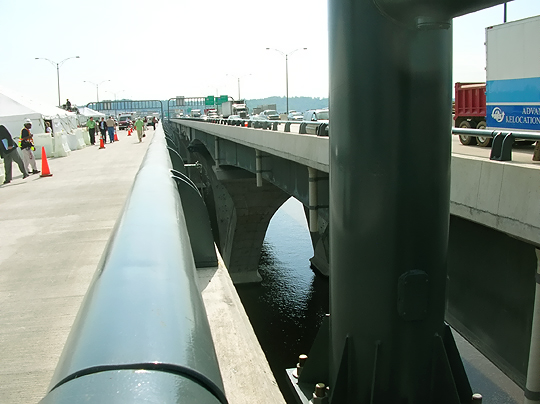 |
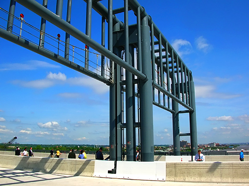
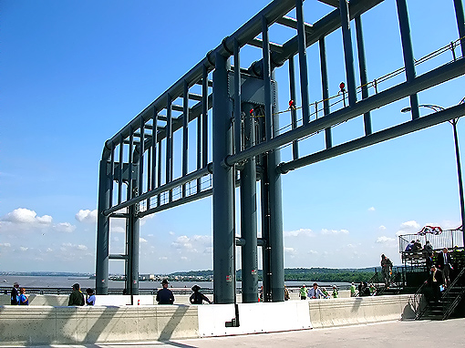
Potomac River Bridge (Woodrow Wilson Bridge) 6-lane Inner Loop bridge, nearing completion. This roadway is the 3-lane express (inner) roadway of the new 6-lane Inner Loop Potomac River Bridge. Near the highest point of the bridge, just east of the drawspan. Looking against the flow (toward Maryland) of the future traffic. There are two separate Potomac River Bridges, and to the right is recently-opened (in June and July of 2006) new 6-lane Outer Loop Potomac River Bridge, which is currently configured to carry 3 Beltway Outer Loop lanes and 3 Beltway Inner Loop lanes. |
 |
Twin-span Potomac River Bridges, same vantage point as previous photo, but with telephoto. |
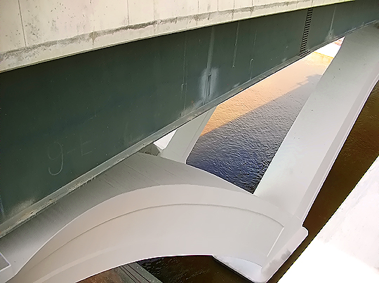 |
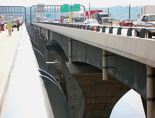
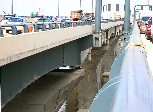
Outer Loop Potomac River Bridge, view of girders, V-piers and river. The completed V-piers are being finished with a smooth surface and a white coating. |
 |
Potomac River Bridge 6-lane Inner Loop bridge, nearing completion. This roadway is the 3-lane express (inner) roadway of the new 6-lane Inner Loop Potomac River Bridge. Near the highest point of the bridge, looking toward the the drawspan. Looking with the flow (toward Virginia) of the future traffic. There are two separate Potomac River Bridges, and to the left is recently-opened (in June and July of 2006) new 6-lane Outer Loop Potomac River Bridge, which is currently configured to carry 3 Beltway Outer Loop lanes and 3 Beltway Inner Loop lanes. |
 |
Twin-span Potomac River Bridges, same vantage point as previous photo, but with telephoto. |
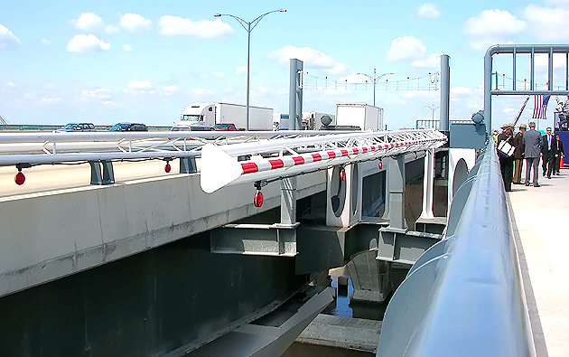 |
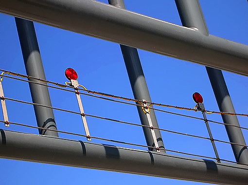
Twin-span Potomac River Bridges, in the center of the photo is the view of the traffic barrier that swings across the Inner Loop express roadway to stop traffic before lifting the drawspan. |
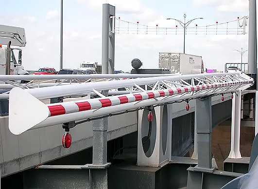 |
Same vantage point as previous photo, but with more zoom on the traffic barrier that swings across the Inner Loop express roadway to stop traffic before lifting the drawspan. |
|
|
United
States President (1913-1921) Woodrow Wilson's
1919 Pierce-Arrow limousine, took part in the dedication ceremonies for
the 6-lane new Inner Loop bridge of the Woodrow Wilson Memorial Bridge. Quote
(in blue text):
When Woodrow Wilson returned from France after negotiating the Treaty of Versailles in 1919, a new Pierce-Arrow limousine awaited him at the dock in New York to take him back to Washington. The automobile had just been added to the White House fleet. Wilson favored this automobile so much that when he left office his friends purchased it for him to use. The car had received its finishing touches at the plant of the maufacturer, the Pierce-Arrow Motor Car Company of Buffalo, New York, in June 1919. It was the 120th of the "Series 51" model. |
|
|
Woodrow Wilson's 1919 Pierce-Arrow limousine, near the ceremony platform at the highest point of the new Inner Loop bridge. |
|
|
Woodrow Wilson's 1919 Pierce-Arrow limousine. |
|
|
Woodrow Wilson's 1919 Pierce-Arrow limousine. |
 |
Potomac River Bridge (Woodrow Wilson Bridge) 6-lane Inner Loop bridge, nearing completion. This roadway is the local (outer) roadway of the Inner Loop (Virginia bound) of the Beltway. Standing near the Maryland end of the bridge. Standing near the concrete parapet between the roadway to the left and the pedestrian and bicycle path to the right on the other side of the concrete barrier. |
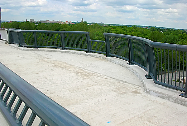 |
Potomac River Bridge 6-lane Inner Loop bridge, nearing completion. This roadway is the local (outer) roadway of the Inner Loop (Virginia bound) of the Beltway. Standing near the highest point of the bridge. Standing near the concrete parapet between the roadway and the pedestrian path to the right on the other side of the concrete barrier. The widened semi-circular section of the path (of which there will a number of them), is for pedestrians to have a place to view the scenery, and be out of the way of the pedestrian and bicycle traffic. |
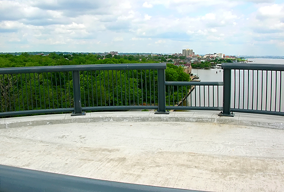 |
Similar vantage point as previous photo at the widened semi-circular section of the path, but looking down the river toward downtown Washington in the distance, with Old Town Alexandria to the left. |
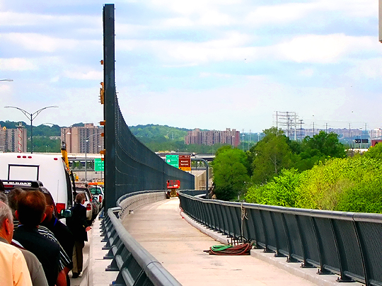 |
Potomac River Bridge (Woodrow Wilson Bridge) 6-lane Inner Loop bridge, Virginia approach, looking at sound barrier under construction along the north side of the bridge, to reduce the noise impacts to Old Town Alexandria. The pedestrian and bicycle path is to the right of the sound barrier, and the roadway is to the left of the sound barrier. Looking in the direction of Inner Loop (toward Virginia) traffic. |
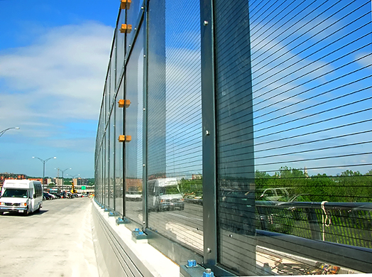 |
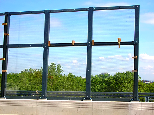
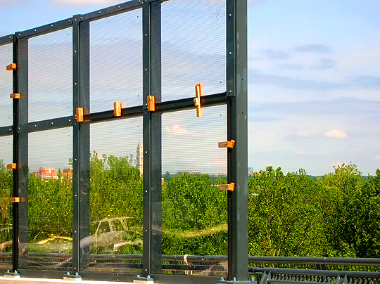
Potomac River Bridge 6-lane Inner Loop bridge, Virginia approach, looking at sound barrier under construction along the north side of the bridge, to reduce the noise impacts to Old Town Alexandria. A 1,550-foot transparent wall on the new Wilson Bridge will provide soundproofing for Old Town Alexandria residents while preserving the view from the bridge; and the wall, made of acrylic panels called Paraglas, will be 17 feet tall. Bore holes in the panels reveal that the panel is about 1 inch thick. |
 |
Potomac River Bridge 6-lane Inner Loop bridge, Virginia approach, looking at sound barrier under construction along the north side of the bridge, to reduce the noise impacts to Old Town Alexandria. This is the east (river) end of the barrier. |
 |
Potomac River Bridge 6-lane Inner Loop bridge, Virginia approach, looking at sound barrier under construction along the north side of the bridge, to reduce the noise impacts to Old Town Alexandria. This is the east (river) end of the barrier. |
 |
Potomac River Bridge (Woodrow Wilson Bridge), looking eastbound from a stage over the center of the Inner Loop bridge, toward Maryland. The Maryland shore is visible in the distance. |
 |
Woodrow Wilson Bridge, same vantage point as previous photo, with telephoto. |
 |
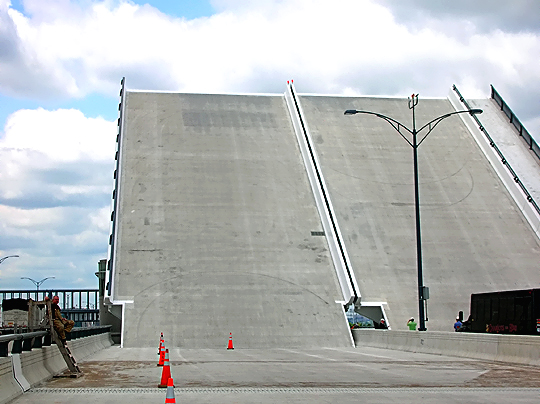
Woodrow
Wilson Bridge, the drawspan is raised in the background behind the ceremony
platform. A nice feature about this drawspan is that its roadway deck is made
of reinforced concrete; and while it is much heavier than the original bridge's
steel grid drawspan roadway deck, it won't have the problem of it being slippery
when wet. The dedication ceremony is underway. |
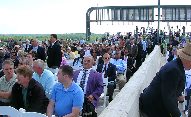 |
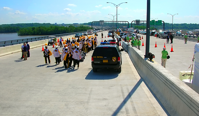
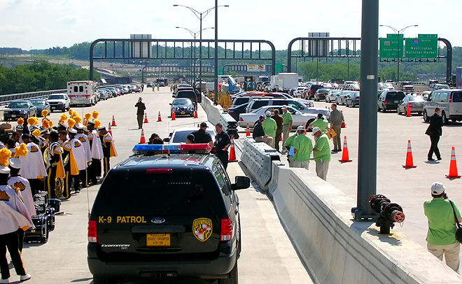
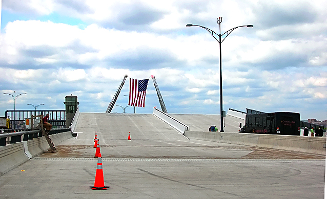
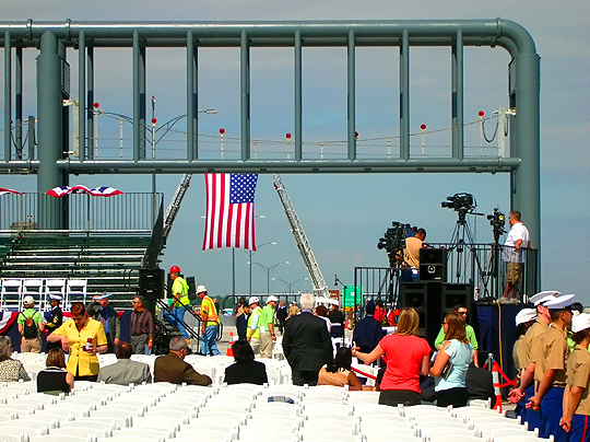
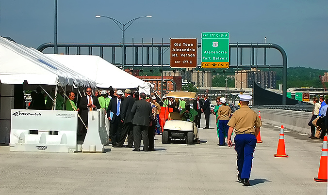
Looking rearward toward the seating area for the attendees at the dedication ceremony, who were there by specific invitation (yes, that included the Roads to the Future author!) from the Woodrow Wilson Bridge Project officials. |
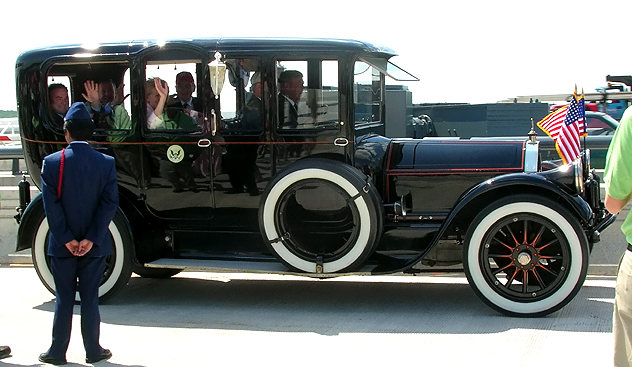 |
Woodrow Wilson's 1919 Pierce-Arrow limousine, with the dignitaries on board. That included U.S. Secretary of Transportation Mary E. Peters, Virginia U.S. Senator John W. Warner, Jr., Virginia Governor Timothy M. Kaine, and Maryland Governor Martin O'Malley. |
 |
Speaking at the podium is U.S. Secretary of Transportation, Mary E. Peters. |
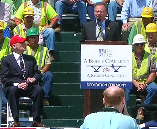 |
Speaking at the podium is Virginia Governor Timothy M. Kaine. |
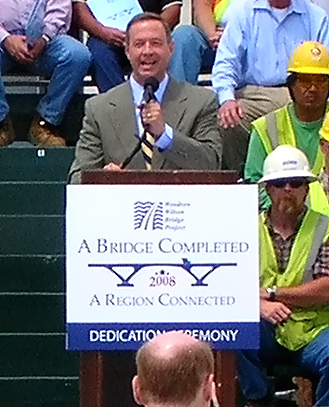 |
Speaking at the podium is Maryland Governor Martin O'Malley. |
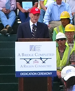 |
Speaking at the podium is Virginia U.S. Senator John W. Warner, Jr. |
 |
Ribbon cutting ceremony by the dignitaries. |
 |
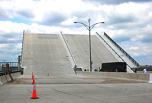
Potomac
River Bridge (Woodrow Wilson Bridge), the Inner Loop bridge drawspan is raised
in the background behind the ceremony platform. A nice feature about this
drawspan is that its roadway deck is made of reinforced concrete; and while
it is much heavier than the original bridge's steel grid drawspan roadway
deck, it won't have the problem of it being slippery when wet. The drawspan
was engineered with much heavier counterweights so that heavier bascule spans
could be utilized.
The ceremony ran from 11:00 to about 12:00 pm, and it has just ended, and the operator will lower the drawspan so that participants will once again have access to the Virginia portion of the bridge. This photo and the next 7 photos show the drawspan being lowered. |
 |
Woodrow Wilson Bridge, the Inner Loop bridge drawspan is being lowered. |
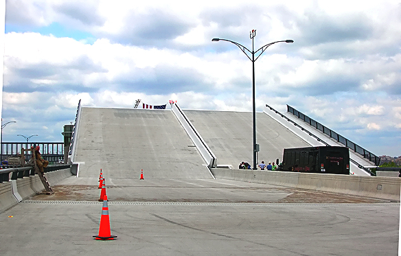 |
Woodrow Wilson Bridge, the Inner Loop bridge drawspan is being lowered. |
 |
Woodrow Wilson Bridge, the Inner Loop bridge drawspan is being lowered. |
 |
Woodrow Wilson Bridge, the Inner Loop bridge drawspan is being lowered. |
 |
Woodrow Wilson Bridge, the Inner Loop bridge drawspan is being lowered. |
 |
Woodrow Wilson Bridge, the Inner Loop bridge drawspan is being lowered. |
 |
Woodrow Wilson Bridge, the Inner Loop bridge drawspan is fully lowered and is in alignment with the roadways. Notice the drawspan operator's tower and Outer Loop bridge to the left. Looking with the flow (toward Virginia) of the future traffic. |
This article was released on May 21, 2007, with the first 36 photos above. The following 20 photos were added on June 8, 2008.
The following series of 20 photos were taken on May 15, 2008, and are in driving sequence along the 3-lane local (outer) roadway of the Potomac River Bridge (Woodrow Wilson Bridge) 6-lane Inner Loop bridge. The bridge's pedestrian and bicycle path is alongside the north edge of the Inner Loop bridge. The large photos have sizes ranging from 162 to 266 kilobytes, with most of them being under 224 kilobytes. With a broadband or network Internet connection each photo will download within seconds, but with a dial-up Internet connection it will be somewhat slower.
 |
Potomac River Bridge (Woodrow Wilson Bridge) 6-lane Inner Loop bridge, nearing completion. This roadway is the 3-lane local (outer) roadway of the Inner Loop (Virginia bound) of the Beltway. Standing at the Maryland end of the bridge ... notice at the bottom of the photo, the joint between the approach pavement (black asphalt) and the reinforced concrete bridge deck (light beige color). |
 |
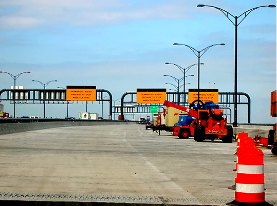
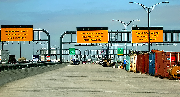
Potomac River Bridge 6-lane Inner Loop bridge, nearing completion. This roadway is the 3-lane local (outer) roadway of the Inner Loop (Virginia bound) of the Beltway. The maximum grade on the new WWB Maryland approach is 2.30% near the Maryland shore, and is 1.20% approaching the high point of the bridge. This photo shows the Beltway Inner Loop advance warning signs for the drawspan of the Woodrow Wilson Bridge. |
 |
Potomac River Bridge 6-lane Inner Loop bridge, 3-lane local (outer) roadway. Looking against the flow (toward Maryland) of the future traffic. The overpass near the end of the WWB, is part of the pedestrian/bicycle path that will connect the two states via a separated path along the left (north) edge of the under-construction Inner Loop WWB, and the trail will carry pedestrian/bicycle traffic between US-1 south of Alexandria and pedestrian/bicycle trails in Maryland. Maryland Interstate I-295 Interchange construction is in the distance. |
 |
Potomac River Bridge 6-lane Inner Loop bridge, 3-lane local (outer) roadway. Looking with the flow (toward Virginia) of the future traffic. |
 |
Potomac River Bridge (Woodrow Wilson Bridge) 6-lane Inner Loop bridge, 3-lane local (outer) roadway. The large vehicle parked to the right, is a Maryland State Police mobile command post truck. |
 |
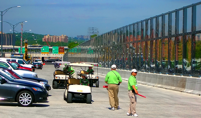
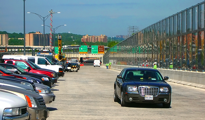
Potomac River Bridge 6-lane Inner Loop bridge, 3-lane local (outer) roadway. |
 |
Potomac River Bridge 6-lane Inner Loop bridge, 3-lane local (outer) roadway. The maximum grade on the new WWB Maryland approach is 2.30% near the Maryland shore, and is 1.20% approaching the high point of the bridge. |
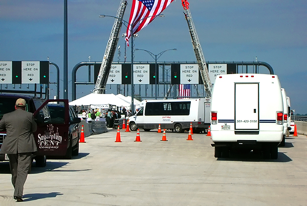 |
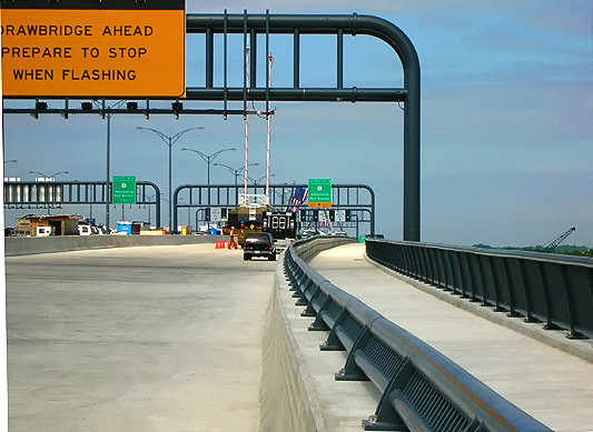
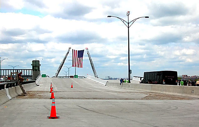
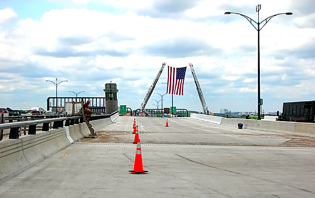
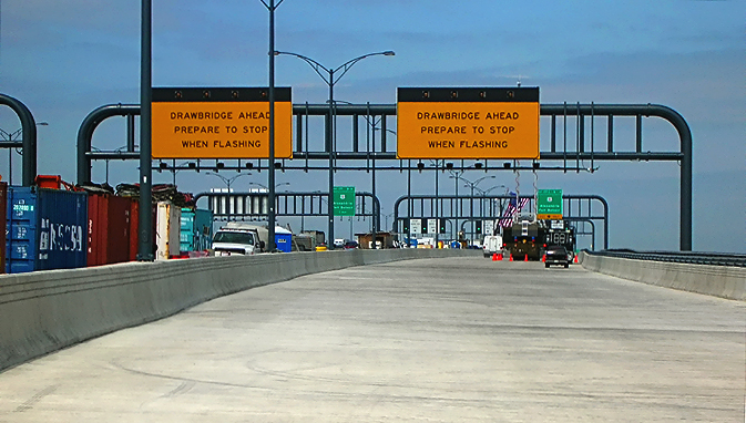
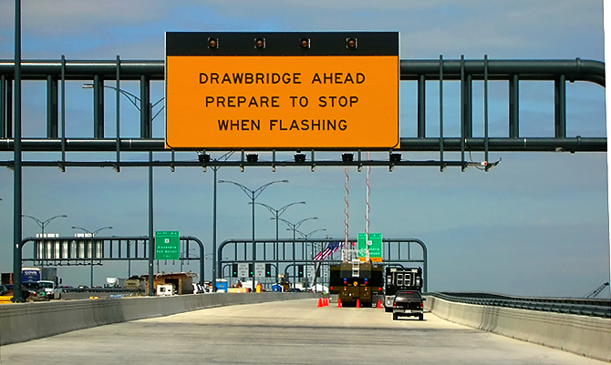
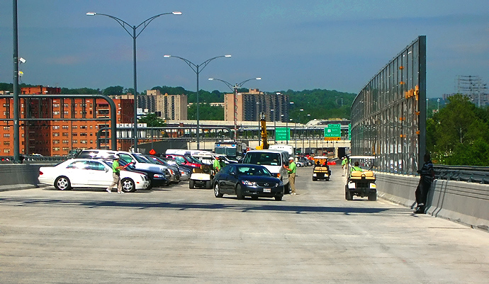
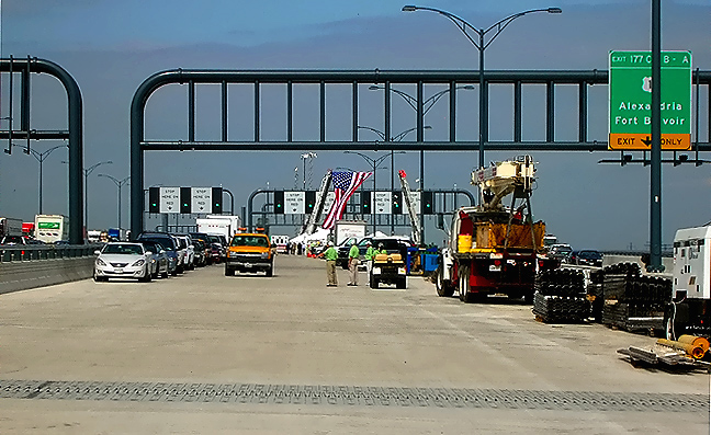
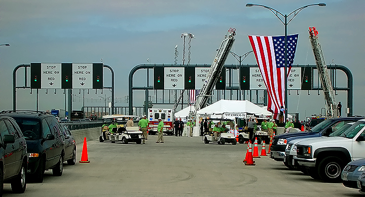
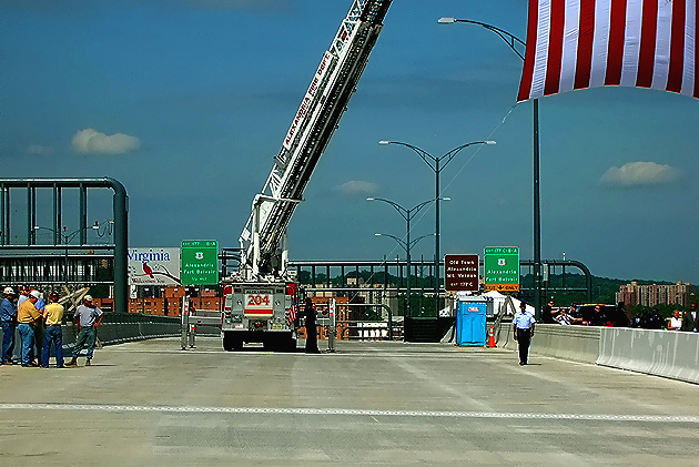
Potomac River Bridge 6-lane Inner Loop bridge, 3-lane local (outer) roadway. Approaching the ceremony area which is near the highest section of the bridge. This photo shows the Beltway Inner Loop final warning signs for the drawspan of the Woodrow Wilson Bridge, and it has green, yellow and red signals to control traffic. |
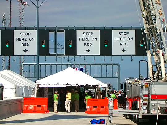 |
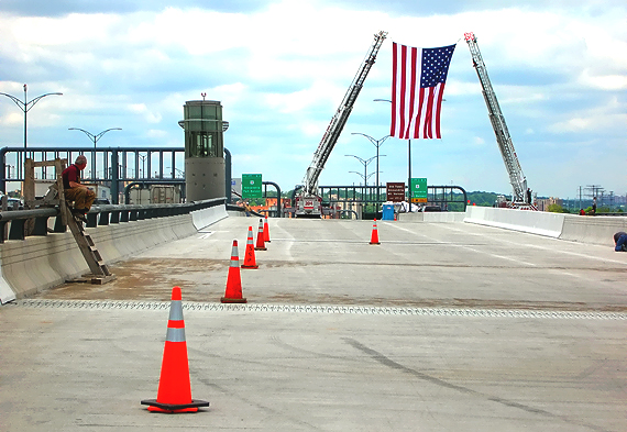
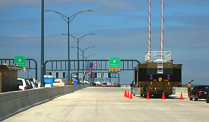
Potomac River Bridge 6-lane Inner Loop bridge, 3-lane local (outer) roadway. In the ceremony area. |
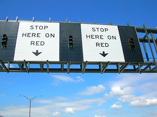 |
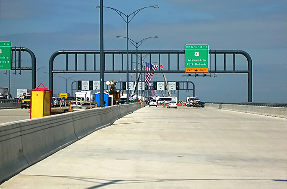
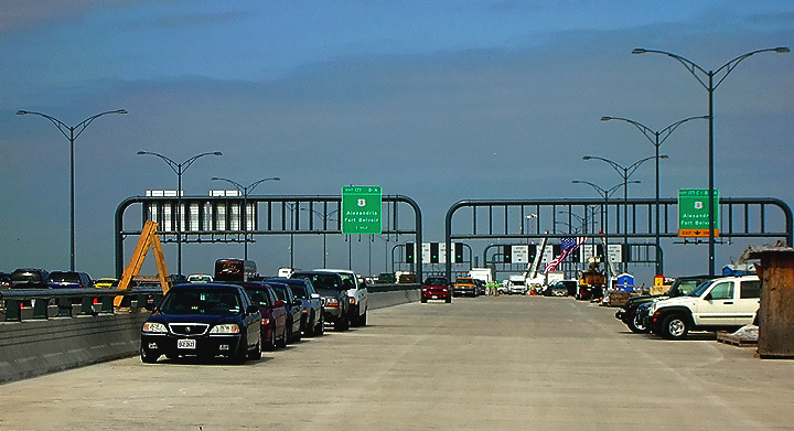
Potomac River Bridge (Woodrow Wilson Bridge) 6-lane Inner Loop bridge, 3-lane local (outer) roadway. In the ceremony area. Closeup of overhead sign assembly and signals that directs traffic to stop at no further than that point when the drawspan is about to be raised. |
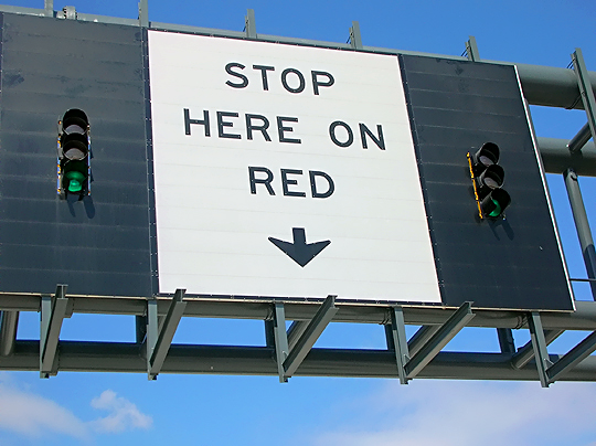 |
Potomac River Bridge 6-lane Inner Loop bridge, 3-lane local (outer) roadway. In the ceremony area. Closeup of overhead sign assembly and signals that directs traffic to stop at no further than that point when the drawspan is about to be raised. |
 |
Potomac River Bridge 6-lane Inner Loop bridge, 3-lane local (outer) roadway. In the seating area for the attendees at the dedication ceremony, who were there by specific invitation. The overhead structure has a crash barrier that is lowered before opening the drawspan, to prevent any vehicle from proceeding any further. There are red warning lights on top of the crash barrier. |
 |
Potomac River Bridge 6-lane Inner Loop bridge, 3-lane local (outer) roadway. Near the highest point of the bridge. The drawspan is at the area where the group of people are standing. Looking with the flow (toward Virginia) of the future traffic. |
 |
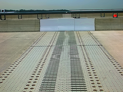
Potomac River Bridge 6-lane Inner Loop bridge, 3-lane local (outer) roadway. Standing on the drawspan ... if you look carefully you can see two transverse (perpendicular to traffic) joints in the drawspan ... the closest is the seam between the two bascule leaves, and the farther is the seam between the west bascule and the Virginia approach span. |
 |
Potomac River Bridge (Woodrow Wilson Bridge) 6-lane Inner Loop bridge, 3-lane local (outer) roadway. On the Virginia approach of the bridge. The maximum grade on the new WWB Virginia approach is 3.00%. |
 |
Potomac River Bridge 6-lane Inner Loop bridge, 3-lane local (outer) roadway. Virginia approach, notice the sound barrier along the north side of the bridge, to reduce the noise impacts to Old Town Alexandria. A 1,550-foot transparent wall on the new Wilson Bridge will provide soundproofing for Old Town Alexandria residents while preserving the view from the bridge; and the wall, made of acrylic panels called Paraglas, is 17 feet tall. The pedestrian and bicycle path is to the right of the sound barrier, and the roadway is to the left of the sound barrier. In the distance is the Hunting Towers apartment buildings, and the Beltway U.S. Route 1 Interchange construction which is part of the WWB Project. |
 |
Potomac River Bridge 6-lane Inner Loop bridge, 3-lane local (outer) roadway. |
 |
Potomac River Bridge 6-lane Inner Loop bridge, 3-lane local (outer) roadway. |
 |
Potomac River Bridge (Woodrow Wilson Bridge) 6-lane Inner Loop bridge, 3-lane local (outer) roadway. In the distance the overpassing structure is the Washington Street Urban Deck in Alexandria VA. Washington Street is the highway that crosses the Beltway. The completed Washington Street Deck spans the entire reconstructed 12-lane Beltway, and the deck is over 200 feet long and over 200 feet wide, and carries the 4-lane Washington Street with landscaping over the rest of the deck. The Washington Street Urban Deck removes the 'barrier effect' to pedestrians that would exist with a simple replacement of the 4-lane Washington Street overpass over the 12-lane Beltway. |
 |
Potomac River Bridge 6-lane Inner Loop bridge, 3-lane local (outer) roadway. Ahead is the Virginia end of the bridge ... notice the transition between the approach pavement (black asphalt) and the reinforced concrete bridge deck (light beige color). Strong telephoto shot. |
This article was released on May 21, 2007, with the first 36 photos above, and the next 20 photos were added on June 8, 2008. The following 25 photos were added on August 20, 2008.
The following series of 25 photos were taken on May 15, 2008, and are in driving sequence along the 3-lane express (inner) roadway of the Potomac River Bridge (Woodrow Wilson Bridge) 6-lane Inner Loop bridge. The bridge's pedestrian and bicycle path is alongside the north edge of the Inner Loop bridge. The large photos have sizes ranging from 98 to 258 kilobytes, with most of them being under 174 kilobytes. With a broadband or network Internet connection each photo will download within seconds, but with a dial-up Internet connection it will be somewhat slower.
 |
I-95/I-495 Capital Beltway, 3-lane express (inner) roadway. Looking against the flow (into Maryland) into of future traffic. Maryland Interstate I-295 Interchange construction is in the distance. Notice the high-mast lighting that has been installed in the interchange area. |
 |
WWB Project construction, the new pylon with the name of the new bridge, carrying the same name as the original bridge, the Woodrow Wilson Memorial Bridge, and carrying the same medallion of President Woodrow Wilson which was formerly on the side of the original bridge's drawspan control tower. This is at the Maryland end of the bridges, installed between the two new bridges. |
 |
Potomac River Bridge (Woodrow Wilson Bridge) 6-lane Inner Loop bridge, nearing completion. This roadway is the 3-lane express (inner) roadway of the Inner Loop (Virginia bound) of the Beltway. Standing near the Maryland end of the bridge. Looking with the flow (toward Virginia) of the future traffic. The maximum grade on the new WWB Maryland approach is 2.30% near the Maryland shore, and is 1.20% approaching the high point of the bridge. |
 |
Potomac River Bridge 6-lane Inner Loop bridge, nearing completion. This roadway is the 3-lane express (inner) roadway of the Inner Loop (Virginia bound) of the Beltway. |
 |
Potomac River Bridge 6-lane Inner Loop bridge, nearing completion. This roadway is the 3-lane express (inner) roadway of the Inner Loop (Virginia bound) of the Beltway. Looking against the flow (toward Maryland) into future traffic. The overpass near the end of the WWB, is part of the pedestrian/bicycle path that will connect the two states via a separated path along the right (north) edge of the under-construction Inner Loop WWB, and the trail will carry pedestrian/bicycle traffic between US-1 south of Alexandria and pedestrian/bicycle trails in Maryland. Maryland Interstate I-295 Interchange construction is in the distance. |
 |
Potomac River Bridge 6-lane Inner Loop bridge, nearing completion. This roadway is the 3-lane express (inner) roadway of the Inner Loop (Virginia bound) of the Beltway. In the foreground, the metal structure is a bridge expansion joint, that was installed in the reinforced concrete roadway deck. Construction vehicles are parked on the near right, and the vehicles on the left and in the distance are associated with today's bridge dedication ceremonies. Looking with the flow (toward Virginia) of the future traffic. |
 |
Potomac River Bridge 6-lane Inner Loop bridge, nearing completion. This roadway is the 3-lane express (inner) roadway of the Inner Loop (Virginia bound) of the Beltway. The metal structure is a bridge expansion joint, that was installed in the reinforced concrete roadway deck; transverse (perpendicular to traffic) view of the joint. |
 |
Potomac River Bridge 6-lane Inner Loop bridge, nearing completion. This roadway is the 3-lane express (inner) roadway of the Inner Loop (Virginia bound) of the Beltway. |
 |
Potomac River Bridge 6-lane Inner Loop bridge, nearing completion. This roadway is the 3-lane express (inner) roadway of the Inner Loop (Virginia bound) of the Beltway. The maximum grade on the new WWB Maryland approach is 2.30% near the Maryland shore, and is 1.20% approaching the high point of the bridge. |
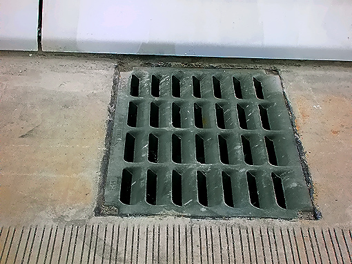 |
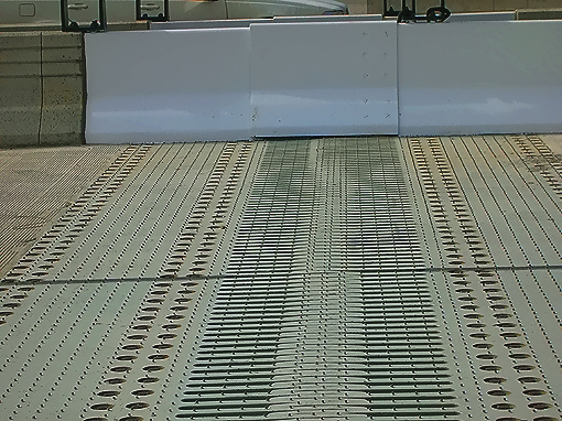
Potomac River Bridge 6-lane Inner Loop bridge, nearing completion. This roadway is the 3-lane express (inner) roadway of the Inner Loop (Virginia bound) of the Beltway. Drainage inlet to drain rain water from the reinforced concrete roadway deck; transverse (perpendicular to traffic) view of the joint. |
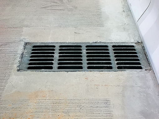 |
Potomac River Bridge 6-lane Inner Loop bridge, nearing completion. This roadway is the 3-lane express (inner) roadway of the Inner Loop (Virginia bound) of the Beltway. Drainage inlet to drain rain water from the reinforced concrete roadway deck; longitudinal (along the direction of traffic) view of the joint. |
 |
Potomac River Bridge 6-lane Inner Loop bridge, nearing completion. This roadway is the 3-lane express (inner) roadway of the Inner Loop (Virginia bound) of the Beltway. The overhead structure has a crash barrier that is lowered down to the roadway, before opening the drawspan, to prevent any vehicle from proceeding any further. There are red warning lights on top of the crash barrier. Old Town Alexandria is in the far distance. |
 |
Potomac River Bridge 6-lane Inner Loop bridge, nearing completion. The overhead structure has a crash barrier that is lowered down to the roadway, before opening the drawspan, to prevent any vehicle from proceeding any further. There are red warning lights on top of the crash barrier. Close view of the barrier and lights. |
 |
Potomac River Bridge 6-lane Inner Loop bridge, nearing completion. This roadway is the 3-lane express (inner) roadway of the Inner Loop (Virginia bound) of the Beltway. The overhead structure has a crash barrier that is lowered down to the roadway, before opening the drawspan, to prevent any vehicle from proceeding any further. There are red warning lights on top of the crash barrier. Washington, D.C. is in the far distance. The ceremony platform is to the right. |
 |
Potomac River Bridge 6-lane Inner Loop bridge, nearing completion. This roadway is the 3-lane express (inner) roadway of the Inner Loop (Virginia bound) of the Beltway. The Inner Loop bridge drawspan is fully lowered and is in alignment with the roadways. Notice the drawspan operator's tower and Outer Loop bridge to the left. The bascule spans are just forward of the operator's tower. A nice feature about this drawspan is that its roadway deck is made of reinforced concrete; and while it is much heavier than the original bridge's steel grid drawspan roadway deck, it won't have the problem of it being slippery when wet. The drawspan was engineered with much heavier counterweights so that heavier bascule spans could be utilized. |
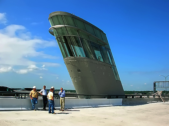 |
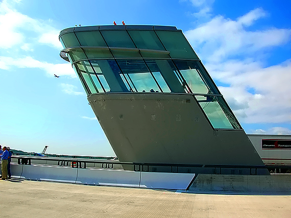
Potomac River Bridge 6-lane Inner Loop bridge, nearing completion. This roadway is the 3-lane express (inner) roadway of the Inner Loop (Virginia bound) of the Beltway. The new drawbridge Operator's Tower, which is located between the two new bridges, at the Virginia end of the bascule span. The forward-leaning part of the tower 'leans' over the drawspan to provide the necessary visibility for the operator. This tower is considerably smaller than the original tower, as the higher vertical navigational clearance (70 feet new, versus 50 feet original) under the drawspan when closed, means far fewer (about one per week) drawspan openings will be needed, therefore the human operator will only need to be there occasionally. |
 |
Potomac River Bridge 6-lane Inner Loop bridge, nearing completion. This roadway is the 3-lane express (inner) roadway of the Inner Loop (Virginia bound) of the Beltway. Standing on the drawspan section of the bridge. The new drawbridge Operator's Tower, which is located between the two new bridges, at the Virginia end of the bascule span. Upper part of the tower. |
 |
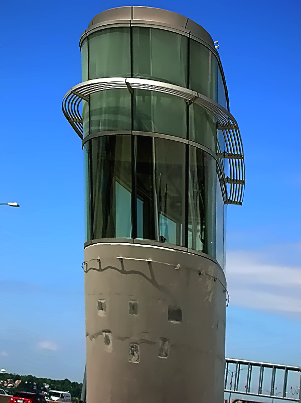
Potomac River Bridge 6-lane Inner Loop bridge, nearing completion. This roadway is the 3-lane express (inner) roadway of the Inner Loop (Virginia bound) of the Beltway. The new drawbridge Operator's Tower, which is located between the two new bridges, at the Virginia end of the bascule span. Side view of the tower. |
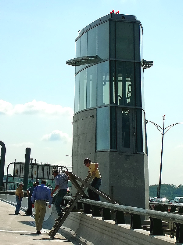 |
Potomac River Bridge 6-lane Inner Loop bridge, nearing completion. This roadway is the 3-lane express (inner) roadway of the Inner Loop (Virginia bound) of the Beltway. The new drawbridge Operator's Tower, which is located between the two new bridges, at the Virginia end of the bascule span. Rear view of the tower. |
 |
Potomac River Bridge 6-lane Inner Loop bridge, nearing completion. This roadway is the 3-lane express (inner) roadway of the Inner Loop (Virginia bound) of the Beltway. Standing on the drawspan section of the bridge. |
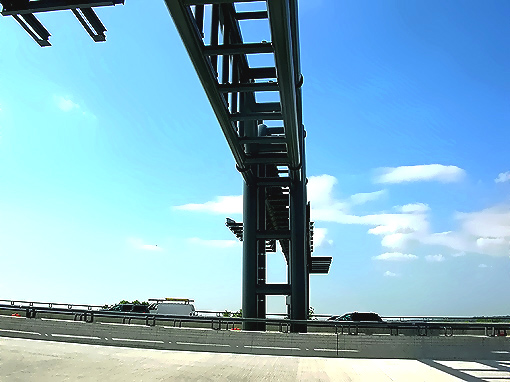 |
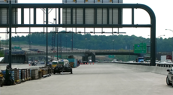
Potomac River Bridge 6-lane Inner Loop bridge, nearing completion. This roadway is the 3-lane express (inner) roadway of the Inner Loop (Virginia bound) of the Beltway. The overhead structure is for roadway signs, and these overhead structures on the WWB are designed to a very robust standard to survive very high wind speeds (Roads to the Future estimates sustained wind speeds of up to at least 120 mph; need to research this). According to the Saffir-Simpson Hurricane Scale, a Category Three Hurricane has sustained winds of 111-130 mph (96-113 kt or 178-209 km/hr). It is highly unlikely that any storm of that intensity will ever strike the Washington, D.C. area. |
 |
Potomac River Bridge 6-lane Inner Loop bridge, nearing completion. This roadway is the 3-lane express (inner) roadway of the Inner Loop (Virginia bound) of the Beltway. Closer view of the overhead structure in the previous photo. |
 |
Potomac River Bridge 6-lane Inner Loop bridge, nearing completion. This roadway is the 3-lane express (inner) roadway of the Inner Loop (Virginia bound) of the Beltway. The maximum grade on the new WWB Virginia approach is 3.00%. In the distance to the center and left, is the Hunting Towers apartment buildings. |
 |
Potomac River Bridge 6-lane Inner Loop bridge, nearing completion. This roadway is the 3-lane express (inner) roadway of the Inner Loop (Virginia bound) of the Beltway. In the distance to the left, is the Hunting Towers apartment buildings. In the distance the overpassing structure is the Washington Street Urban Deck in Alexandria VA. Washington Street is the highway that crosses the Beltway. The completed Washington Street Deck spans the entire reconstructed 12-lane Beltway, and the deck is over 200 feet long and over 200 feet wide, and carries the 4-lane Washington Street with landscaping over the rest of the deck. The Washington Street Urban Deck removes the 'barrier effect' to pedestrians that would exist with a simple replacement of the 4-lane Washington Street overpass over the 12-lane Beltway. In the distance is the Hunting Towers apartment buildings, and the Beltway U.S. Route 1 Interchange construction which is part of the WWB Project. |
This article was released on May 21, 2007, with the first 36 photos above, and the next 20 photos were added on June 8, 2008, and the next 25 photos were added on August 20, 2008. The following 22 photos were added on September 25, 2008.
The permanent 3-lane roadway which will be the Beltway Outer Loop local roadway when the WWB Project is complete, from just east of the VA-241 Telegraph Road interchange to a couple hundred feet west of the Washington Street Urban Deck at the US-1 interchange, was opened to traffic on May 11, 2008. This opening has put all Outer Loop traffic on new roadways constructed as part of the WWB Project's US-1 Interchange segment.
The express roadways on each Potomac River bridge will open in late 2008, after needed approach roadway and interchange construction is completed at either end of the bridge.
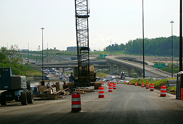
The following 22 photos were taken on May 25, 2008, by Roads to the Future. They were all taken with a 2.6x telephoto lens. This is a drive eastbound (Beltway Outer Loop) from the Eisenhower Avenue Connector interchange to the Woodrow Wilson Bridge.
Click on the photo to get a large version of the photo. The large photos have sizes ranging from 113 to 244 kilobytes, with most of them being under 178 kilobytes. With a broadband or network Internet connection each photo will download within seconds, but with a dial-up Internet connection it will be somewhat slower.
 |
I-95/I-495 Capital Beltway, eastbound (Outer Loop, toward Wilson Bridge), at the Eisenhower Avenue Connector interchange, Virginia Exit 174. The western limit of construction for the WWB Project is at this interchange, and construction has begun to the right, with widening under construction. The 8-lane (4 each way) Beltway has been narrowed to 6 lanes (3 each way) for the construction staging between the Eisenhower Avenue Connector interchange and the VA-241 Telegraph Road interchange. The Beltway will be widened to 5 lanes each way east of the Eisenhower Avenue Connector interchange, increasing to 6 lanes each way about a mile east of here. |
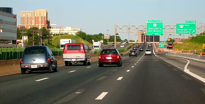 |
I-95/I-495 Capital Beltway, eastbound (Outer Loop, toward Wilson Bridge),
approaching the VA-241 Telegraph Road interchange, Virginia Exit
176. The Beltway passes over Cameron Run on a bridge just before the upgrade
in the highway ahead, notice the expansion joints of the bridge.
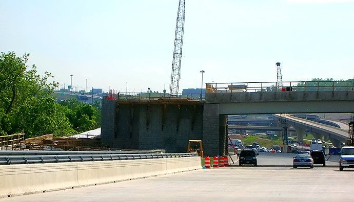
This segment of the Beltway will be reconstructed in the Telegraph Road segment of the Woodrow Wilson Bridge Project, a $236 million contract which just began construction, and this contract includes raising the Beltway roadways to provide 5 feet more elevation over Cameron Run to provide a higher resistance to flooding in heavy rainstorm conditions. Per the VDOT Dashboard entry for the project on March 16, 2008, the Contract Award was $236,393,188, the Contract Execution Date was February 12, 2008, and the Original Specified Completion Date is June 30, 2013. The Contract Execution Date includes the Notice to Proceed for the contractor. The construction contractor is CK Constructors, a joint venture of Corman Construction, Inc., and Kiewit Corporation. The contract to rebuild the I-95/I-495 interchange at Telegraph Road, and the remainder of the Beltway between the US-1 Interchange project segment and the Eisenhower Avenue Connector interchange (Virginia Exit 174), will take 5 years to complete. The contract includes 11 ramps and bridges, 5 box culvert extensions, drainage improvements, retaining walls, overhead signs, noise walls, pedestrian paths, landscaping, and environmental mitigation. |
 |
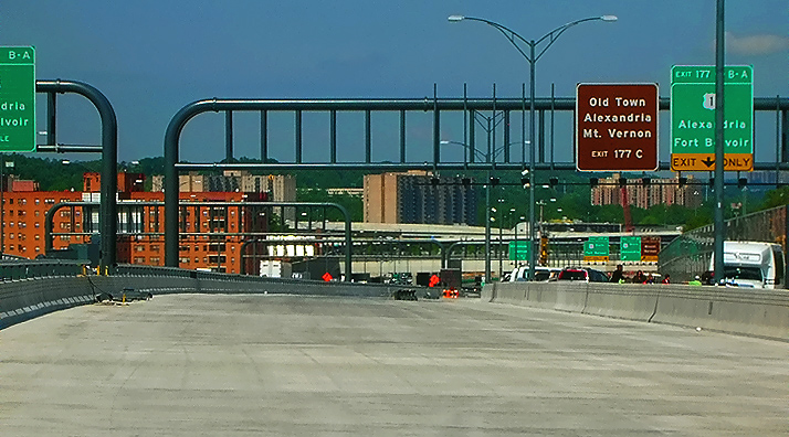
I-95/I-495 Capital Beltway, eastbound (Outer Loop), at the VA-241 Telegraph Road interchange. The construction of the U.S. I Interchange segment of the WWB Project, is visible ahead.
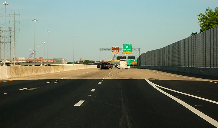
The transition to the newly-opened permanent 3-lane roadway which will be the Beltway Outer Loop local roadway when the WWB Project is complete, is visible ahead where the darker asphalt pavement begins and curves to the right. This segment from just east of the VA-241 Telegraph Road interchange to the a couple hundred feet west of the Washington Street Urban Deck at the US-1 interchange, was opened to traffic on May 11, 2008. This opening has resulted in all Outer Loop traffic operating on new roadways constructed as part of the WWB Project's US-1 Interchange segment and Potomac River Bridge segment. |
 |
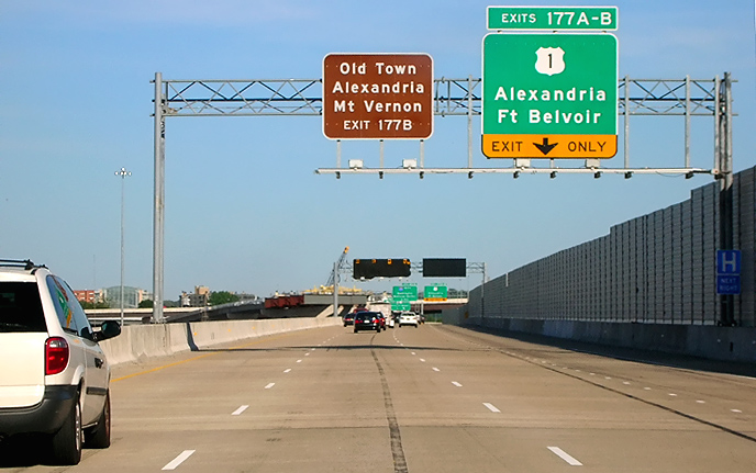
I-95/I-495 Capital Beltway, eastbound (Outer Loop), on the transition to the newly-opened 3-lane local roadway, approaching the US-1 interchange, Virginia Exit 177. The WMATA Metro rapid rail transit line Huntington Route (Yellow Line trains) runs on aerial structure, over the Beltway immediately ahead. |
 |
I-95/I-495 Capital Beltway, eastbound (Outer Loop), on the transition to the newly-opened 3-lane local roadway, approaching the US-1 interchange. |
 |
I-95/I-495 Capital Beltway, eastbound (Outer Loop), on the newly-opened 3-lane local roadway, approaching the US-1 interchange. The bridge that begins ahead passes along the edge of Cameron Run ... notice in the middle of the photo, the joint between the approach pavement (black asphalt) and the reinforced concrete bridge deck (light beige color). Notice the sound barrier to the right. |
 |
I-95/I-495 Capital Beltway, eastbound (Outer Loop), on the 3-lane local roadway, approaching the US-1 interchange. The new Beltway 3-lane express roadways are under construction to the left, and will open to traffic in late 2008. The mainline roadway continues along the bridge that runs alongside of Cameron Run. |
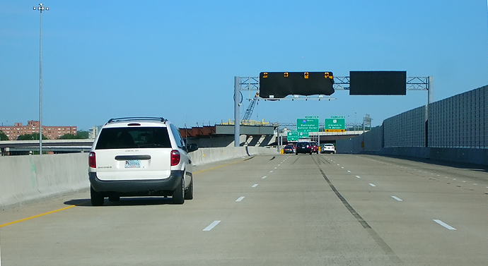 |
I-95/I-495 Capital Beltway, eastbound (Outer Loop), on the 3-lane local roadway, approaching the US-1 interchange. |
 |
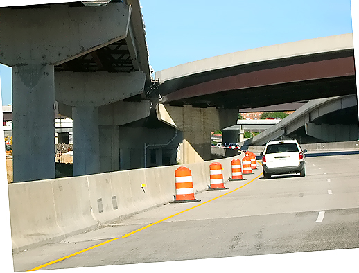
I-95/I-495 Capital Beltway, eastbound (Outer Loop), on the 3-lane local roadway, approaching the US-1 interchange. The partially completed overhead bridge ahead, will be the new ramp from the Eisenhower Valley to the Beltway Outer Loop. |
 |
I-95/I-495 Capital Beltway, eastbound (Outer Loop), on the 3-lane local roadway, at the US-1 interchange. The partially completed overhead bridge ahead, will be the new ramp from the Eisenhower Valley to the Beltway Outer Loop. |
 |
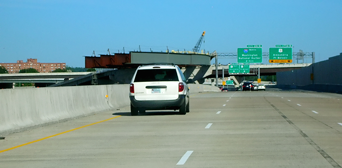
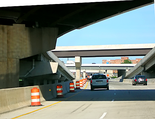
I-95/I-495 Capital Beltway, eastbound (Outer Loop, toward Wilson Bridge), on the 3-lane local roadway, at the US-1 interchange. The bridge to the left, will be part of the new ramp from the Eisenhower Valley to the Beltway Outer Loop express roadway, and the bridges in the center of the photo, are part of the ramps from southbound US-1 to the express and local roadways of the Outer Loop. The mainline roadway continues along the bridge that runs alongside of Cameron Run. |
 |
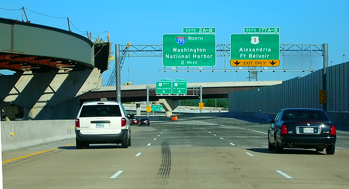
I-95/I-495 Capital Beltway, eastbound (Outer Loop), on the 3-lane local roadway, at the US-1 interchange. The bridge to the left, will be part of the new ramp from the Eisenhower Valley to the Beltway Outer Loop express roadway, and the bridges in the center of the photo, are part of the ramps from southbound US-1 to the express and local roadways of the Outer Loop. |
 |
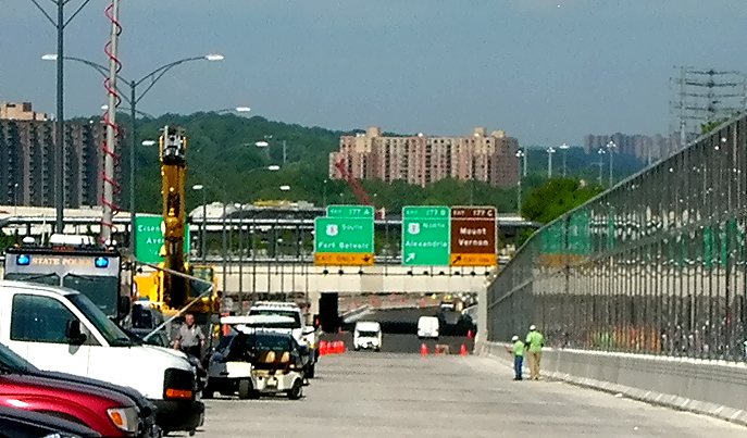
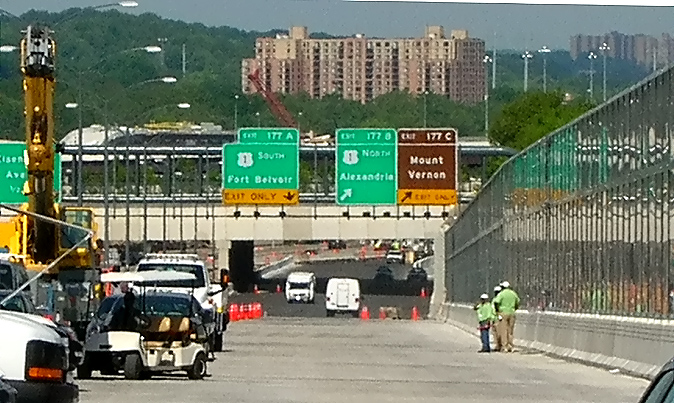
I-95/I-495 Capital Beltway, eastbound (Outer Loop), on the 3-lane local roadway, at the US-1 interchange. |
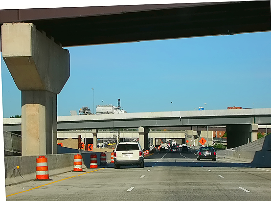 |
I-95/I-495 Capital Beltway, eastbound (Outer Loop), on the 3-lane local roadway, at the US-1 interchange. The bridge at the top of the photo, is part of the ramp from southbound US-1 to the express and local roadways of the Outer Loop. The bridge in the middle of the photo, is the US-1 mainline roadways. The mainline roadway bridge ends a couple hundred yards ahead, transitioning onto land roadway. |
 |
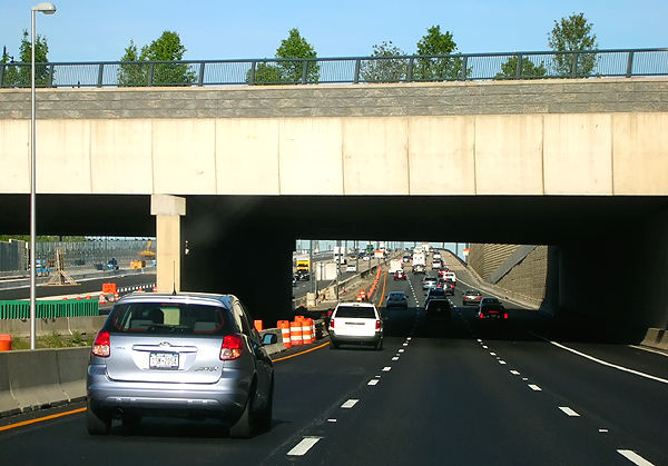
I-95/I-495 Capital Beltway, eastbound (Outer Loop), on the 3-lane local roadway, at the US-1 interchange. The bridge in the middle of the photo, is the US-1 mainline roadways. |
 |
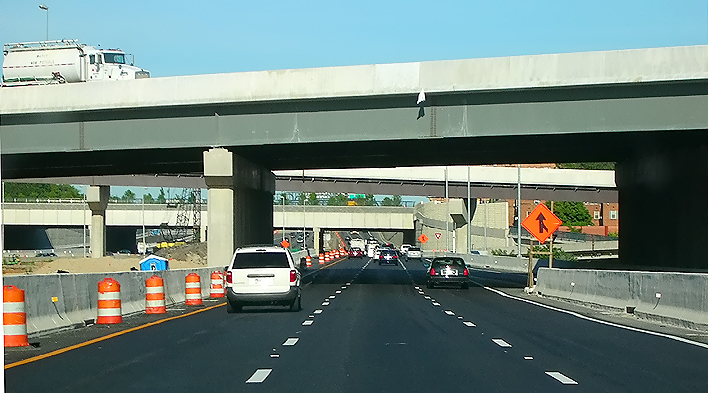
I-95/I-495 Capital Beltway, eastbound (Outer Loop), on the 3-lane local roadway, at the US-1 interchange. The bridge at the top of the photo, is the US-1 mainline roadways. The bridge in the middle of the photo, is part of the semi-directional ramp from northbound US-1 to the Beltway Inner Loop. |
 |
I-95/I-495 Capital Beltway, eastbound (Outer Loop), on the 3-lane local roadway, at the US-1 interchange. The bridge at the top of the photo, is part of the semi-directional ramp from northbound US-1 to the Beltway Inner Loop. In the middle of the photo, is the overpassing Washington Street Urban Deck. In the upper right the Hunting Towers apartments are visible. |
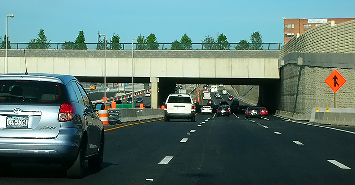 |
I-95/I-495 Capital Beltway, eastbound (Outer Loop), on the 3-lane local roadway, at the US-1 interchange. In the middle of the photo, is the overpassing Washington Street Urban Deck. |
 |
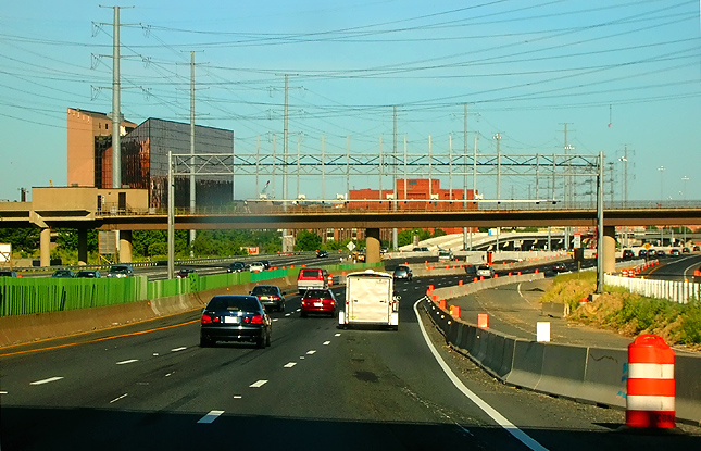
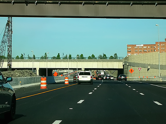
I-95/I-495 Capital Beltway, eastbound (outer Loop, toward Wilson Bridge), on the 3-lane local roadway, approaching the overpassing Washington Street Urban Deck. Washington Street is the highway that crosses the Beltway. The Washington Street Deck spans the entire reconstructed 12-lane Beltway, and the deck is over 200 feet long and over 200 feet wide, and carries the 4-lane Washington Street with landscaping over the rest of the deck. The Washington Street Urban Deck removes the 'barrier effect' to pedestrians that would exist with a simple replacement of the 4-lane Washington Street overpass over the 12-lane Beltway (actually 14 lanes including auxiliary lanes). |
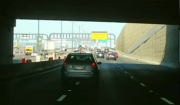 |
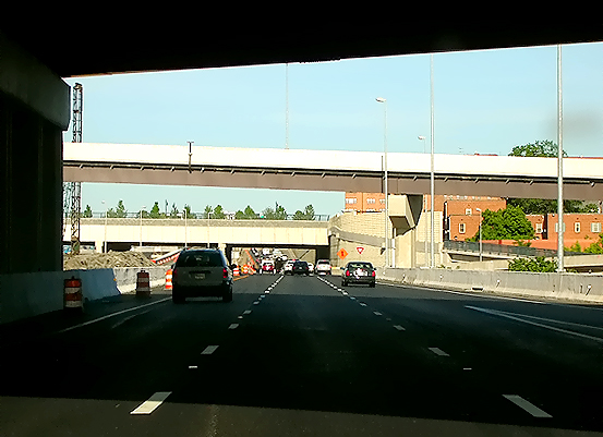
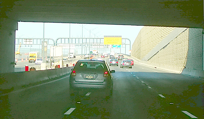
I-95/I-495 Capital Beltway, eastbound (outer Loop), on the 3-lane local roadway, passing under the overpassing Washington Street Urban Deck. The Virginia end of the Woodrow Wilson Bridge is near the overhead sign gantry ahead. |
 |
Same photo as the previous photo, but over-brightened to show details under the deck. |
 |
I-95/I-495 Capital Beltway, eastbound (Outer Loop), on the 3-lane local roadway between the Washington Street Urban Deck and the first new 6-lane Woodrow Wilson Bridge. The Virginia end of the bridge is near the overhead sign gantry ahead. |
 |
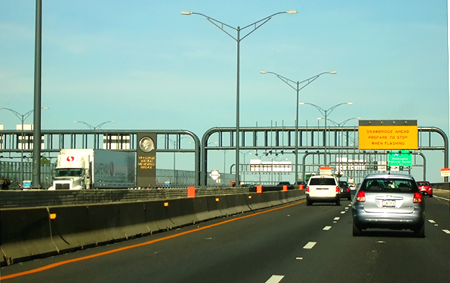
Woodrow Wilson Bridge, Outer Loop span, on the 3-lane roadway which will be the Beltway Outer Loop local roadway when the WWB Project is complete, heading eastbound toward Maryland. The maximum grade on the Virginia approach of the bridge is 3.00%. |
Lead article - Woodrow Wilson Bridge Project Photos
All photos by Scott Kozel.
Copyright © 2008 by Scott Kozel. All rights reserved. Reproduction, reuse, or distribution without permission is prohibited.
By Scott M. Kozel, Capital Beltway dot com, Roads to the Future
(Created 5-21-2008, last updated 9-26-2008)