
| Woodrow Wilson Bridge Project Photos - March 2005 |
The following 29 photos show various aerial views of the I-95/I-495 Woodrow Wilson Bridge (WWB) Project construction, including the new Potomac River Bridge under construction, the new U.S. Route 1 Interchange under construction, and the new Interstate 295 Interchange under construction.
These photos were taken on March 2, 2005, by the Virginia Department of Transportation, and are posted here with their permission, and Roads to the Future utilized Adobe PhotoDeluxe Business Edition to brighten all the photos and to align and crop some of the photos. Click on the photo to get a large version of the photo. In later versions of Netscape and Internet Explorer, you probably will need to use Full Screen mode (the F11 key can be utilized to swap back and forth between Full Screen and Regular) to see the full size of the large photo without browser-induced image shrinkage. The large photos have sizes ranging from 135 to 287 kilobytes, with most of them being under 208 kilobytes. With a broadband or network Internet connection each photo will download within seconds, but with a dial-up Internet connection it will be slow.
 |
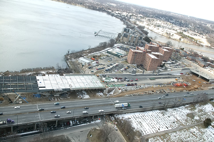
U.S. Route 1 Interchange construction, looking east across Hunting Creek (also known as Cameron Run), and the 8-lane I-95/I-495 Capital Beltway, with Alexandria on the north side of the Beltway, and the Potomac River and Woodrow Wilson Bridge is visible in the distance. The long new bridge under construction on the near side of the Beltway, is part of the US Route 1 Interchange Advanced Bridge contract, and the bridge will carry the Beltway Outer Loop local roadway. The cleared area on both sides of the Beltway is for the widened highway, and one of the sites of the US Route 1 Interchange Ground Improvement contract. |
 |
U.S. Route 1 Interchange construction, looking east across Hunting Creek, and the I-95/I-495 Capital Beltway, with Alexandria on the north side of the Beltway. This is a closer view of the right center portion of the previous photo. US-1 runs generally left to right in this photo. The bridges in the lower left corner, the loop ramp under construction, and the outer ramp under construction on the far side of US-1, are parts of the US Route 1 Interchange Advanced Bridge contract. |
 |
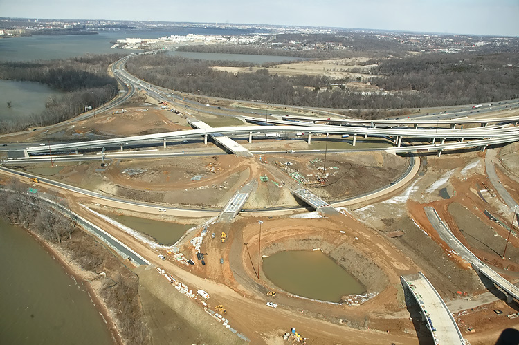
U.S. Route 1 Interchange construction, looking north across Hunting Creek, and the I-95/I-495 Capital Beltway, with Alexandria on the north side of the Beltway. This photo was taken from over US-1, and the new ramps under construction can be seen on either side of US-1. Nearly all of the southern half of the original US-1/I-495 interchange was built on bridge structure to span the creek and low-lying ground areas, and US-1 itself is on a bridge from south of the creek to just north of the Beltway. |
 |
Mount Vernon Memorial Highway runs from the bottom of the photo, upward past the apartment complex where the Mount Vernon Memorial Highway becomes Washington Street, and Washington Street crosses the Beltway and goes into Old Town Alexandria. The Beltway runs left-right across the center of the photo. The Potomac River and Washington, D.C. is in the distance. |
 |
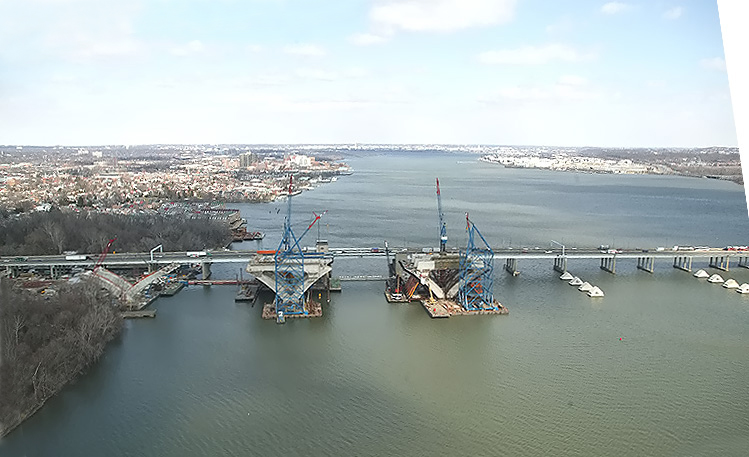
Virginia approaches construction to the Potomac River Bridge, looking north. Construction in the center of the photo is the Potomac River Bridge Virginia Approach Spans contract. The new Virginia abutment for the Potomac River Bridge is visible in the left of the photo. The existing Woodrow Wilson Bridge and Old Town Alexandria and the Potomac River are visible in the upper part of the photo. |
 |
Virginia approaches construction to the Potomac River Bridge, looking north. Construction in the center of the photo is the Potomac River Bridge Virginia Approach Spans contract. The existing Woodrow Wilson Bridge and Old Town Alexandria and the Potomac River are visible in the upper part of the photo. The new Virginia abutment for the Potomac River Bridge is visible in the left of the photo. Jones Point is visible in the right of the photo. The piers for several spans of the new Potomac River Bridge for the Beltway Outer Loop, have been built, and the steel girders have been placed, which will support the future roadway deck. |
 |
Potomac River Bridge construction, looking north, across Jones Point, at the Virginia Approach Spans construction, and the Bascule Span construction. The new 12-lane twin-span bridge is being built just to the south of the existing 6-lane Woodrow Wilson Bridge. |
 |
Potomac River Bridge construction, looking north, across Jones Point, at the Virginia Approach Spans construction, and the Bascule Span construction. The new 12-lane twin-span bridge is being built just to the south of the existing 6-lane Woodrow Wilson Bridge. Similar vantage point as the previous photo, but a more wide angle view. |
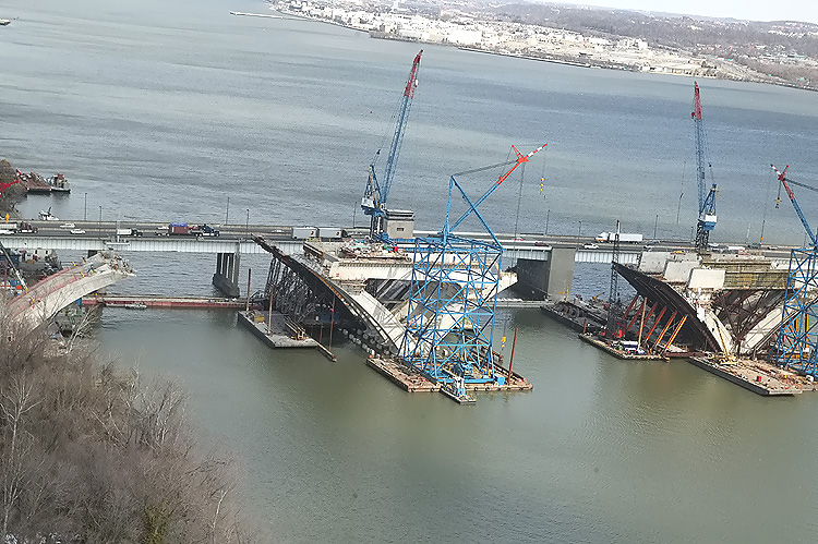 |
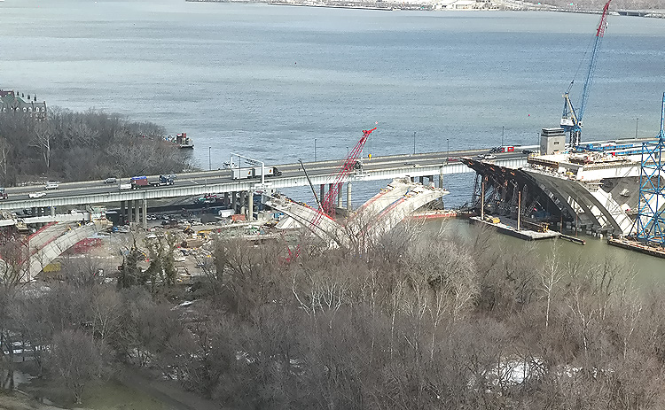
Potomac River Bridge construction, looking north, closer view of the Bascule Span construction, which is being built under the Potomac River Bridge Bascule Spans contract. |
 |
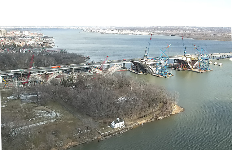
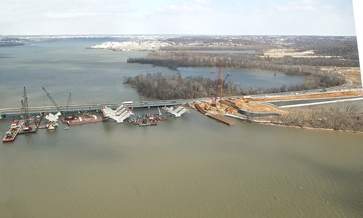
Potomac River Bridge construction, looking north, similar vantage point as the previous photo, but a more wide angle view. The Maryland Approach Spans construction is visible in the right of the photo, which is being built under the Potomac River Bridge Maryland Approach Spans contract. |
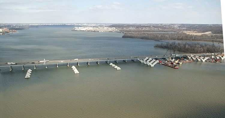 |
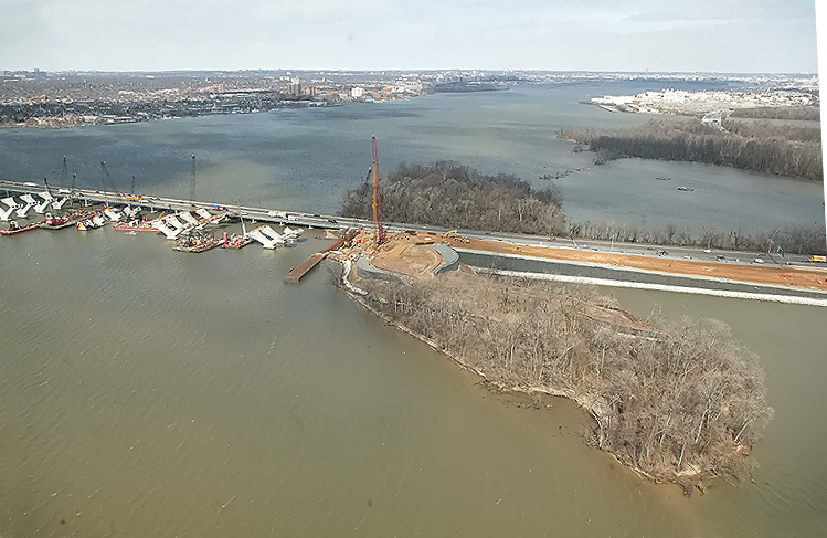
Potomac River Bridge construction, looking north, the Maryland Approach Spans construction. The new 12-lane twin-span bridge is being built just to the south of the existing 6-lane Woodrow Wilson Bridge. The large "blocks" on the river are the foundations for the new bridge, built via the Potomac River Bridge Foundations contract. Downtown Washington, D.C. is on the horizon, and if you look closely you can see the Washington Monument. |
 |
Potomac River Bridge construction, looking north, the Maryland Approach Spans construction, and the Maryland I-295 Interchange construction is visible at the right edge of the photo. |
 |
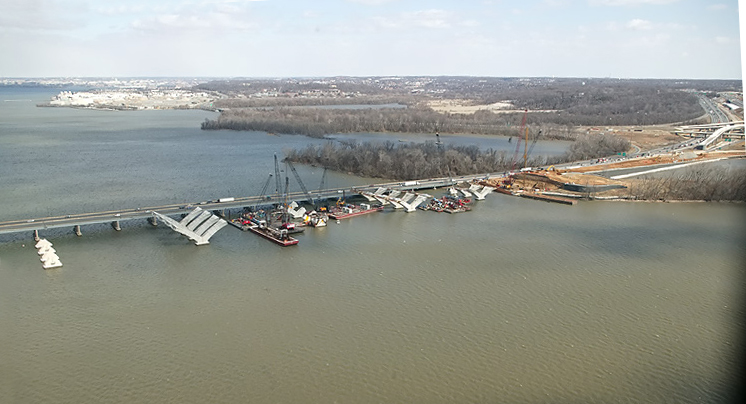
Potomac River Bridge construction, looking north, the Maryland Approach Spans construction. The new 12-lane twin-span bridge is being built just to the south of the existing 6-lane Woodrow Wilson Bridge. The piers for the Maryland Approach Spans are being built on the foundations for the new bridge. |
 |
Potomac River Bridge construction, looking north, the Maryland Approach Spans construction. The new 12-lane twin-span bridge is being built just to the south of the existing 6-lane Woodrow Wilson Bridge. The eastern landfall of the bridge is on Rosalie Island. |
 |
Potomac River Bridge construction, looking north, the Maryland Approach Spans construction. The new 12-lane twin-span bridge is being built just to the south of the existing 6-lane Woodrow Wilson Bridge. The eastern landfall of the bridge is on Rosalie Island, and the island is seen in full in this photo, and a land causeway is utilized for the highway between Rosalie Island and the Maryland shoreline. |
 |
Interstate 295 Interchange construction, looking east, from about the same vantage point as the previous photo, but looking to the right. I-295 is seen as it sweeps to the left and then upward, to the center of Washington, D.C. |
 |
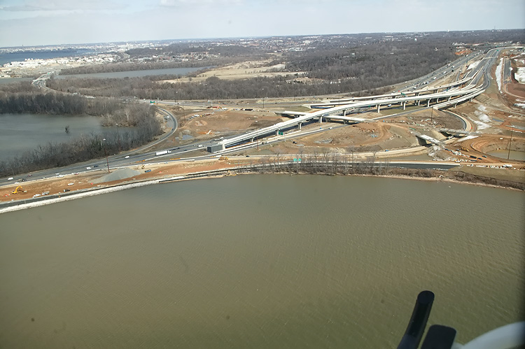
Interstate 295 Interchange construction, looking north. I-295 is seen as it heads upward to the center of Washington, D.C. High capacity roadways and ramps are being constructed to make this a 4-way interchange, with the southerly extension heading into the National Harbor development which began construction in 2004. Website for National Harbor. |
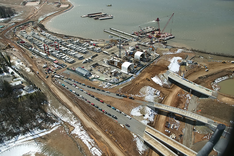 |
Interstate 295 Interchange construction, looking south, the south section of the interchange that heads into the property of the National Harbor development. The center and left part of the photo shows the fabrication yard for the pre-casting of the segments that are being utilized for the piers on the Potomac River Bridge Maryland Approach Spans construction. |
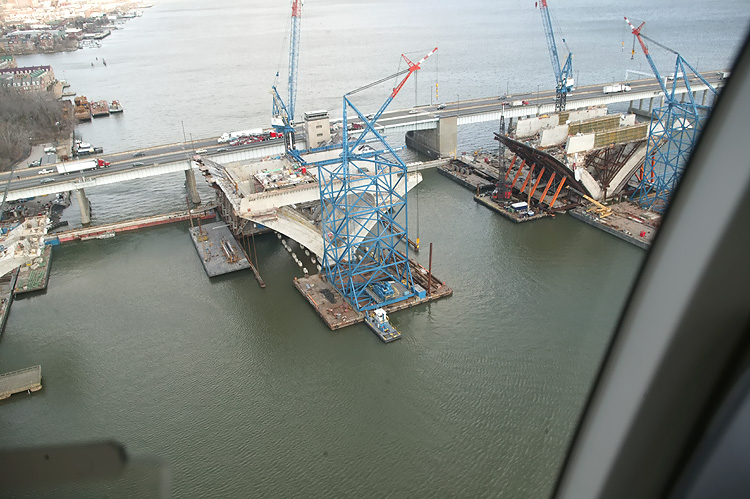 |
Potomac River Bridge construction, looking north, close view of the Bascule Span construction, which is being built under the Potomac River Bridge Bascule Spans contract. The new 12-lane twin-span bridge is being built just to the south of the existing 6-lane Woodrow Wilson Bridge. |
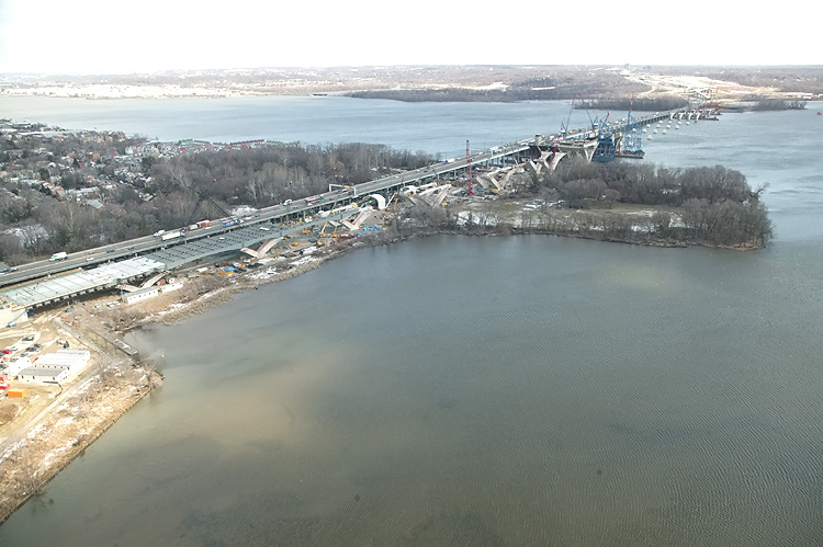 |
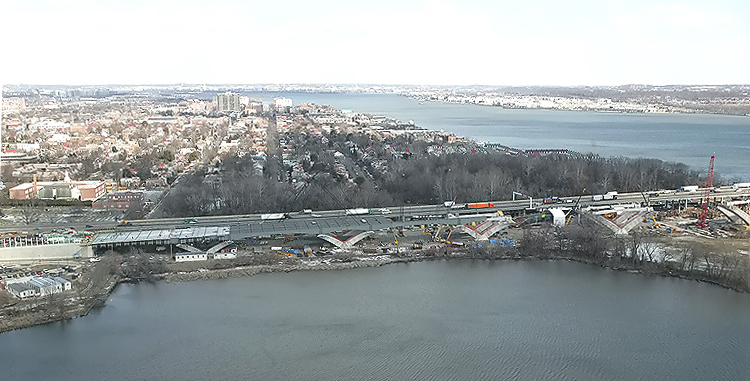
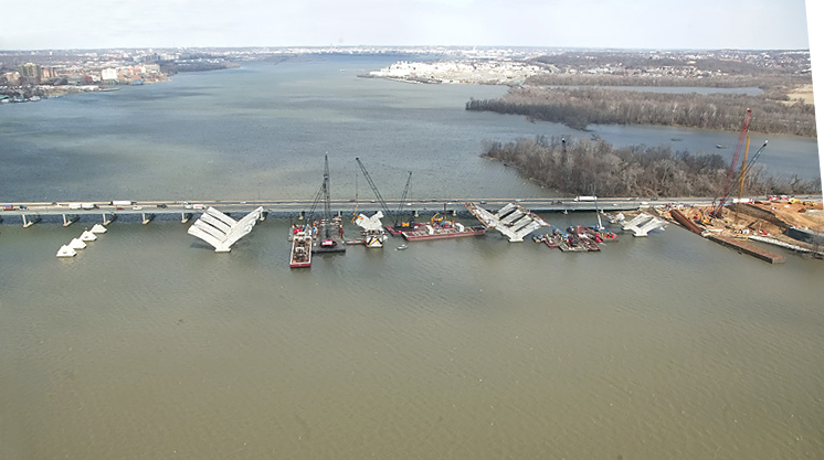
Entire Woodrow Wilson Bridge visible, looking north from Virginia toward Maryland in the distance, the point of land to the right is Jones Point. The new 12-lane twin-span bridge is being built just to the south of the existing 6-lane Woodrow Wilson Bridge. The Virginia Approach Spans construction is to the left, the Bascule Span construction is to the center, the Maryland Approach Spans construction is to the right, the Maryland Beltway land approaches are visible in the upper right corner of the photo. |
 |
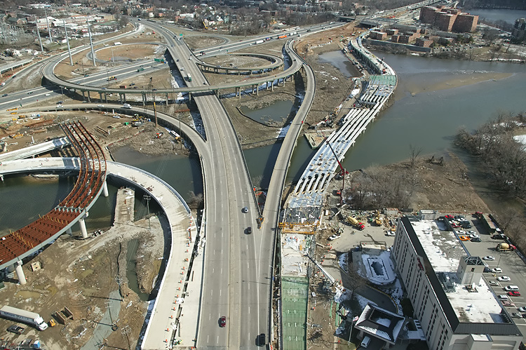
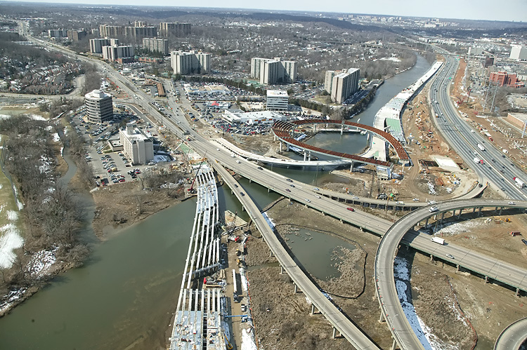
Virginia approaches construction to the Potomac River Bridge, looking west. Construction in the foreground is the Potomac River Bridge Virginia Approach Spans contract, and construction of the trumpet-shaped piers is visible, with the existing 6-lane Beltway to the right. The new Virginia abutment for the Potomac River Bridge is visible in the center of the photo, and the land approach construction is visible above that, with the Hunting Towers apartment complex to the left of that, and the Washington Street Deck construction is visible, with the existing U.S. Route 1 Interchange visible in the distance. The piers for several spans of the new Potomac River Bridge for the Beltway Outer Loop, have been built, and the steel girders have been placed, which will support the future roadway deck. |
 |
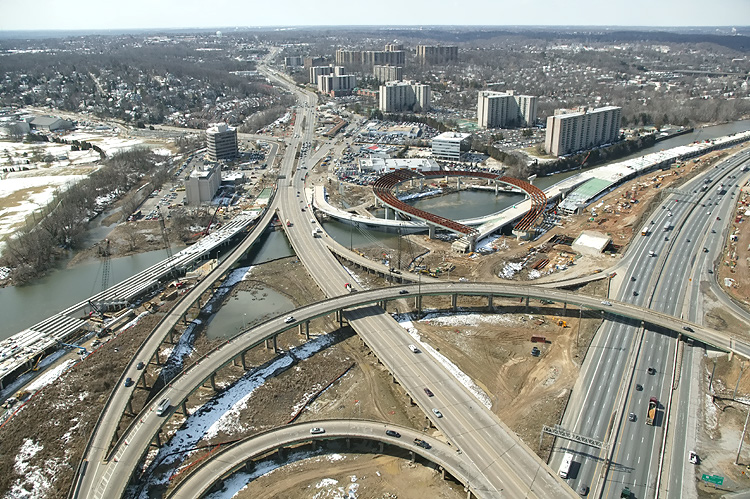
Virginia approaches construction to the Potomac River Bridge, looking south. The new 12-lane twin-span bridge is being built just to the south of the existing 6-lane Woodrow Wilson Bridge. The Hunting Towers apartment complex is in the center of the photo, and the Washington Street Deck construction is visible at the right edge of the photo. |
 |
Virginia approaches construction to the Potomac River Bridge, looking south. Looking from over Washington Street, across the Beltway and WWB Project, and Washington Street south of the apartments becomes the Mount Vernon Memorial Highway and heads to Mount Vernon. The new highway's retaining walls close to the buildings are almost complete, and the Washington Street Deck has been completed over the future local and express Beltway Outer Loop roadways. Washington Street is the highway that crosses the Beltway, and its traffic is being maintained during construction over the Beltway. The completed Washington Street Deck will span the entire reconstructed 12-lane Beltway, and the deck will be over 200 feet long and over 200 feet wide, and will carry the 4-lane divided Washington Street with landscaping over the rest of the deck. |
 |
U.S. Route 1 Interchange construction, looking south across the I-95/I-495 Capital Beltway and Hunting Creek. The ramp bridges under construction are part of the US Route 1 Interchange Advanced Bridge contract. |
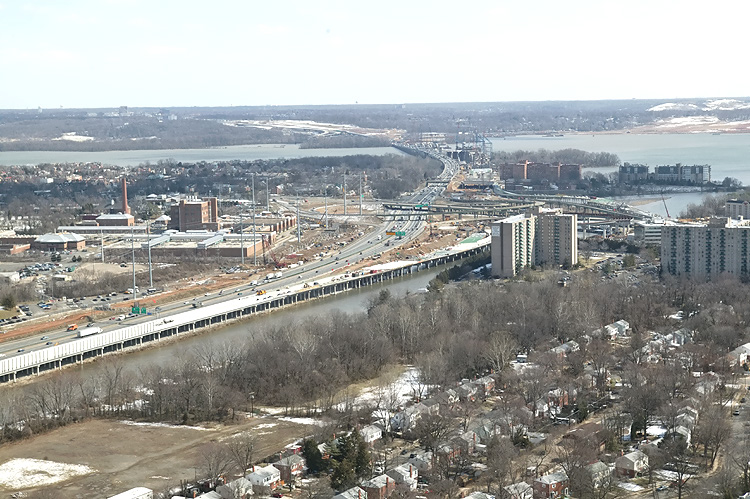 |
U.S. Route 1 Interchange construction, looking east across Hunting Creek, and the I-95/I-495 Capital Beltway, with Alexandria on the north side of the Beltway. The US Route 1 Interchange Advanced Bridge contract construction is visible in the foreground, and the existing U.S. Route 1 Interchange is visible in the center of the photo, and beyond that is the Woodrow Wilson Bridge, the Potomac River, and Maryland. |
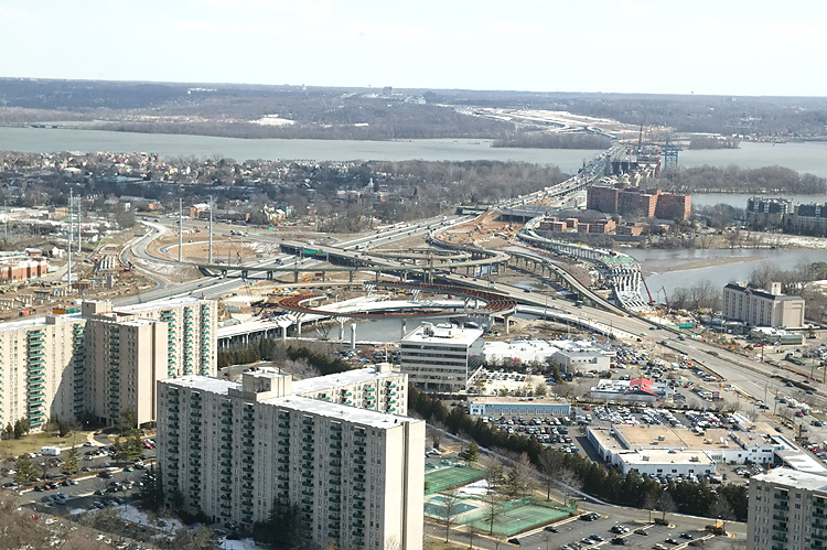 |
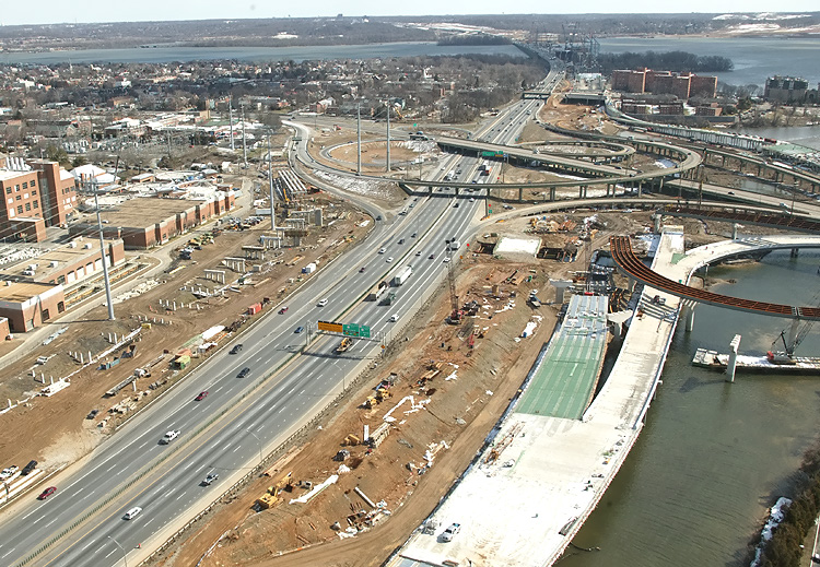
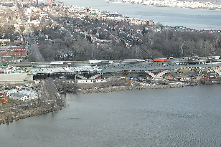
U.S. Route 1 Interchange construction, looking east across Hunting Creek, and the I-95/I-495 Capital Beltway, with Alexandria on the north side of the Beltway, and the Potomac River in the distance. The existing U.S. Route 1 Interchange is visible in the center of the photo, and the Woodrow Wilson Bridge is visible in the upper right corner of the photo. The US Route 1 Interchange (Major Portion) contract is in its early stages, with it being about 10% complete as of the April 2005 release of this article. |
 |
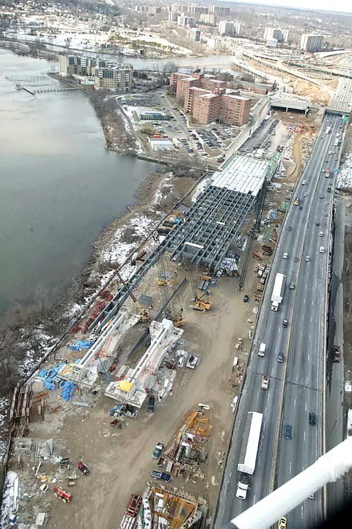
U.S. Route 1 Interchange construction, looking north across Hunting Creek, and the I-95/I-495 Capital Beltway, with Alexandria on the north side of the Beltway, and the Potomac River in the distance. The existing U.S. Route 1 Interchange is visible in the center of the photo. The highway in the foreground is U.S. Route 1. The bridges under construction on the near side of the Beltway, are part of the US Route 1 Interchange Advanced Bridge contract. |
 |
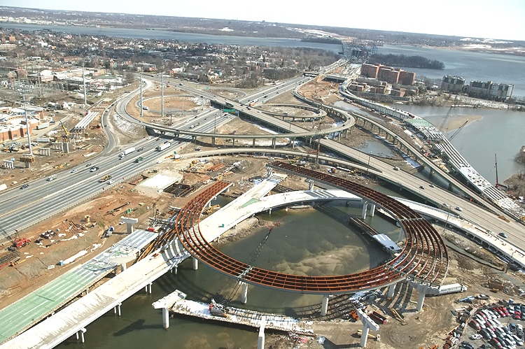
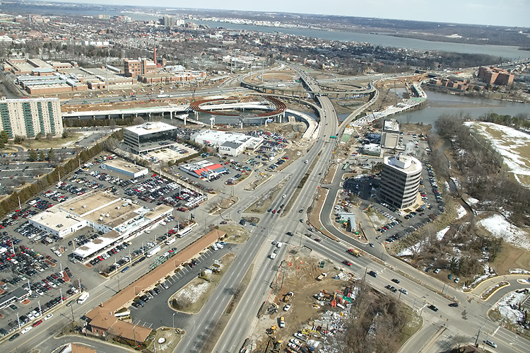
U.S. Route 1 Interchange construction, looking west across the I-95/I-495 Capital Beltway and Hunting Creek. This photo captures almost all of the US Route 1 Interchange Advanced Bridge contract, which includes the new ramp bridges at the south section of the interchange, and the long bridge for the Beltway Outer Loop local roadway. |
 |
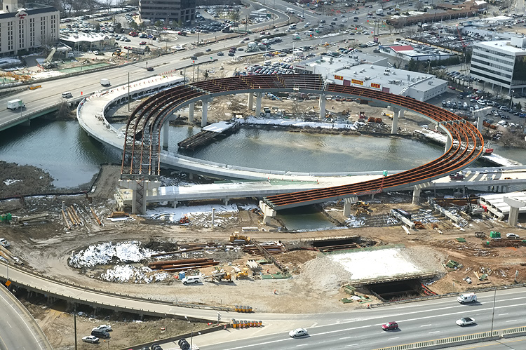
U.S. Route 1 Interchange construction, looking south along U.S. Route 1, with the Beltway to the right. The original U.S. Route 1 Interchange has a considerable amount of bridgework across areas of water and low-lying land, with a long bridge on U.S. 1 and bridges on four of the ramps. The interchange seen here is in essentially the same format as when it opened to traffic in 1961, with a modified cloverleaf design with a semi-directional ramp connecting southbound U.S. 1 to northbound I-95/I-495, and with a collector-distributor (C-D) roadway intercepting the two loop ramps on southbound I-95/I-495. |
Lead article - Woodrow Wilson Bridge Project Photos
Copyright © 2005 by Scott Kozel. All rights reserved. Reproduction, reuse, or distribution without permission is prohibited.
By Scott M. Kozel, Capital Beltway dot com, Roads to the Future
(Created 4-2-2005, updated 7-25-2005, moved to capital-beltway.com on 3-17-2007)