
| Woodrow Wilson Bridge Project Photos - February 2009 |
These photos were taken on February 12, 2009 by the Virginia Department of Transportation, and are posted here with their permission. Roads to the Future utilized PhotoDeluxe Business Edition to sharpen and to align the photos. Click on the photo to get a large version of the photo. You may need to use Full Screen mode (the F11 key can be utilized to swap back and forth between Full Screen and Regular) to see the full size of the large photo without browser-induced image shrinkage. The large photos have sizes ranging from 126 to 252 kilobytes, with most of them being under 179 kilobytes. With a broadband or network Internet connection each photo will download within seconds, but with a dial-up Internet connection it will be somewhat slower.
A white surfacing has been applied on the concrete surface of the bridge piers and on the surface of the steel girders, and this surfacing is polymer-based with a mixture of fine aggregate, designed to be very durable and to last for many years, and designed to make the bridge glow at day and at night. The underside of the bridge also has lighting to illuminate it at night, and does a great job of illuminating the bridge, as the photos below demonstrate.
 |
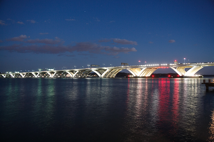
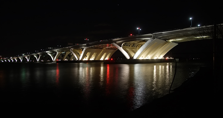
Woodrow Wilson Bridge, view from north of the bridge, from the Old Town Alexandria shoreline of the Potomac River, looking south toward the bascule span and Maryland approach of the bridge. |
 |
Woodrow Wilson Bridge, view from north of the bridge, from the Old Town Alexandria shoreline, looking south toward the Maryland approach of the bridge. |
 |
Woodrow
Wilson Bridge, view from north of the bridge, from the Old Town Alexandria
shoreline, looking south toward the bascule span of the bridge.
The Potomac River has a naturally deep channel in this area, and it is about 500 feet from the Virginia shoreline at this point, and it is about 22 feet deep, and that is the shipping channel, and that is the location of the bascule span. The Potomac River in this area ranges from 3/4 to 1 mile wide. |
 |
Woodrow Wilson Bridge, view from north of the bridge, from the Old Town Alexandria shoreline, looking south toward the Maryland approach of the bridge. |
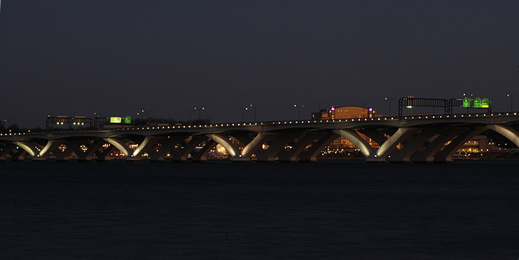 |
Woodrow Wilson Bridge, view from north of the bridge, from the Old Town Alexandria shoreline, looking south toward the Maryland approach of the bridge. |
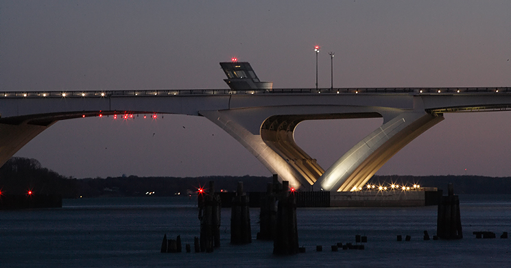 |
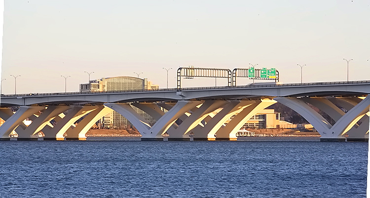
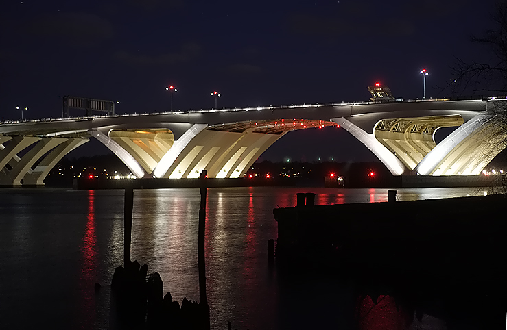
Woodrow Wilson Bridge, view from north of the bridge, from the Old Town Alexandria shoreline, looking south toward the bascule span of the bridge. Notice the bascule span operator's tower on the bridge. |
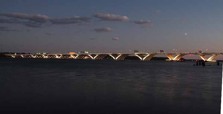 |
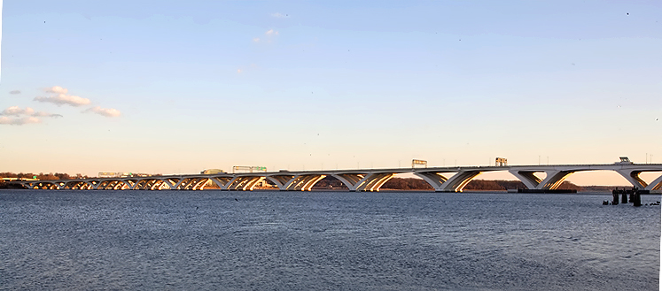
Woodrow Wilson Bridge, view from north of the bridge, from the Old Town Alexandria shoreline, looking south toward the bascule span and Maryland approach of the bridge. |
 |
Woodrow Wilson Bridge, view from north of the bridge, from the Old Town Alexandria shoreline, looking south toward the bascule span and Maryland approach of the bridge. |
 |
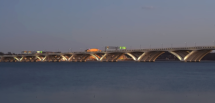
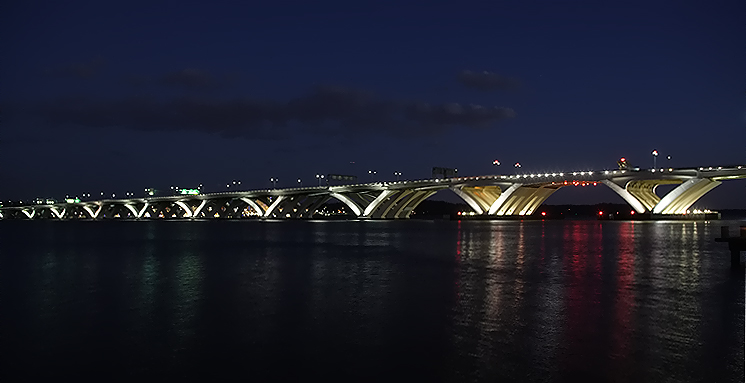
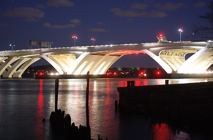
Woodrow Wilson Bridge, view from north of the bridge, from the Old Town Alexandria shoreline, looking south toward the bascule span and Maryland approach of the bridge. Notice that all of the piers of the bascule span are illuminated, and that only the outside piers of the approach spans are illuminated. |
 |
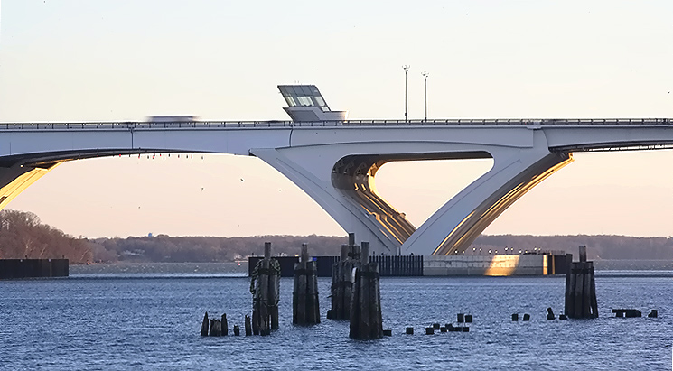
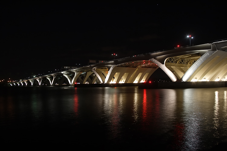
Woodrow Wilson Bridge, view from north of the bridge, from the Old Town Alexandria shoreline, looking south toward the bascule span of the bridge. The new bascule span has 70 feet of vertical navigational clearance when the drawspan is closed, 20 feet higher than the original bridge's bascule span which had 50 feet of vertical navigational clearance when its drawspan was closed. The original drawspan opened approximately 260 times per year to allow for the passage of marine traffic with greater than 50 foot height above water. Because the new drawbridges are 20 feet higher than the pre-existing bridge, the number of openings will be reduced to about 65 per year (or about one per week), about a 75 percent reduction. |
 |
Woodrow Wilson Bridge, view from north of the bridge, from the Old Town Alexandria shoreline, looking south toward the bascule span and Maryland approach of the bridge. |
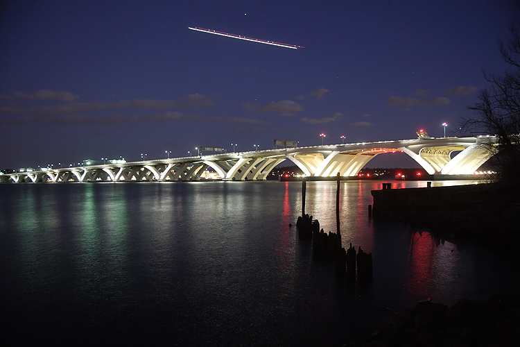 |
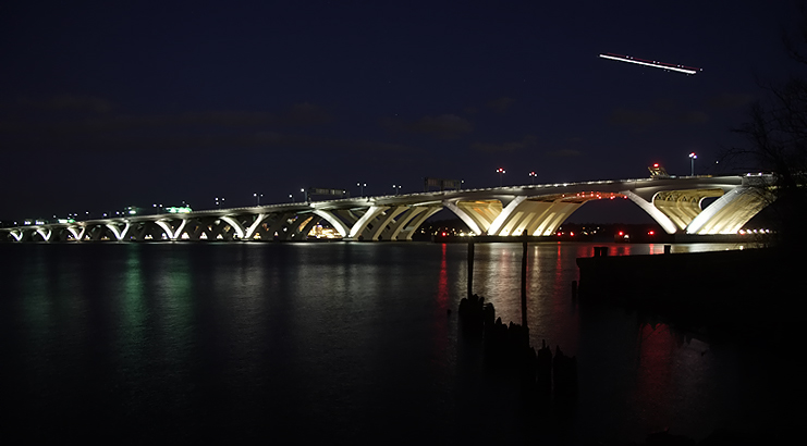
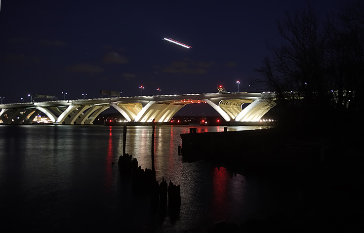
Woodrow Wilson Bridge, view from north of the bridge, from the Old Town Alexandria shoreline, looking south toward the bascule span and Maryland approach of the bridge. At least some of these photos were taken with a time lapse ... the long white and red streak in the upper part of some of these photos is an airliner on final approach to National Airport which is 3 miles north of the WWB. Differing lengths of time lapse would account for why there are variations in the brightness of some of the photos. |
 |
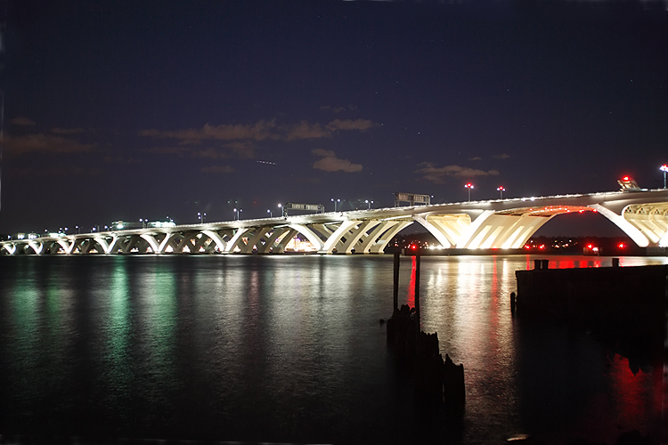
Woodrow Wilson Bridge, view from north of the bridge, from the Old Town Alexandria shoreline, looking south toward the bascule span of the bridge. |
 |
Woodrow Wilson Bridge, view from north of the bridge, from the Old Town Alexandria shoreline, looking south toward the bascule span of the bridge. |
 |
Woodrow Wilson Bridge, view from north of the bridge, from the Old Town Alexandria shoreline, looking south toward the bascule span and Maryland approach of the bridge. |
 |
Woodrow Wilson Bridge, view from north of the bridge, from the Old Town Alexandria shoreline, looking south toward the bascule span and Maryland approach of the bridge. Notice that all of the piers of the bascule span are illuminated, and that only the outside piers of the approach spans are illuminated. |
 |
Woodrow Wilson Bridge, view from north of the bridge, from the Old Town Alexandria shoreline, looking south toward the bascule span and Maryland approach of the bridge. |
 |
Woodrow Wilson Bridge, view from north of the bridge, from the Old Town Alexandria shoreline, looking south toward the bascule span and Maryland approach of the bridge. |
Lead article - Woodrow Wilson Bridge Project Photos
Copyright © 2009 by Scott Kozel. All rights reserved. Reproduction, reuse, or distribution without permission is prohibited.
By Scott M. Kozel, Capital Beltway dot com, Roads to the Future
(Created 2-25-2009)