
| Woodrow Wilson Bridge Project Photos - December 2008 |
The following 7 photos show views of the the I-95/I-495 Woodrow Wilson Bridge (WWB) Project construction, showing the completed new Potomac River Bridge, from the vantage point of Old Town Alexandria, Virginia.
These photos were taken on December 26, 2008 by Roads to the Future. You may need to use Full Screen mode (the F11 key can be utilized to swap back and forth between Full Screen and Regular) to see the full size of the large photo without browser-induced image shrinkage. The large photos have sizes ranging from 182 to 255 kilobytes, with most of them being under 217 kilobytes. With a broadband or network Internet connection each photo will download within seconds, but with a dial-up Internet connection it will be somewhat slower.
 |
Woodrow
Wilson Bridge, view from north of the bridge, from the Old Town Alexandria
shoreline, looking south toward the bascule span of the bridge.
The next 3 photos are from the same vantage point, with the camera lens increasing successively to wider angles. |
 |
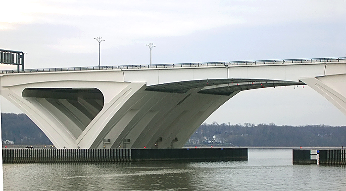
Woodrow
Wilson Bridge, view from north of the bridge, from the Old Town Alexandria
shoreline, looking south toward the bascule span of the bridge.
A white surfacing has been applied on the concrete surface of the bridge piers and on the surface of the steel girders, and this surfacing is polymer-based with a mixture of fine aggregate, designed to be very durable and to last for many years, and designed to make the bridge glow at day and at night. The underside of the bridge also has lighting to illuminate it at night. |
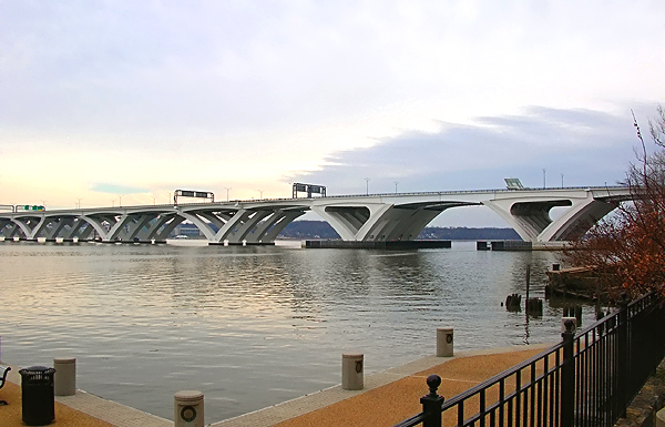 |
Woodrow
Wilson Bridge, view from north of the bridge, from the Old Town Alexandria
shoreline, looking south toward the bascule span and Maryland approach of
the bridge.
The Potomac River has a naturally deep channel in this area, and it is about 500 feet from the Virginia shoreline at this point, and it is about 22 feet deep, and that is the shipping channel, and that is the location of the bascule span. The Potomac River in this area ranges from 3/4 to 1 mile wide. |
 |
Woodrow
Wilson Bridge, view from north of the bridge, from the Old Town Alexandria
shoreline, looking south toward the Maryland approach of the bridge.
The new bascule span has 70 feet of vertical navigational clearance when the drawspan is closed, 20 feet higher than the original bridge's bascule span which had 50 feet of vertical navigational clearance when its drawspan was closed. The original drawspan opened approximately 260 times per year to allow for the passage of marine traffic with greater than 50 foot height above water. Because the new drawbridges are 20 feet higher than the pre-existing bridge, the number of openings will be reduced to about 65 per year (or about one per week), about a 75 percent reduction. |
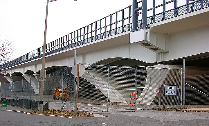 |
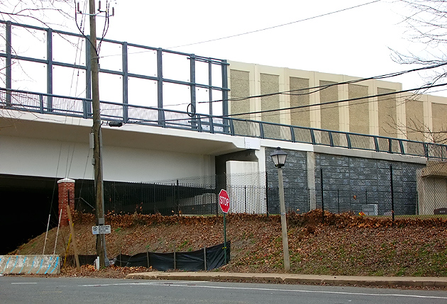
Woodrow Wilson Bridge, Virginia approach, near Royal Street in Alexandria. Notice the sound barrier along the side of the bridge, to reduce the noise impacts to Old Town Alexandria. A 1,550-foot transparent wall on the new Wilson Bridge provides soundproofing for Old Town Alexandria residents while preserving the view from the bridge; and the wall, made of acrylic panels called Paraglas, is 17 feet tall. The next 2 photos are from the same vantage point. |
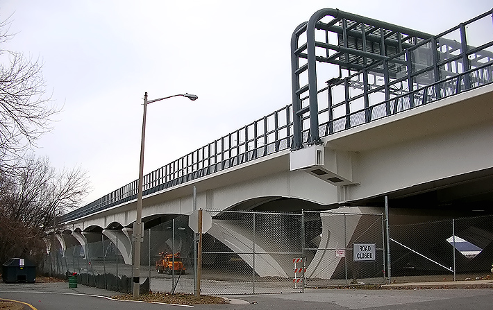 |
Woodrow Wilson Bridge, Virginia approach, near Royal Street in Alexandria. On the nearside of the sound barrier there is a path, that is part of the pedestrian/bicycle path that will connect the two states via a separated path along the north edge of the Inner Loop WWB, and the trail will carry pedestrian/bicycle traffic between US-1 south of Alexandria and pedestrian/bicycle trails in Maryland. The pedestrian/bicycle path will open to traffic in early 2009 when connecting facilities are completed. |
 |
Woodrow Wilson Bridge, Virginia approach, near Royal Street in Alexandria. The bridge's Virginia abutment (bridge terminal structure) is in the center of the photo, and is the point where the Virginia end of the WWB meets the land Beltway approach. The end of the bridge is also where the transparent sound barrier changes to a conventional reinforced concrete sound barrier. The low parapet (bridge railing) is alongside the pedestrian/bicycle path. |
Lead article - Woodrow Wilson Bridge Project Photos
Copyright © 2009 by Scott Kozel. All rights reserved. Reproduction, reuse, or distribution without permission is prohibited.
By Scott M. Kozel, Capital Beltway dot com, Roads to the Future
(Created 1-13-2009)