
| Woodrow Wilson Bridge Project Photos - August 2008 |
The following 23 photos show various views of the I-95/I-495 Woodrow Wilson Bridge (WWB) Project construction, with 22 water-level and ground-level photos of the new Potomac River bridges, and the last photo is of the I-295 interchange.
These photos were taken on August 7, 2008 by the Virginia Department of Transportation, and are posted here with their permission. Roads to the Future utilized PhotoDeluxe Business Edition to sharpen and brighten and to align all of the photos. Click on the photo to get a large version of the photo. You may need to use Full Screen mode (the F11 key can be utilized to swap back and forth between Full Screen and Regular) to see the full size of the large photo without browser-induced image shrinkage. The large photos have sizes ranging from 159 to 249 kilobytes, with most of them being under 203 kilobytes. With a broadband or network Internet connection each photo will download within seconds, but with a dial-up Internet connection it will be somewhat slower.
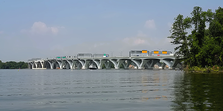 |
Woodrow
Wilson Bridge, view from south of the bridge near the Maryland shoreline.
The Virginia shoreline is visible in the distance across the Potomac River.
The next 16 photos were taken from a boat as it traveled around and under the WWB. |
 |
Woodrow Wilson Bridge, view from south of the bridge near the Maryland shoreline. The Virginia shoreline is visible in the distance across the Potomac River. |
 |
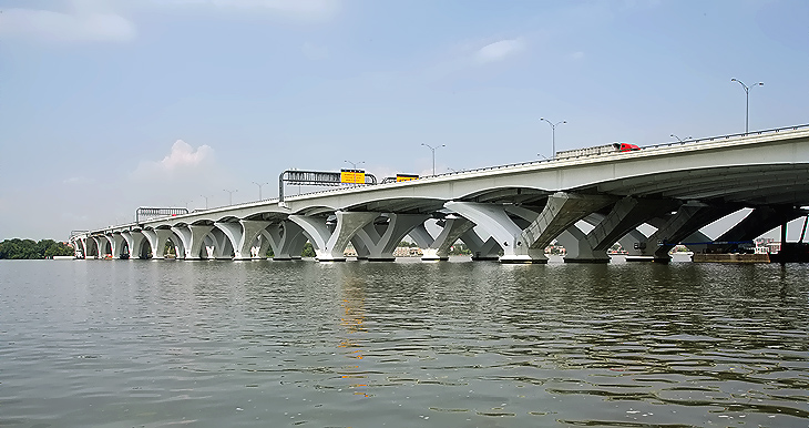
Woodrow Wilson Bridge, view from south of the bridge toward the Maryland approach of the bridge. |
 |
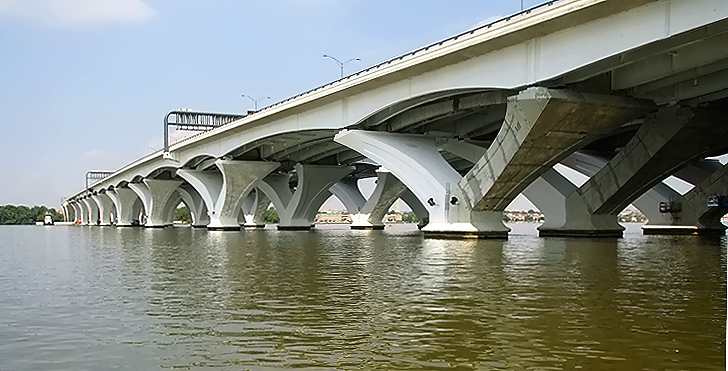
Woodrow
Wilson Bridge, view from south of the bridge toward the Maryland approach
of the bridge.
A white surfacing is being applied on the concrete of the bridge piers and on the steel girders. |
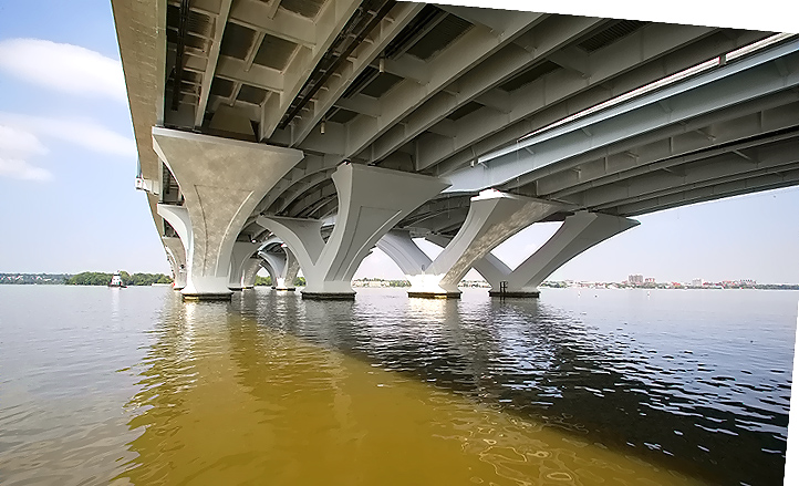 |
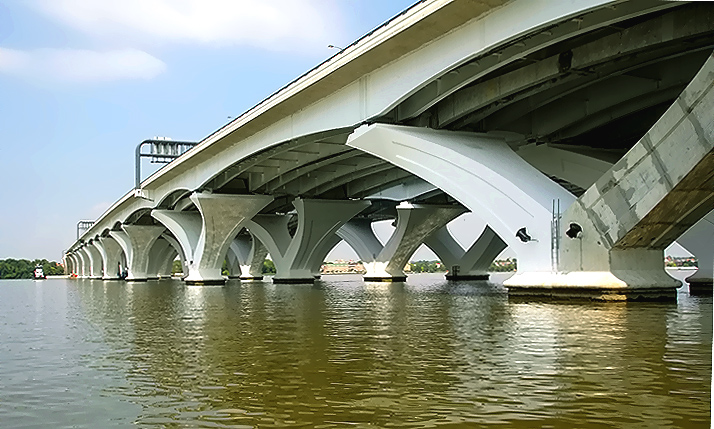
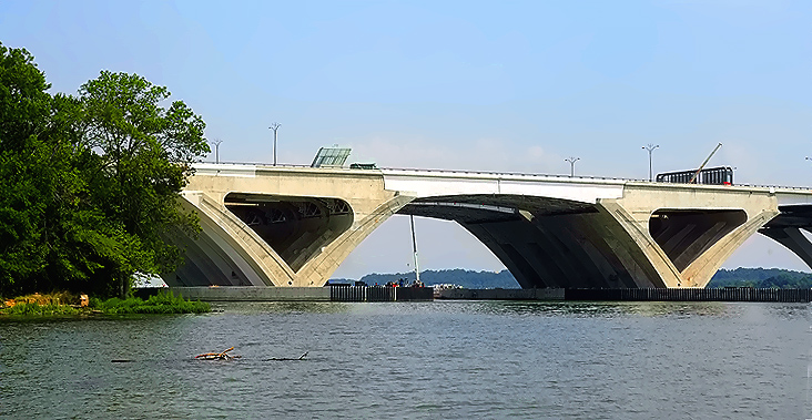
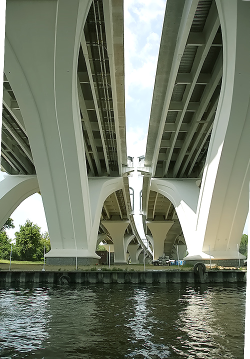
Woodrow Wilson Bridge, view from under the Maryland approach of the bridge. A wide angle lens was used. |
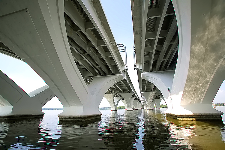 |
Woodrow Wilson Bridge, view from under the Maryland approach of the bridge. A wide angle lens was used. |
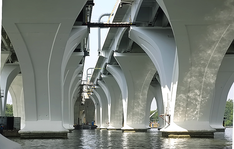 |
Woodrow Wilson Bridge, view from under the Maryland approach of the bridge, taken with a telephoto lens. |
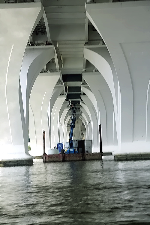 |
Woodrow Wilson Bridge, view from under the Maryland approach of the bridge, taken with a telephoto lens. |
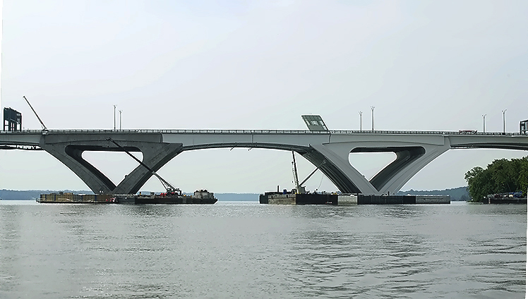 |
Woodrow Wilson Bridge, view from north of the bridge, looking south toward the bascule span of the bridge. The shoreline to the right is Virginia. |
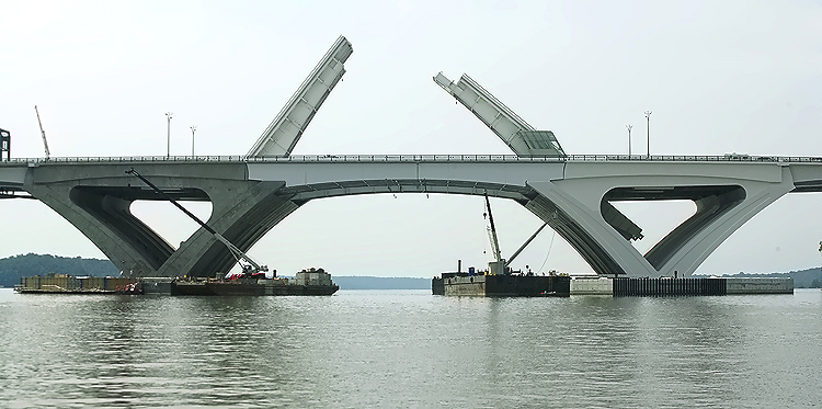 |
Woodrow Wilson Bridge, view from north of the bridge, looking south toward the bascule span of the bridge. The Inner Loop (Virginia bound) bridge's express roadway drawspan is raised (it is not yet open to traffic and this was done for testing). |
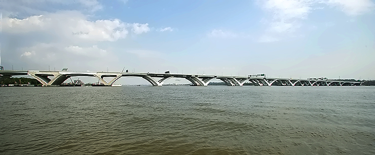 |
Woodrow Wilson Bridge, view from south of the bridge, looking north toward the entire over-water portion of the bridge. To the left is Virginia, to the right is Maryland and Washington, D.C. |
 |
Woodrow
Wilson Bridge, view from south of the bridge near the Virginia shoreline,
looking north at the bascule span.
The Potomac River has a naturally deep channel in this area, and it is about 500 feet from the Virginia shoreline at this point, and it is about 22 feet deep, and that is the shipping channel, and that is the location of the bascule span. |
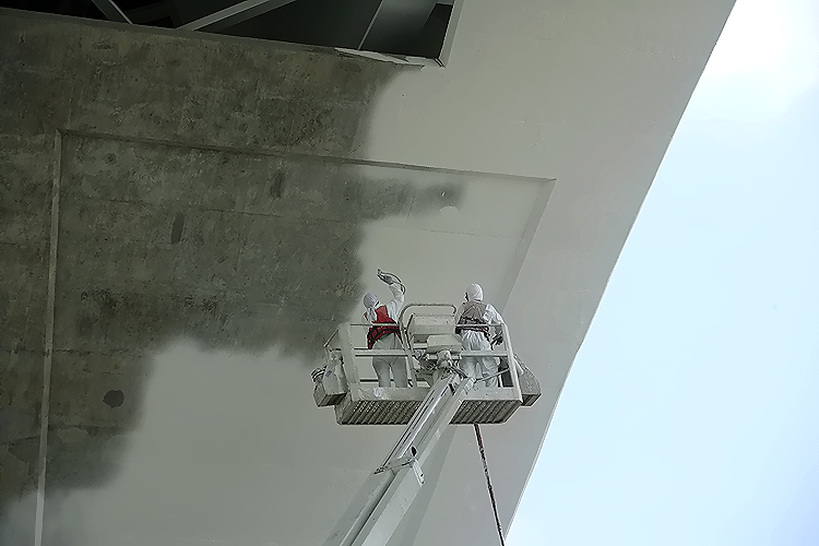 |
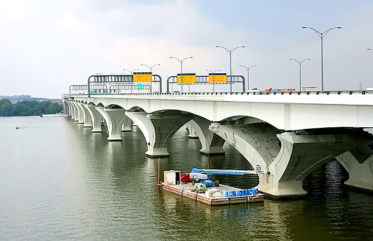
Woodrow Wilson Bridge, a white surfacing is being applied on the concrete of the bridge piers and on the steel girders. |
 |
Woodrow Wilson Bridge, a white surfacing is being applied on the concrete of the bridge piers and on the steel girders. |
 |
Woodrow Wilson Bridge, view from under the Virginia approach of the bridge. The bulkhead ahead is the Virginia shoreline. |
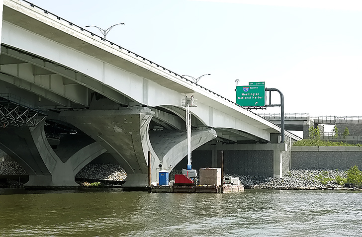 |
Woodrow Wilson Bridge, view from south of the bridge toward the Maryland approach of the bridge. The shoreline ahead is Maryland. A white surfacing is being applied on the concrete of the bridge piers and on the steel girders. |
 |
Woodrow Wilson Bridge, view from south of the bridge toward the Maryland approach of the bridge. A white surfacing is being applied on the concrete of the bridge piers and on the steel girders. |
 |
Woodrow
Wilson Bridge, view from the Maryland shore, Virginia shore is in the distance.
There is a ramp and an overpass near the end of the WWB, that is part of the pedestrian/bicycle path that will connect the two states via a separated path along the north edge of the Inner Loop WWB, and the trail will carry pedestrian and bicycle traffic between US-1 south of Alexandria and pedestrian/bicycle trails in Maryland. This photo and the following photos were taken from that facility. |
 |
Woodrow Wilson Bridge, view from the Maryland shore, Virginia shore is in the distance. |
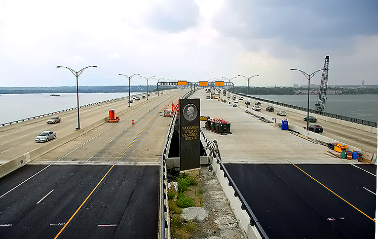 |
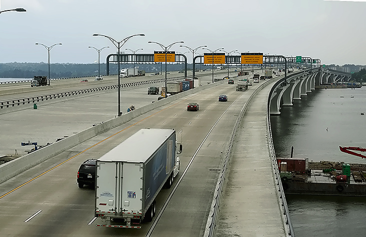
Woodrow
Wilson Bridge, view from the Maryland shore, Virginia shore is in the distance.
The Outer Loop bridge (browner-colored concrete roadway) is to the left, and the Inner Loop bridge (its newness results in the lighter-colored concrete roadway) is to the right. This shows the completed new parallel 6-lane Potomac River bridges, which are currently carrying 3 Beltway Outer Loop lanes and 3 Beltway Inner Loop lanes on the local roadway of each respective bridge. The express roadways on each Potomac River bridge will open in early 2009, after needed approach roadway and interchange construction is completed at either end of the bridge. Notice in the lower part of the photo, the joint between the approach pavement (black asphalt) and the reinforced concrete bridge deck (light beige color). Notice the new pylon with the name of the new bridge, carrying the same name as the original bridge, the Woodrow Wilson Memorial Bridge, and carrying the same medallion of President Woodrow Wilson which was formerly on the side of the original bridge's drawspan control tower. Notice the line painting on the express roadways, a solid white line at the right edge of the roadway, a solid yellow line at the left edge of the roadway, and a dashed white line separating the two lanes. Each express roadway is designed for three lanes, but the left lane will remain closed until a connecting transit facility is built in the future, and this decision has not yet been made as it could be either HOV/busway or rail transit based on a future decision. |
 |
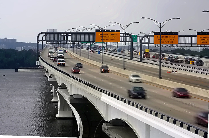
Woodrow Wilson Bridge, view from the Maryland shore, over the Inner Loop 3-lane local roadway. The pedestrian/bicycle trail is on the right side of the bridge, and will open to traffic in early 2009 when connecting facilities are completed. |
 |
Woodrow Wilson Bridge, view from the Maryland shore, over the Inner Loop 3-lane local roadway. |
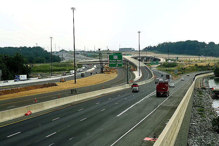 |
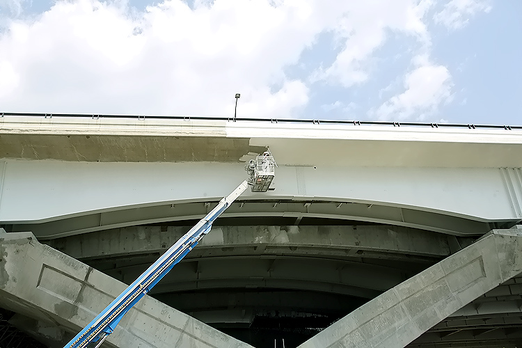
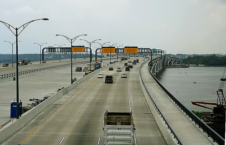
I-95/I-495
Capital Beltway, looking from the pedestrian/bicycle facility, toward the
I-295 interchange, Maryland Exit 2, which is being rebuilt as part of the
WWB project. As mentioned, the Beltway traffic is operating on the permanent
local roadways in the I-295, WWB and US-1 segments of the project, with 3
lanes each way.
Between the local roadways, the express roadways are nearing completion, with lines painted on them for 2 lanes of traffic. The express roadways on the project are being built to their 3-lane ultimate design. |
Lead article - Woodrow Wilson Bridge Project Photos
Copyright © 2008 by Scott Kozel. All rights reserved. Reproduction, reuse, or distribution without permission is prohibited.
By Scott M. Kozel, Capital Beltway dot com, Roads to the Future
(Created 10-3-2008)