
| Springfield Interchange Project Photos - November 2006 |
The following 26 photos show various aerial views of the Springfield Interchange Improvement Project construction.
These photos were taken on November 17, 2006, by the Virginia Department of Transportation, and are posted here with their permission. Roads to the Future utilized Adobe PhotoDeluxe Business Edition to sharpen and brighten all of the photos. Click on the photo to get a large version of the photo. In later versions of Netscape and Internet Explorer, you probably will need to use Full Screen mode (the F11 key can be utilized to swap back and forth between Full Screen and Regular) to see the full size of the large photo without browser-induced image shrinkage. The large photos have sizes ranging from 178 to 260 kilobytes, with most of them being under 224 kilobytes. The photos are in sequence as taken from a helicopter as it made a loop around the interchange area.
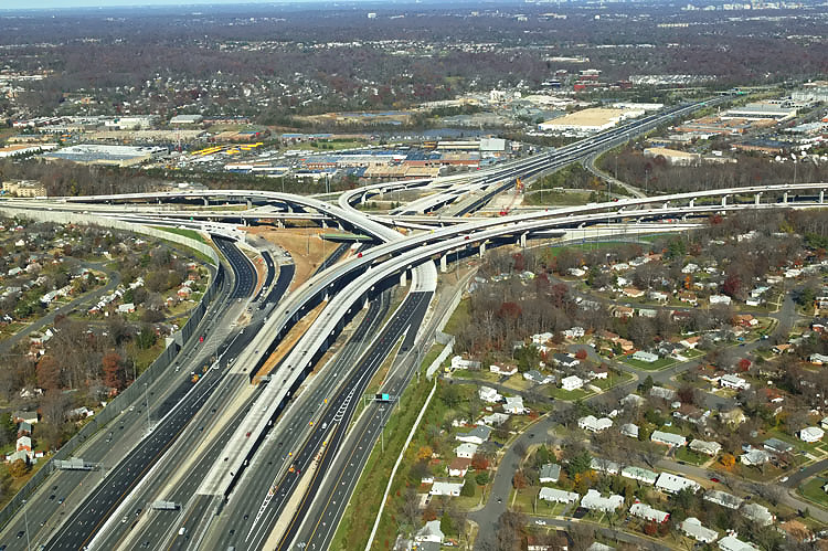 |
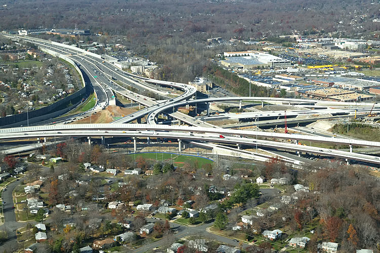
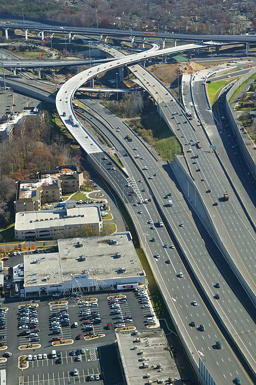
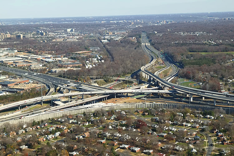
I-95/I-395/I-495 interchange construction, looking north. The Capital Beltway (I-95/I-495 and I-495) runs left-right, and Shirley Highway (I-95 and I-395) runs bottom to upper right. The long elevated bridges between the center and upper right of the photo, are the 2-lane express flyover ramp from the Beltway Inner Loop (from Wilson Bridge) to I-95 southbound, and the 2-lane flyover ramp from I-95 northbound to the Beltway Outer Loop (to Wilson Bridge). The 3-lane northbound flyover ramp from I-95 northbound to the Beltway Inner Loop (toward Tysons Corner), was completed and opened to traffic on August 24, 2006, and that ramp runs from the center of the photo to the upper left. The under construction ramp to the left, is the ramp connecting the Beltway Outer Loop directly to southbound I-95 (to Woodbridge). |
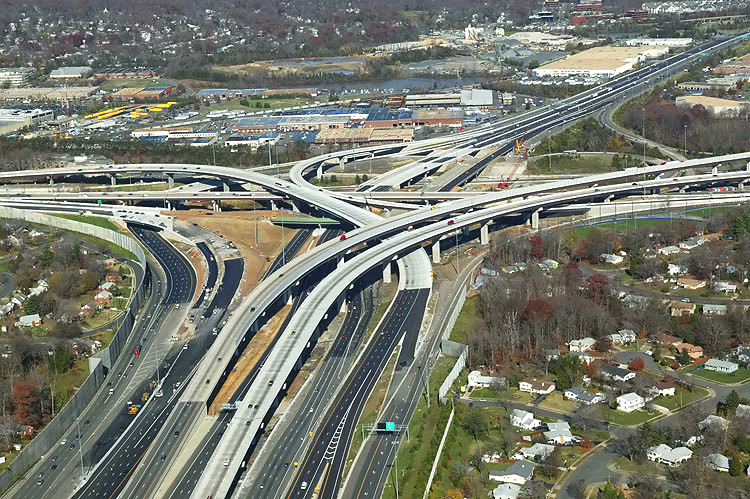 |
I-95/I-395/I-495 interchange construction, looking north. |
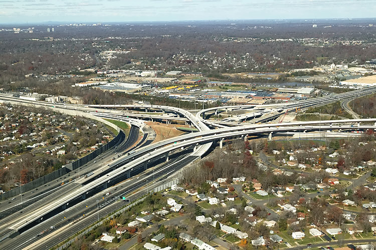 |
I-95/I-395/I-495 interchange construction, looking northwest. |
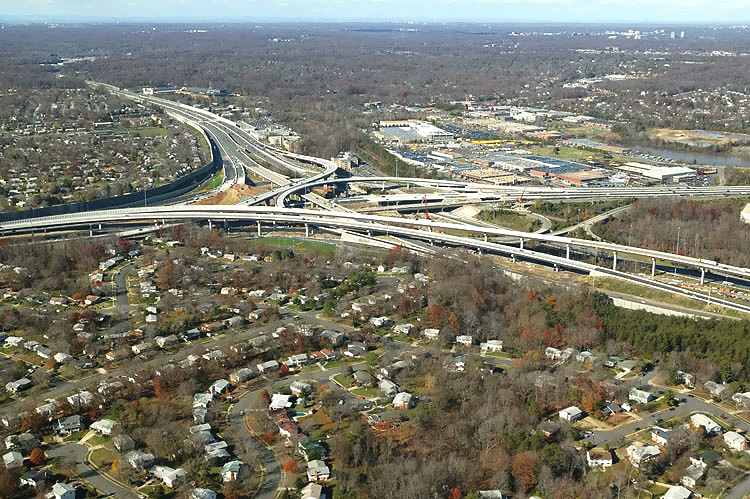 |
I-95/I-395/I-495 interchange construction, looking northwest. |
 |
I-95/I-395/I-495 interchange construction, looking northwest. The pair of elevated ramps in the foreground, are the two flyover bridges that connect the I-95 through traffic movements between the I-95/I-495 Beltway and I-95 Shirley Highway. |
 |
I-95/I-395/I-495 interchange construction, looking west along the Beltway toward Tysons Corner. The long elevated bridge is the 2-lane express flyover ramp from the Beltway Inner Loop (from Wilson Bridge) to I-95 south. The elevated bridge in the left of the photo, is the 2-lane express flyover ramp from I-95 northbound to the Beltway Outer Loop (to Wilson Bridge). |
 |
I-95/I-395/I-495 interchange construction, looking west. Notice the two flyover bridges that connect the I-95 through traffic movements between the I-95/I-495 Capital Beltway and I-95 Shirley Highway. |
 |
I-95/I-395/I-495 interchange construction, looking west along the Beltway toward Tysons Corner. |
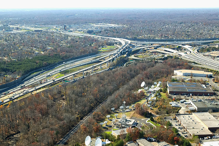 |
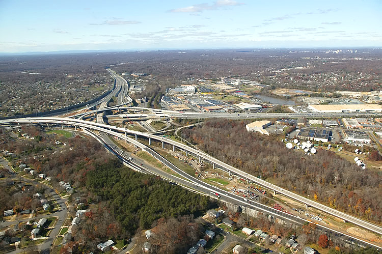
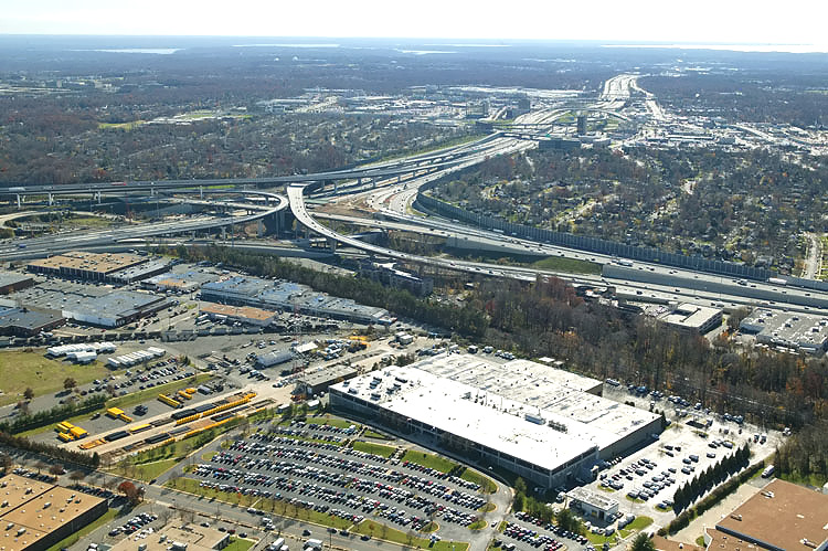
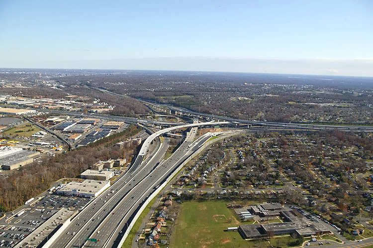
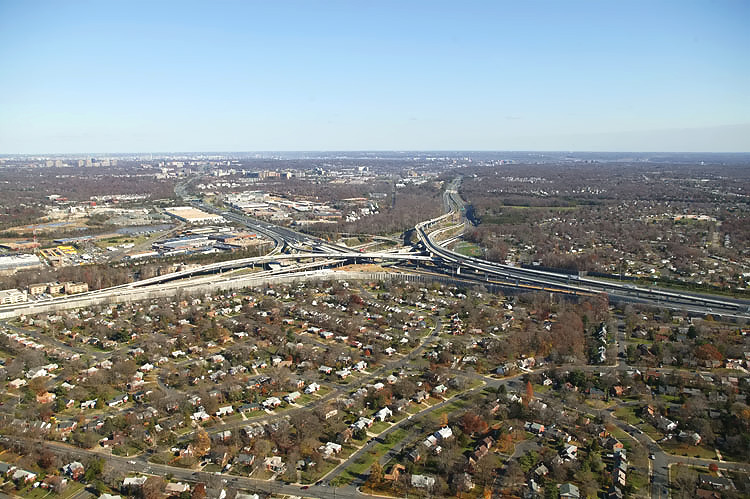
I-95/I-395/I-495 interchange construction, looking southwest. The 2-track mainline of the Norfolk Southern Railroad can be seen, and in addition to freight trains it also carries Virginia Railway Express (VRE) commuter rail trains. The Springfield urban area and the I-95/VA-644 interchange is visible in the upper left of the photo. |
 |
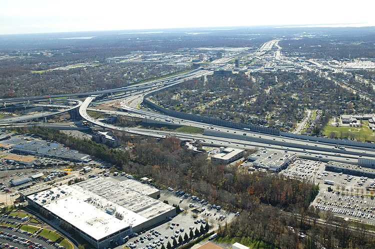
I-95/I-395/I-495 interchange construction, looking southwest. |
 |
I-95/I-395/I-495 interchange construction in the distance, looking south along I-395 Shirley Highway. |
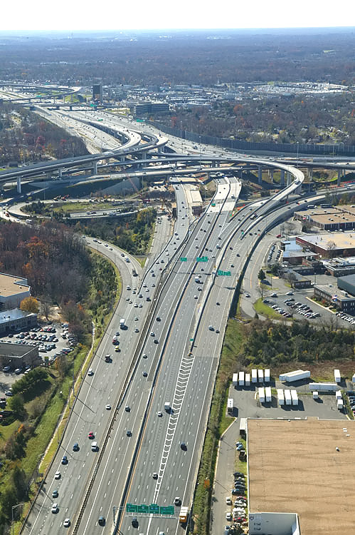 |
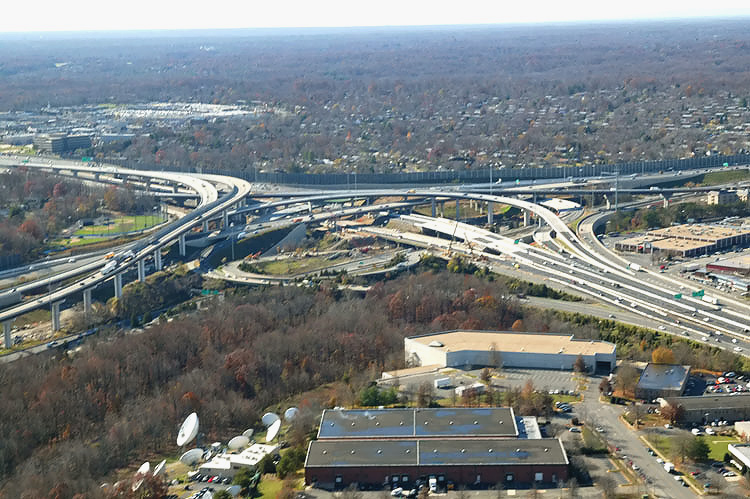
I-95/I-395/I-495 interchange construction, looking south toward Richmond. The Beltway runs left-right, and Shirley Highway runs up-down. Shirley Highway (I-95 south of the Beltway and I-395 north of the Beltway) has 3 mainline lanes each way and a 2-lane reversible roadway for high occupancy vehicle (HOV) traffic, and the reversible roadway is located between the two general purpose roadways. The I-95/VA-644 interchange is in the distance. |
 |
I-95/I-395/I-495 interchange construction, looking south toward Richmond. The Beltway runs left-right, and Shirley Highway runs lower left to upper center. The I-95/VA-644 interchange and the Springfield urban area is in the far distance. |
 |
I-95/I-395/I-495 interchange construction, looking south. |
 |
I-95/I-395/I-495 interchange construction, looking south. |
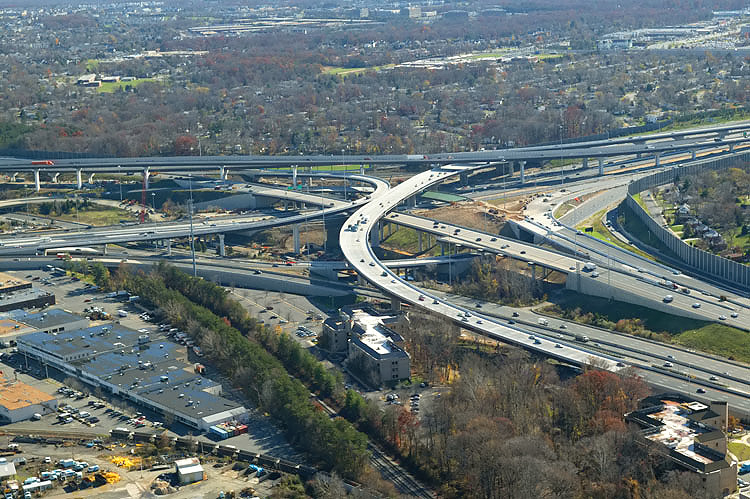 |
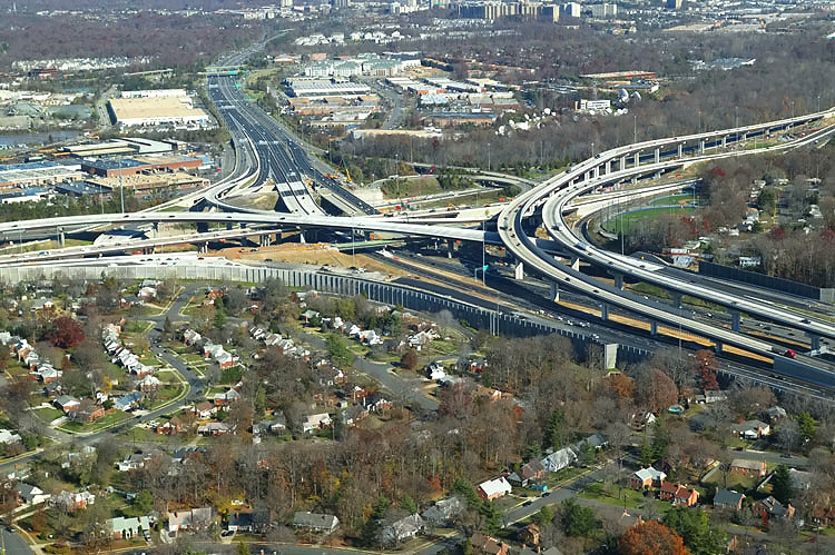
I-95/I-395/I-495 interchange construction, looking southeast. The wide curving elevated ramp in the center of the photo, is the 3-lane northbound flyover ramp from I-95 northbound to the Beltway Inner Loop (toward Tysons Corner), which was completed and opened to traffic on August 24, 2006. |
 |
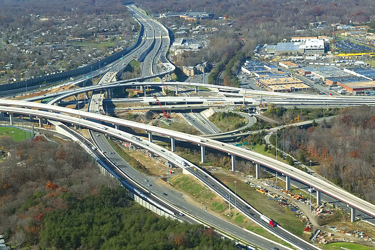
I-95/I-395/I-495 interchange construction, looking east. The Beltway runs from lower right to upper left. The wide curving elevated ramp in the upper center of the photo, is the 3-lane northbound flyover ramp from I-95 northbound to the Beltway Inner Loop (toward Tysons Corner). The under construction ramp to the upper right, is the ramp connecting the Beltway Outer Loop directly to southbound I-95 (to Woodbridge). |
 |
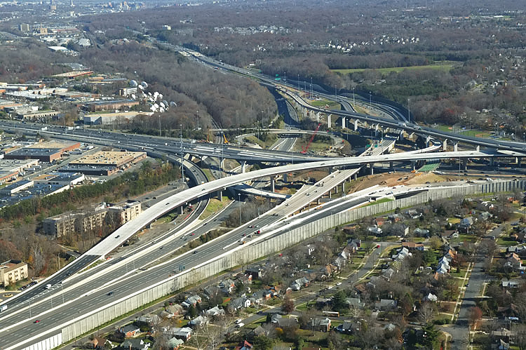
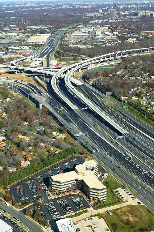
I-95/I-395/I-495 interchange construction, looking east toward the Wilson Bridge. The Beltway runs up-down, and Shirley Highway runs left-right. Reconstruction on the Beltway west approach was completed in May 2004 for Phase 5 of the Springfield Interchange Improvement Project. Phase 5 involved widening the Outer Loop of the Beltway west of I-95, slightly relocating the Outer Loop of the Beltway in the I-95 interchange area, and realignment of the ramp from I-395 south to I-495 west, and widening the Capital Beltway from I-395 west to near the Braddock Road interchange. The Beltway has been greatly expanded in this area. |
 |
I-95/I-395/I-495 interchange construction, looking east. |
 |
I-95/I-395/I-495 interchange construction, looking east. The Beltway runs lower-left to upper left, and Shirley Highway runs left to right. The wide long elevated bridge in the center, is the 3-lane northbound flyover ramp from I-95 northbound to the Beltway Inner Loop (toward Tysons Corner). |
 |
I-95/I-395/I-495 interchange construction, looking east. The Beltway runs lower-left to upper center, and Shirley Highway runs upper left to lower right. The long elevated bridge to the left is the 3-lane northbound flyover ramp from I-95 northbound to the Beltway Inner Loop (toward Tysons Corner), which was completed and opened to traffic on August 24, 2006. |
 |
I-95/I-395/I-495 interchange construction, looking east. |
 |
I-95/I-395/I-495 interchange construction, looking northeast. The Beltway (I-95/I-495 and I-495) runs left-right, and Shirley Highway (I-95 and I-395) runs lower right to upper left. The long elevated bridges in the right of the photo, are the 2-lane express flyover ramp from the Beltway Inner Loop (from Wilson Bridge) to I-95 south, and the 2-lane flyover ramp from I-95 north to the Beltway Outer Loop (to Wilson Bridge). The 3-lane northbound flyover ramp from I-95 northbound to the Beltway Inner Loop (toward Tysons Corner), was completed and opened to traffic on August 24, 2006, and that ramp runs from the center of the photo to the left. |
 |
I-95/I-395/I-495 interchange construction, looking northeast. The Beltway (I-95/I-495 and I-495) runs left-right, and Shirley Highway (I-95 and I-395) runs lower right to upper center. The long elevated bridges in the of the center photo, are the 2-lane express flyover ramp from the Beltway Inner Loop (from Wilson Bridge) to I-95 south, and the 2-lane flyover ramp from I-95 north to the Beltway Outer Loop (to Wilson Bridge). |
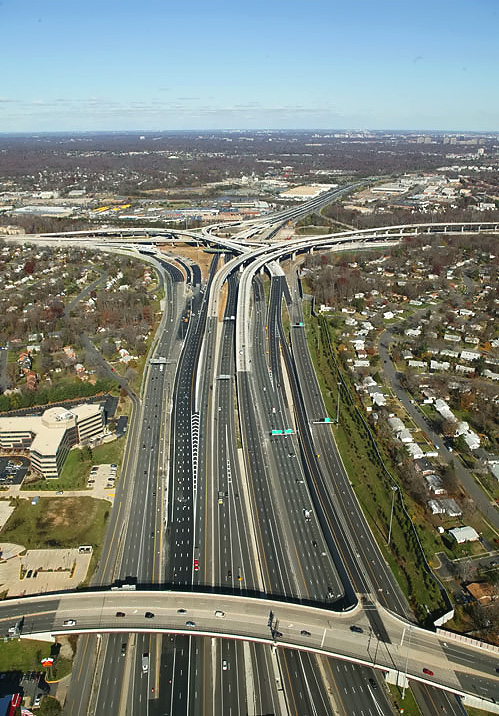 |
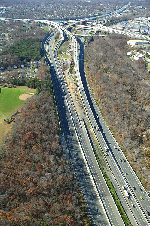
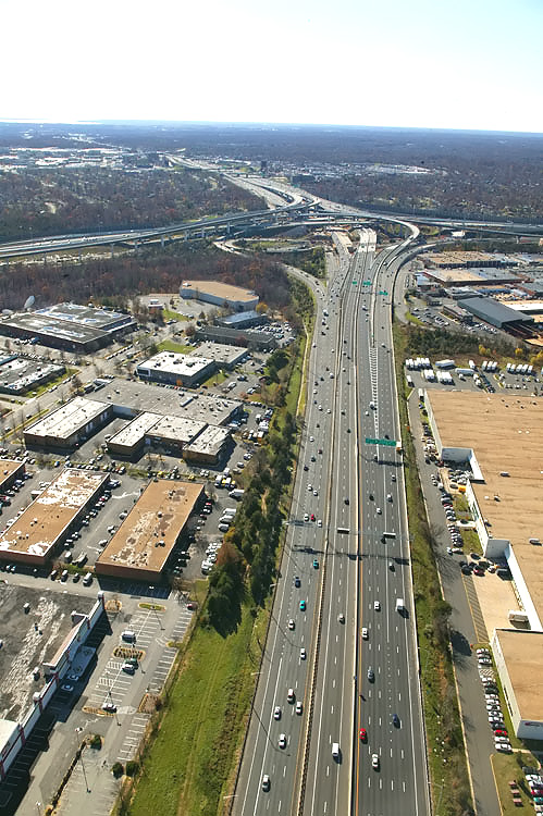
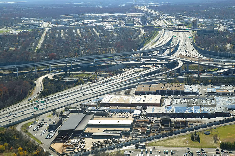
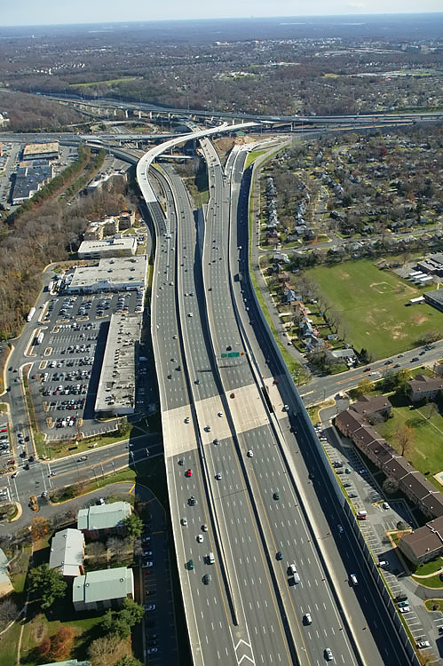
I-95/I-395/I-495 interchange construction, looking north along I-95 Shirley Highway toward Washington. The Beltway runs left-right. This photo was taken from approximately over the I-95/VA-644 interchange, and the I-95/I-395/I-495 interchange is in the distance The overpass bridge in the foreground is Commerce Street. The SIIP Project included the replacement of the 2-lane Commerce Street viaduct over I-95, with a modern 4-lane divided bridge with sidewalks on either side for pedestrians and bicycles. |
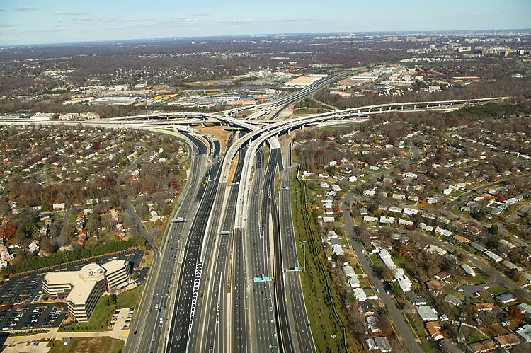 |
I-95/I-395/I-495 interchange construction, looking north. The Beltway (I-95/I-495 and I-495) runs left-right, and Shirley Highway (I-95 and I-395) runs bottom to upper right. The long elevated bridges between the center and upper right of the photo, are the two flyover bridges that connect the I-95 through traffic movements between the I-95/I-495 Beltway and I-95 Shirley Highway. The 3-lane northbound flyover ramp from I-95 northbound to the Beltway Inner Loop (toward Tysons Corner), was completed and opened to traffic on August 24, 2006, and that ramp runs from the center of the photo to the upper left. |
Lead article Springfield Interchange Project Photos
Copyright © 2006 by Scott Kozel. All rights reserved. Reproduction, reuse, or distribution without permission is prohibited.By Scott M. Kozel, Capital Beltway dot com, Roads to the Future
(Created 12-3-2006, moved to capital-beltway.com on 3-16-2007)