
| Springfield Interchange Project Photos - November 2002 |
The following 8 photos show various aerial views of the Springfield Interchange Improvement Project (SIIP) construction, of the reconstructed interchange between I-95 Shirley Highway and VA-644 Old Keene Mill Road / Franconia Road.
These photos were taken on November 21, 2002 by the Virginia Department of Transportation, and are posted here with their permission. Roads to the Future utilized PhotoDeluxe Business Edition to sharpen and brighten and to align all of the photos. Click on the photo to get a large version of the photo. In later versions of Netscape and Internet Explorer, you probably will need to use Full Screen mode (the F11 key can be utilized to swap back and forth between Full Screen and Regular) to see the full size of the large photo without browser-induced image shrinkage. The large photos are BIG, with the sizes ranging from 592 to 716 kilobytes, with most of them being under 665 kilobytes. With a broadband or network Internet connection each photo will download within seconds, but with a dial-up Internet connection it will be slow.
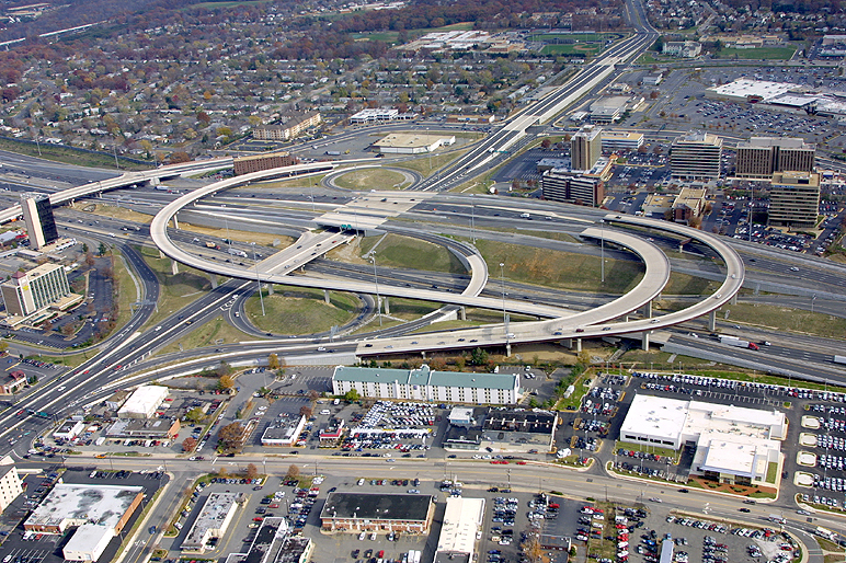 |
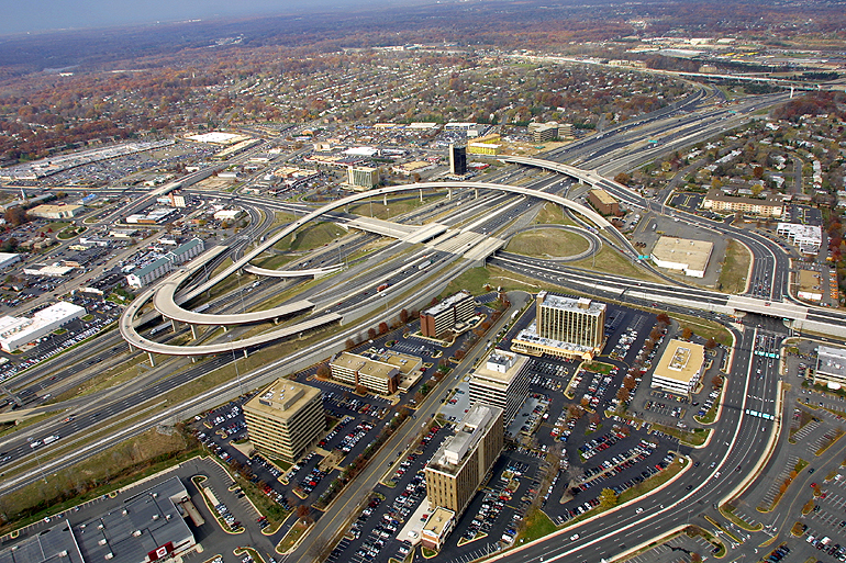
I-95/VA-644 interchange, reconstruction completed, looking east. I-95 runs left-right, and VA-644 runs lower-left to upper right. The expansion of VA-644 Franconia Road near the Springfield Mall was part of the SIIP, and it included elevated 2-lane each way express roadways with the grade separation of two intersections, that over Loisdale Road and Frontier Drive, with outer local 3-lane each way VA-644 roadways intersecting the cross streets at grade. This section of VA-644 and the Mall is in the upper right of the photo. |
 |
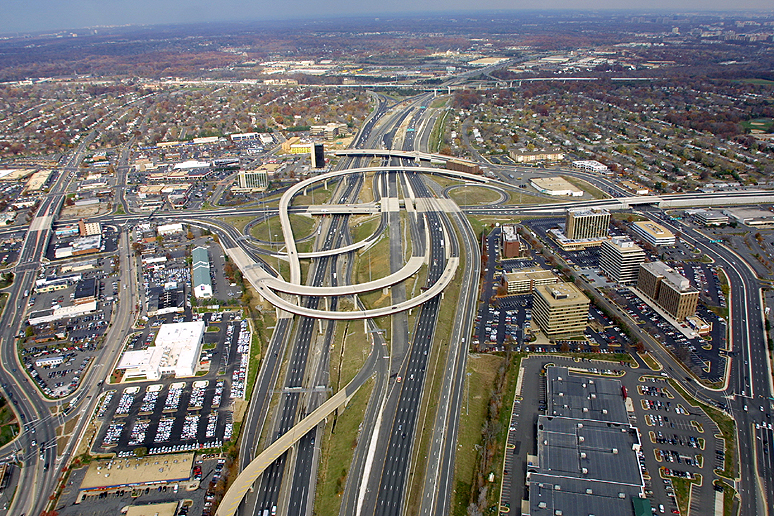
I-95/VA-644 interchange, looking north. I-95 runs bottom to top, and VA-644 runs left to right. The Beltway interchange (I-95/I-395/I-495) is visible in the distance. |
 |
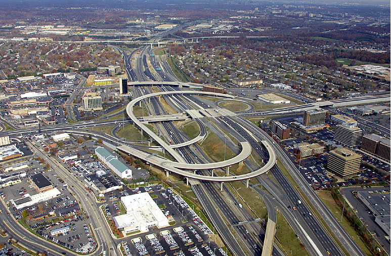
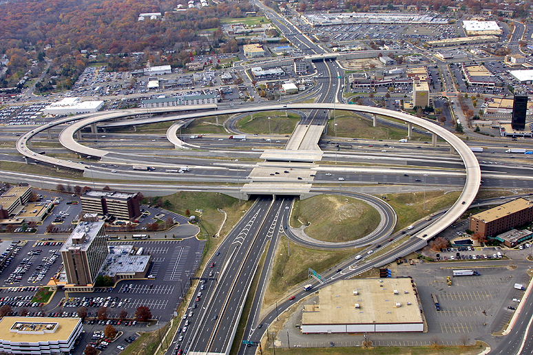
I-95/VA-644 interchange, (reconstruction completed except for I-95 southbound roadway which is part of Phase 6 & 7 now under construction), looking north. I-95 runs bottom to top, and VA-644 runs left to right. The Beltway interchange (I-95/I-395/I-495) is visible in the distance. The 4-lane arterial which runs up-down along the left edge of the photo, is Backlick Road, and it has a grade separation over VA-644 Old Keene Mill Road. |
 |
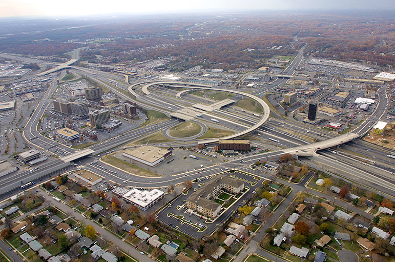
I-95/VA-644 interchange, looking north. I-95 runs bottom to top, and VA-644 runs left to right. The Beltway interchange (I-95/I-395/I-495) is visible in the distance. |
 |
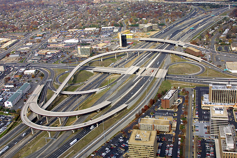
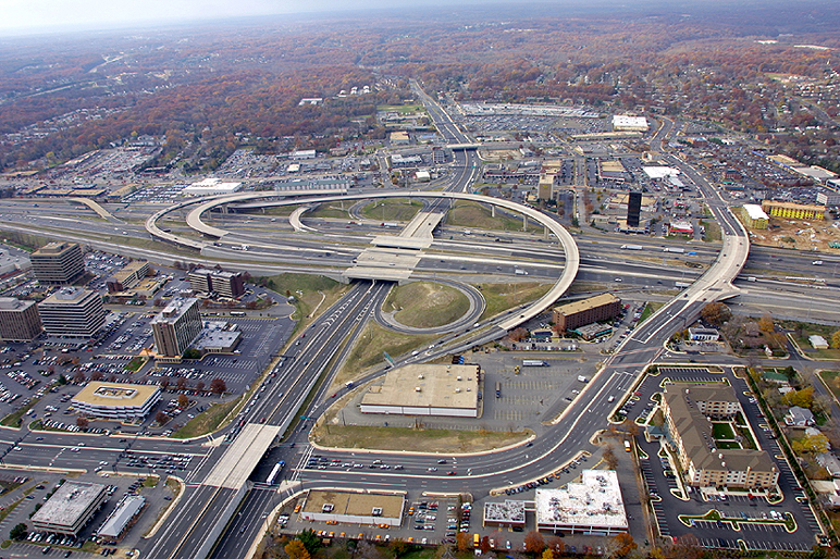
I-95/VA-644 interchange, looking northwest. I-95 runs lower-left to upper-right, and VA-644 runs left to right. The Beltway interchange (I-95/I-395/I-495) is visible in the distance. Loisdale Road is visible in the lower right of the photo, and that road was expanded in the SIIP. |
 |
I-95/VA-644 interchange, looking west. I-95 runs left to right, and VA-644 runs up-down. The overpass of Backlick Road over VA-644 Old Keene Mill Road, is visible in the distance. |
 |
I-95/VA-644 interchange, looking west. I-95 runs left to right, and VA-644 runs up-down. The bridge to the right is the Commerce Street bridge over I-95, and Commerce Street was one of the local roads upgraded in the SIIP, and Commerce Street loops around the lower part of the photo as it passes under the new bridge where VA-644 Franconia Road passes over Commerce Street, and Commerce Street becomes Loisdale Road south of VA-644. |
 |
I-95/VA-644 interchange, looking southwest. I-95 runs upper-left to lower-right, and VA-644 runs lower-left to upper-right. The entire arc of the widened Commerce Street / Loisdale Road is visible in this photo. |
Lead article - Springfield Interchange Project Photos
Copyright © 2004-2005 by Scott Kozel. All rights reserved. Reproduction, reuse, or distribution without permission is prohibited.Article content was created on 6-1-2004 in article "Springfield Interchange Project - Photos", and was moved to this separate article on 8-1-2005.
By Scott M. Kozel, Capital Beltway dot com, Roads to the Future
(Created 8-1-2005, moved to capital-beltway.com on 3-16-2007)