
| Springfield Interchange Project Photos - June 2005 |
The following 27 photos show various aerial views of the Springfield Interchange Improvement Project (SIIP) construction.
These photos were taken on June 16, 2005 by the Virginia Department of Transportation, and are posted here with their permission. Roads to the Future utilized PhotoDeluxe Business Edition to sharpen and brighten and to align all of the photos. Click on the photo to get a large version of the photo. In later versions of Netscape and Internet Explorer, you probably will need to use Full Screen mode (the F11 key can be utilized to swap back and forth between Full Screen and Regular) to see the full size of the large photo without browser-induced image shrinkage. The large photos are BIG, with the sizes ranging from 482 to 587 kilobytes, with most of them being under 529 kilobytes. With a broadband or network Internet connection each photo will download within seconds, but with a dial-up Internet connection it will be slow.
The webpage Springfield Interchange Improvement Project Photo Album - July 2005, is on the Springfield Interchange Improvement Project official website, and has June 2005 aerial photos of the project, from the same batch of photos as was used for this Roads to the Future website article; and the second photo on the SIIP webpage has nice labeling of the various roadways and ramps.
The day was partly cloudy when the photos were taken, so some of the photos have lighter and darker areas.
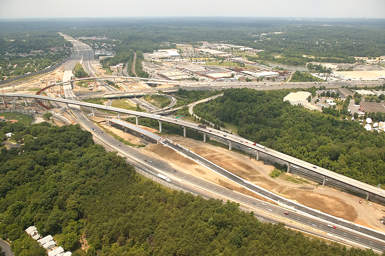 |
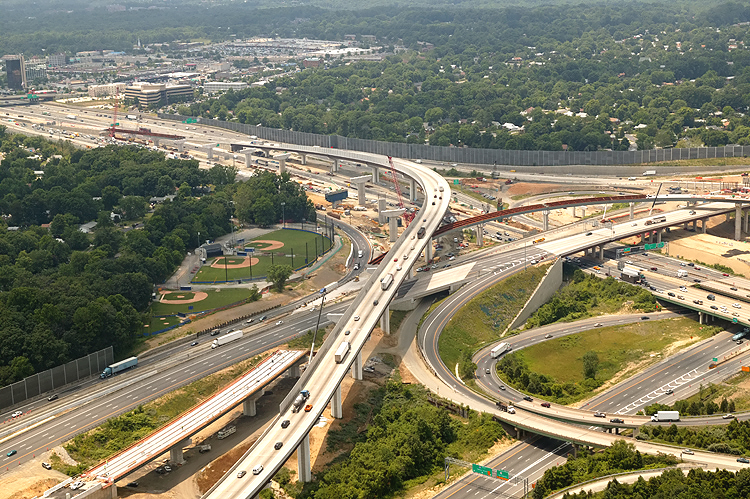
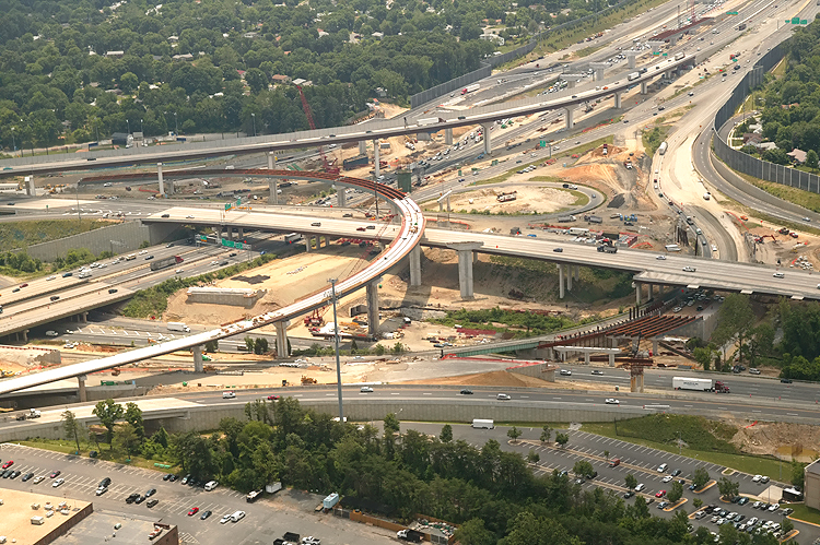
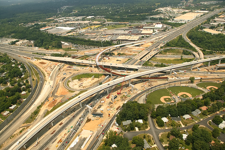
I-95/I-395/I-495 interchange construction, looking west toward Tysons Corner. The Beltway (I-95/I-495 and I-495) runs from the foreground toward the top of the photo, and Shirley Highway (I-95 and I-395) runs left-right. The long elevated bridge is the 2-lane express flyover ramp from the Beltway Inner Loop (from Wilson Bridge) to I-95 south. |
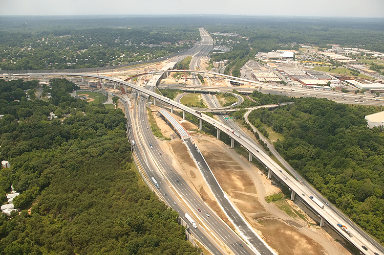 |
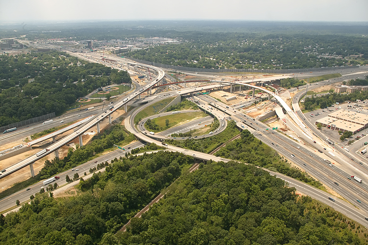
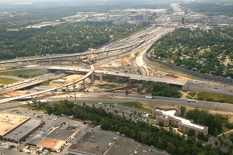
I-95/I-395/I-495 interchange construction, looking west. The Beltway runs from the foreground toward the top of the photo, and Shirley Highway runs left-right. The long elevated bridge is the 2-lane express flyover ramp from the Beltway Inner Loop (from Wilson Bridge) to I-95 south. |
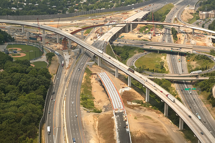 |
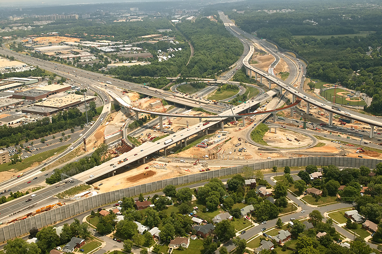
I-95/I-395/I-495 interchange construction, looking west. The Beltway runs from the foreground toward the top of the photo, and Shirley Highway runs left-right. The long elevated bridge is the 2-lane express flyover ramp from the Beltway Inner Loop (from Wilson Bridge) to I-95 south. The beginnings of construction can be seen for the 2-lane flyover ramp from I-95 north to the Beltway Outer Loop (to Wilson Bridge). The one-lane flyover ramp from I-395 to the Beltway Outer Loop (to Wilson Bridge) is mostly complete, and can be seen in the upper part of the photo. |
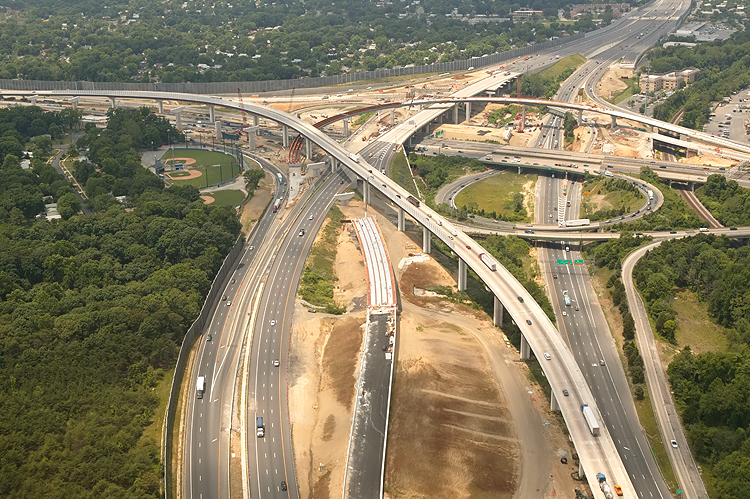 |
Very similar vantage point to the previous photo, from slightly to the north. |
 |
Similar
vantage point to the previous photo, from slightly to the north, with a wide-angle
lens.
|
 |
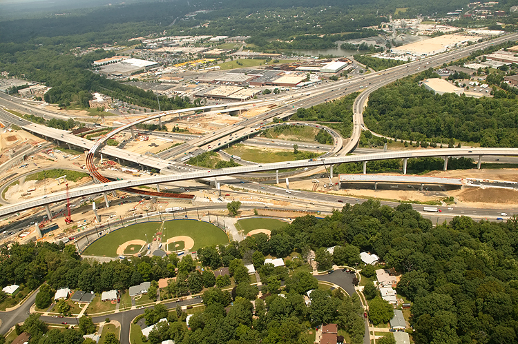
I-95/I-395/I-495 interchange construction, looking southwest. The Beltway runs bottom-left to upper-right, and Shirley Highway runs left-right. The long elevated bridge is the 2-lane express ramp from the Beltway Inner Loop (from Wilson Bridge) to I-95 south. |
 |
Similar vantage point to the previous photo, from more to the north, with a wide-angle lens. The 2-track mainline of the Norfolk Southern Railroad can be seen, and in addition to freight trains it also carries Virginia Railway Express (VRE) commuter rail trains. |
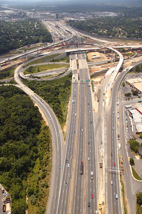 |
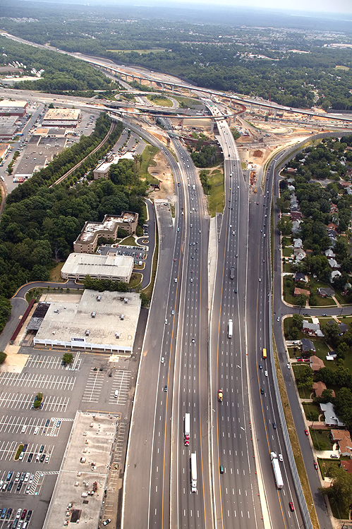
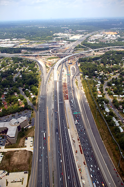
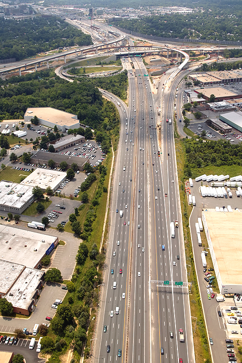
I-95/I-395/I-495 interchange construction, looking south toward Richmond. The Beltway runs left-right, and Shirley Highway runs up-down. Shirley Highway (I-95 south of the Beltway and I-395 north of the Beltway) has 3 mainline lanes each way and a 2-lane reversible roadway for high occupancy vehicle (HOV) traffic, and the reversible roadway is between the two general purpose roadways. The I-95/VA-644 interchange is in the distance. |
 |
I-95/I-395/I-495 interchange construction, looking south. The Beltway runs left-right, and Shirley Highway runs up-down. The I-95/VA-644 interchange is in the distance. |
 |
I-95/I-395/I-495 interchange construction, looking south. The Beltway runs left-right, and Shirley Highway runs up-down. The one-lane flyover ramp from I-395 to the Beltway Outer Loop (to Wilson Bridge) is mostly complete, and can be seen in the left part of the photo. The bridges over the Beltway Inner Loop for the southbound I-395/I-95 collector-distributor roadway, are under construction and are visible in the center of the photo. |
 |
I-95/I-395/I-495 interchange construction, looking south. The Beltway runs left-right, and Shirley Highway runs lower-left to upper right. The one-lane flyover ramp from I-395 to the Beltway Outer Loop (to Wilson Bridge) is mostly complete, and can be seen in the left and center part of the photo. The bridges over the Beltway Inner Loop for the southbound I-395/I-95 collector-distributor roadway, are under construction and are visible in the right of the photo. |
 |
Similar
vantage point to the previous photo, a more wide-angle view.
|
 |
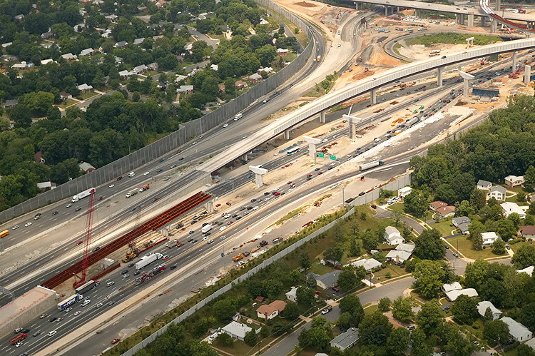
I-95/I-395/I-495 interchange construction, looking east toward the Wilson Bridge. The Beltway runs up-down, and Shirley Highway runs left-right. Reconstruction on the Beltway west approach was completed in May 2004 for Phase 5 of the Springfield Interchange Improvement Project. Phase 5 involved widening the outer loop of the Beltway west of I-95, slightly relocating the outer loop of the Beltway in the I-95 interchange area, and realignment of the ramp from I-395 south to I-495 west, and widening the Capital Beltway from I-395 west to Braddock Road. The Beltway has been greatly expanded in this area. |
 |
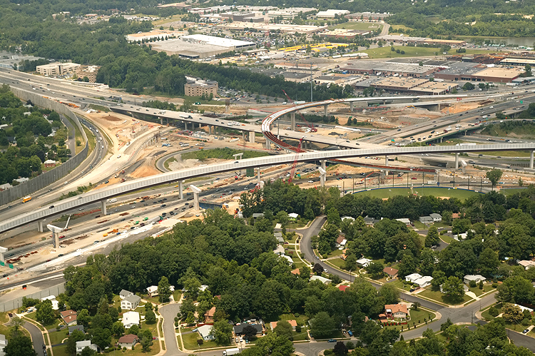
I-95/I-395/I-495 interchange construction, looking northeast. The Beltway runs left-right, and Shirley Highway runs upper-left to lower-right. |
 |
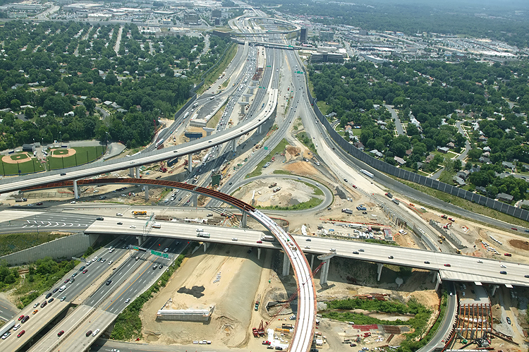
I-95/I-395/I-495 interchange construction, looking north toward Washington. The Beltway runs left-right, and Shirley Highway runs up-down. This photo was taken from approximately over the I-95/VA-644 interchange. |
 |
I-95/I-395/I-495 interchange construction, looking north. The Beltway runs left-right, and Shirley Highway runs up-down. This photo was taken from approximately over the I-95/VA-644 interchange. The long elevated bridge is the 2-lane express flyover ramp from the Beltway Inner Loop (from Wilson Bridge) to I-95 south. The beginnings of construction (the red steel beams) can be seen for the 2-lane flyover ramp from I-95 north to the Beltway Outer Loop (to Wilson Bridge). The one-lane flyover ramp from I-395 to the Beltway Outer Loop (to Wilson Bridge) is mostly complete, and can be seen in the top of the photo. |
 |
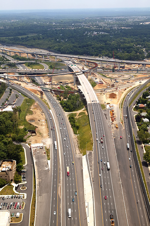
I-95/I-395/I-495 interchange construction, looking northwest. The segment of I-95 between VA-644 and the Beltway fills this photo. The long elevated bridge is the 2-lane express flyover ramp from the Beltway Inner Loop (from Wilson Bridge) to I-95 south. The beginnings of construction (the red steel beams) can be seen for the 2-lane flyover ramp from I-95 north to the Beltway Outer Loop (to Wilson Bridge). |
 |
I-95/I-395/I-495 interchange construction, looking northwest. The long elevated bridge is the 2-lane express flyover ramp from the Beltway Inner Loop (from Wilson Bridge) to I-95 south. The one-lane flyover ramp from I-395 to the Beltway Outer Loop (to Wilson Bridge) is mostly complete, and can be seen in the center part of the photo. |
 |
I-95/I-395/I-495 interchange construction, looking west toward Tysons Corner. The Beltway runs from the foreground toward the top of the photo, and Shirley Highway runs left-right. The long elevated bridge is the 2-lane express flyover ramp from the Beltway Inner Loop (from Wilson Bridge) to I-95 south. Reconstruction on the Beltway east approach was completed in October 2004 for Phase 4 of the Springfield Interchange Improvement Project. Phase 4 involved these three major portions: construct the I-95 southbound roadway from Capital Beltway to Franconia-Springfield Parkway, construct a 4,800-foot-long flyover bridge for traffic heading west on I-495 to I-95 south (the I-95 southbound through route), and widen the Capital Beltway from I-395 east to Van Dorn Street. |
 |
I-95/I-395/I-495
interchange construction, looking southwest. The Beltway runs bottom-left
to upper-right, and Shirley Highway runs left-right. The long elevated bridge
is the 2-lane express ramp from the Beltway Inner Loop (from Wilson Bridge)
to I-95 south. The 2-track mainline of the Norfolk Southern Railroad can be
seen, and in addition to freight trains it also carries Virginia Railway Express
(VRE) commuter rail trains. |
 |
I-95/I-395/I-495 interchange construction in the distance, looking south. The Beltway runs left-right, and Shirley Highway runs up-down. Shirley Highway (I-95 south of the Beltway and I-395 north of the Beltway) has 3 mainline lanes each way and a 2-lane reversible roadway for high occupancy vehicle (HOV) traffic, and the reversible roadway is between the two general purpose roadways. |
 |
I-95/I-395/I-495 interchange construction, looking east toward the Wilson Bridge. The Beltway runs up-down, and Shirley Highway runs left-right. Reconstruction on the Beltway west approach was completed in May 2004 for Phase 5 of the Springfield Interchange Improvement Project. The wide pavement stub to the left, is for the 3-lane ramp that will be built from I-95 north to the Beltway Inner Loop of the Beltway (to Tysons Corner). |
 |
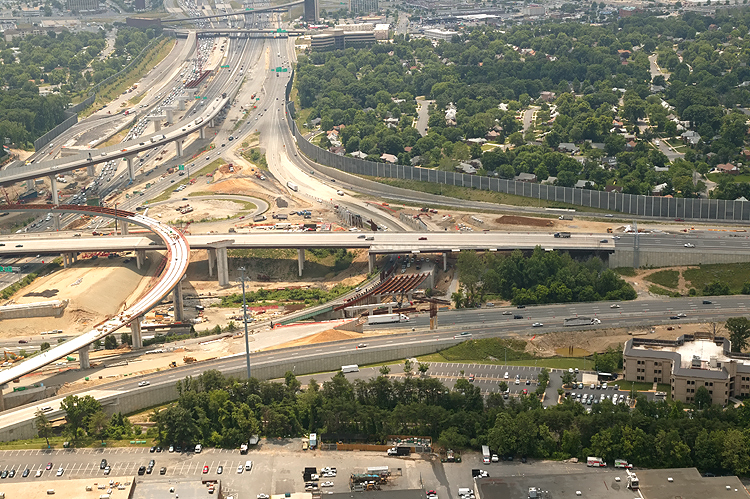
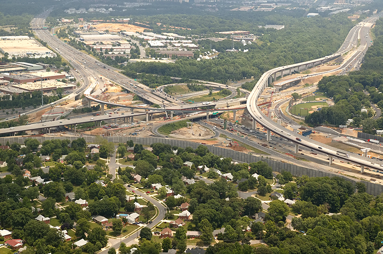
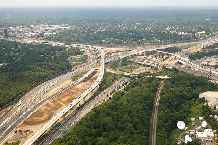
I-95/I-395/I-495 interchange construction, looking northeast. The Beltway runs lower-left to top, and Shirley Highway runs left-right. The Beltway Outer Loop was realigned and raised onto a long bridge, to accommodate ramps to be built. The long elevated bridge (to the right) is the 2-lane express flyover ramp from the Beltway Inner Loop (from Wilson Bridge) to I-95 south. The one-lane flyover ramp from I-395 to the Beltway Outer Loop (to Wilson Bridge) is mostly complete, and can be seen in the center of the photo. |
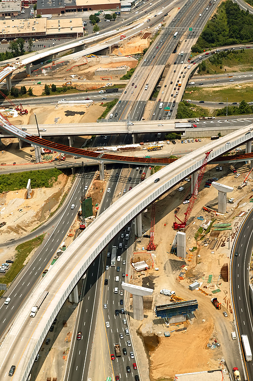 |
I-95/I-395/I-495 interchange construction, looking north toward Washington. The Beltway runs left-right, and Shirley Highway runs up-down. Close view of the center of the interchange. In the foreground is the 2-lane express flyover ramp from the Beltway Inner Loop (from Wilson Bridge) to I-95 south. In the upper left and center, is the one-lane flyover ramp from I-395 to the Beltway Outer Loop (to Wilson Bridge) which is mostly complete. |
 |
I-95/I-395/I-495 interchange construction, looking northwest. The Beltway runs left-right, and Shirley Highway runs lower-left to top. The long elevated bridge is the 2-lane express flyover ramp from the Beltway Inner Loop (from Wilson Bridge) to I-95 south. The one-lane flyover ramp from I-395 to the Beltway Outer Loop (to Wilson Bridge) is mostly complete, and can be seen in the center of the photo. |
 |
I-95/I-395/I-495 interchange construction, looking northwest. The Beltway runs left-right, and Shirley Highway runs lower-left to upper right. The long elevated bridge is the 2-lane express flyover ramp from the Beltway Inner Loop (from Wilson Bridge) to I-95 south. The one-lane flyover ramp from I-395 to the Beltway Outer Loop (to Wilson Bridge) is mostly complete, and can be seen in the left center of the photo. |
 |
I-95/I-395/I-495 interchange construction, looking south toward Richmond. The Beltway runs left-right, and Shirley Highway runs up-down. The one-lane flyover ramp from I-395 to the Beltway Outer Loop (to Wilson Bridge) is mostly complete, and can be seen in the lower left part of the photo. The bridges over the Beltway Inner Loop for the southbound I-395/I-95 collector-distributor roadway, are under construction and are visible in the lower right corner of the photo. |
Lead article - Springfield Interchange Project Photos
Copyright © 2005 by Scott Kozel. All rights reserved. Reproduction, reuse, or distribution without permission is prohibited.By Scott M. Kozel, Capital Beltway dot com, Roads to the Future
(Created 8-1-2005, moved to capital-beltway.com on 3-16-2007)