
| Springfield Interchange Project Photos - February 2004 |
The following 8 photos show various aerial views of the Springfield Interchange Improvement Project construction.
These photos were taken on February 19, 2004 by the Virginia Department of Transportation, and are posted here with their permission. Roads to the Future utilized PhotoDeluxe Business Edition to sharpen and brighten and to align all of the photos. Click on the photo to get a large version of the photo. In later versions of Netscape and Internet Explorer, you probably will need to use Full Screen mode (the F11 key can be utilized to swap back and forth between Full Screen and Regular) to see the full size of the large photo without browser-induced image shrinkage. The large photos are BIG, with the sizes ranging from 440 to 529 kilobytes, with most of them being under 485 kilobytes. With a broadband or network Internet connection each photo will download within seconds, but with a dial-up Internet connection it will be slow.
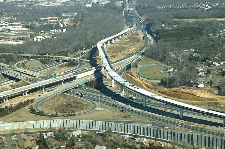 |
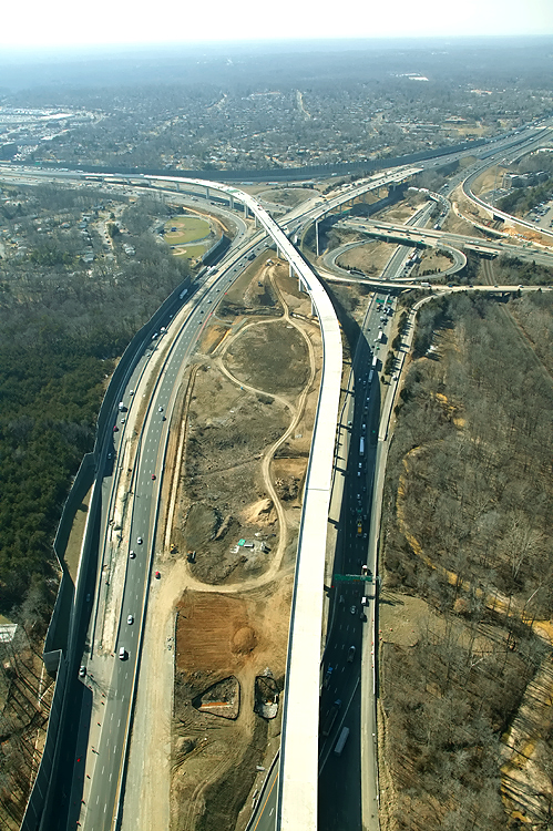
I-95/I-395/I-495 interchange construction, looking east. The Beltway runs toward the top of the photo, and Shirley Highway runs left-right. The long elevated bridge under construction is the ramp from the Beltway Inner Loop (from Wilson Bridge) to I-95 south. |
 |
I-95/I-395/I-495 interchange construction, looking east. The Beltway runs toward the top of the photo, and Shirley Highway runs left-right. The long elevated bridge under construction is the ramp from the Beltway Inner Loop (from Wilson Bridge) to I-95 south. |
 |
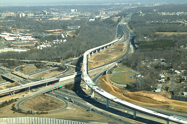
I-95/I-395/I-495 interchange construction, looking north. The Beltway runs left-right, and Shirley Highway runs toward the top of the photo. The long elevated bridge under construction is the ramp from the Beltway Inner Loop (from Wilson Bridge) to I-95 south. |
 |
I-95/I-395/I-495 interchange construction, looking north. The Beltway runs left-right, and Shirley Highway runs up-down. The long elevated bridge under construction is the ramp from the Beltway Inner Loop (from Wilson Bridge) to I-95 south. |
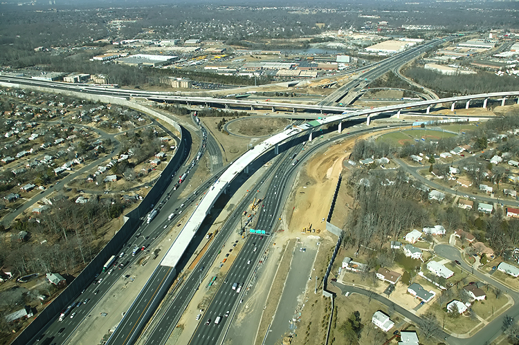 |
I-95/I-395/I-495 interchange construction, looking north. The Beltway runs left-right, and Shirley Highway runs up-down. The long elevated bridge under construction is the ramp from the Beltway Inner Loop (from Wilson Bridge) to I-95 south. |
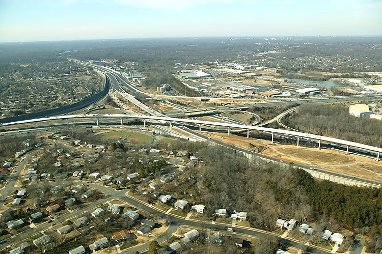 |
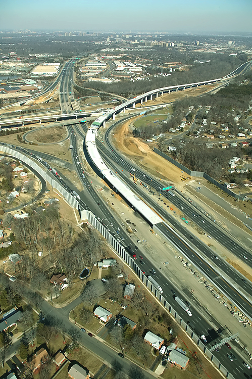
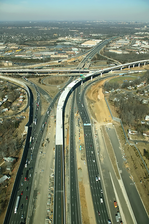
I-95/I-395/I-495 interchange construction, looking west. The Beltway runs top-left to lower-right, and Shirley Highway runs left-right. The long elevated bridge under construction is the ramp from the Beltway Inner Loop (from Wilson Bridge) to I-95 south. |
 |
I-95/I-395/I-495 interchange construction, looking west. The Beltway runs up-down, and Shirley Highway runs left-right. The long elevated bridge under construction is the ramp from the Beltway Inner Loop (from Wilson Bridge) to I-95 south. Notice the Beltway Outer Loop bridge on the recently opened relocated section of the Outer Loop. |
 |
I-95/I-395/I-495 interchange construction, looking west. The Beltway runs up-down, and Shirley Highway runs left-right. The long elevated bridge under construction is the ramp from the Beltway Inner Loop (from Wilson Bridge) to I-95 south. |
Lead article - Springfield Interchange Project Photos
Copyright © 2004-2005 by Scott Kozel. All rights reserved. Reproduction, reuse, or distribution without permission is prohibited.
Article content was created on 6-1-2004 in article "Springfield Interchange Project - Photos", and was moved to this separate article on 8-1-2005.
By Scott M. Kozel, Capital Beltway dot com, Roads to the Future
(Created 8-1-2005, moved to capital-beltway.com on 3-16-2007)