
| Springfield Interchange Project Photos - December 2006 |
The following 37 photos show various driving views of the Springfield Interchange Improvement Project (SIIP) construction.
These photos were taken on December 25, 2006 by Roads to the Future. All photos were taken with a 2.2x telephoto lens setting. Click on the photo to get a large version of the photo (they range in size from 131 to 214 kilobytes, with most being less than 179 kilobytes).
These photos are of a drive along I-95 Shirley Highway and the I-95/I-495 Capital Beltway, in sequence, northbound on I-95 Shirley Highway, then along the express flyover ramp to I-95 north, and then along the Outer Loop of the Capital Beltway. The 2-lane flyover ramp from I-95 north to the Beltway Outer Loop (to Wilson Bridge), was completed and opened to traffic on January 19, 2006. This ramp is an Interstate-standard 2-lane mainline roadway that is easily drivable at 60 mph.
 |
I-95 Shirley Highway, northbound approaching the Fairfax County Parkway interchange (Exit 166). The first advance notification sign for the Springfield express ramp highway to I-95 north, is visible, indicating that it is 4 miles ahead. It is simply signed as continuous northbound I-95. |
 |
I-95 Shirley Highway, northbound approaching the Fairfax County Parkway interchange. This segment of I-95 has 3 general purpose lanes each way, with a reversible 2-lane HOV (High Occupancy Vehicle) roadway between the two general purpose roadways. Notice the sound barrier to the left. |
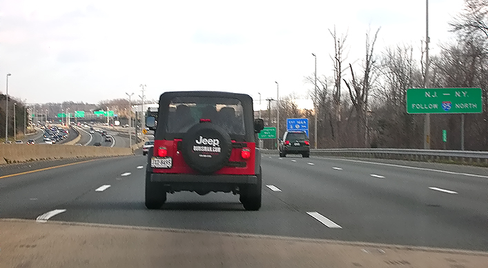 |
I-95 Shirley
Highway, northbound about 2 miles from Springfield. An advance notification
sign for the Springfield express ramp highway
to I-95 north, is visible to the right, indicating -- N.J. - N.Y. FOLLOW 95 NORTH |
 |
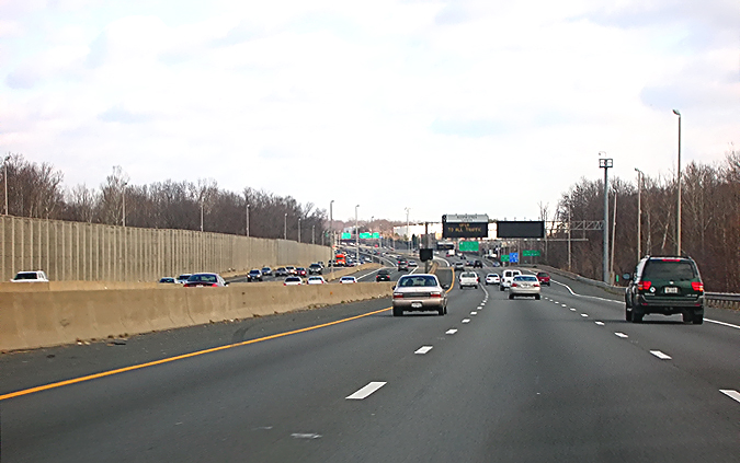
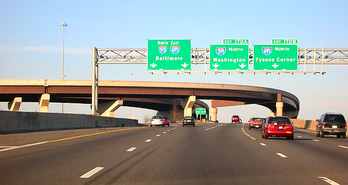
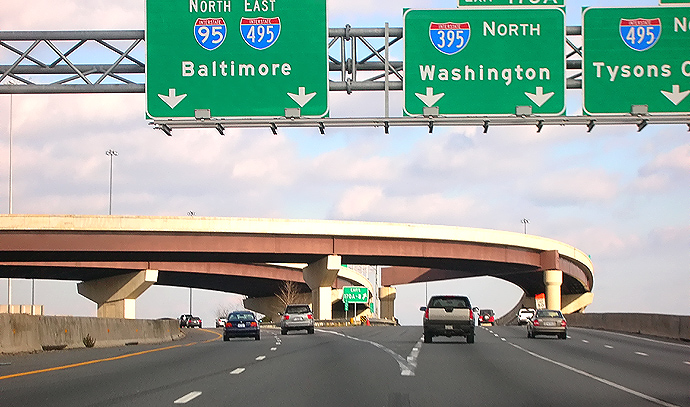
I-95 Shirley Highway, northbound 1 and 1/2 miles from Springfield. An advance notification sign is visible to the right. Northbound I-395 (Shirley Highway to Washington), and northbound I-495 (Beltway Inner Loop to Tysons Corner), are signed as exits from I-95, in accordance with nationally recognized highway signing standards. |
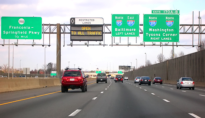 |
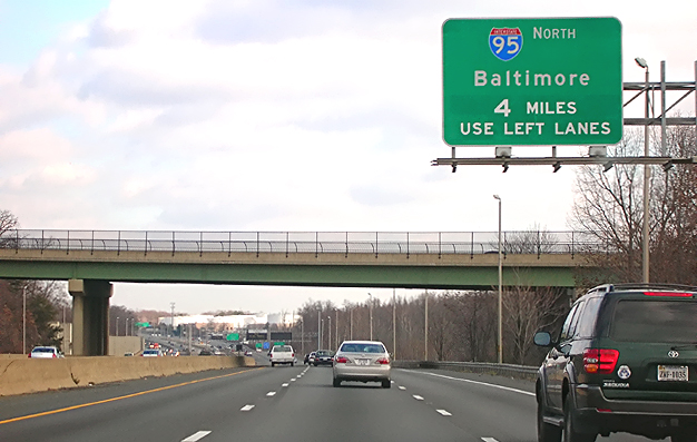
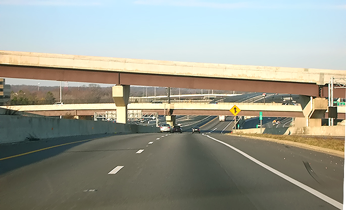
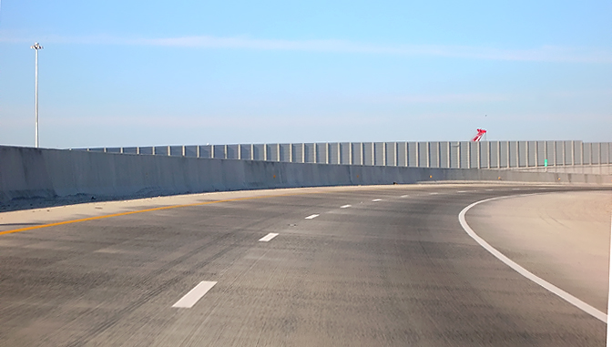
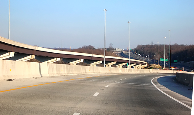
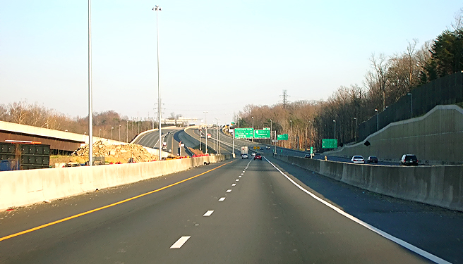
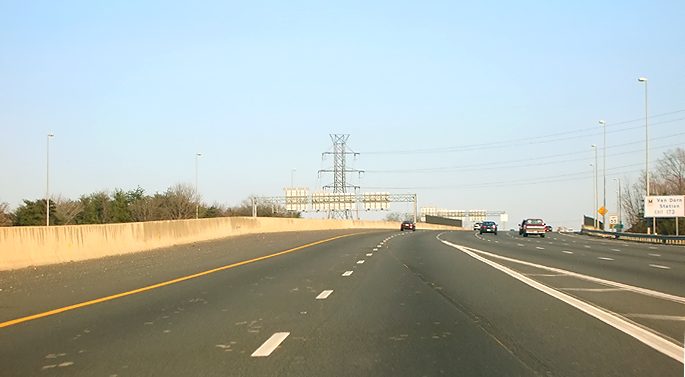
I-95 Shirley Highway, northbound 1 mile from Springfield. An advance notification sign for the Springfield express ramp highway to I-95 north, is visible above (NORTH 95 - EAST 495 - Baltimore - LEFT LANES), 1 mile from the ramp highway. There are 4 northbound lanes, and traffic to the Outer Loop of the Beltway is directed to the left two lanes, and traffic to I-395 and to the Inner Loop of the Beltway is directed to the right two lanes. Notice the variable message sign (VMS) that is indicating the status of the I-95/I-395 Shirley Highway 2-lane reversible roadway, which today (December 25th, a national holiday) is open to unrestricted traffic, and at this time is operating northbound. Notice the sound barrier to the right. |
 |
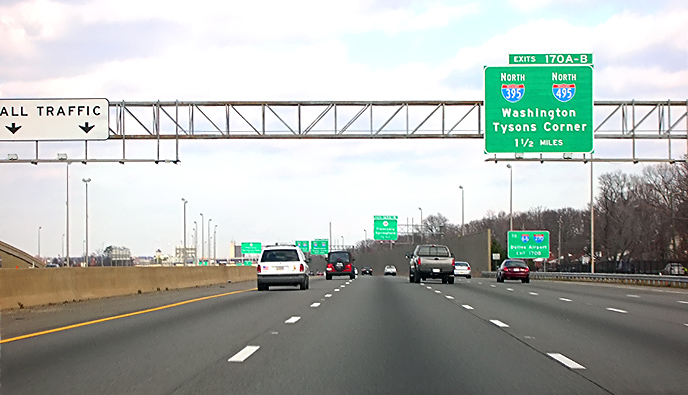
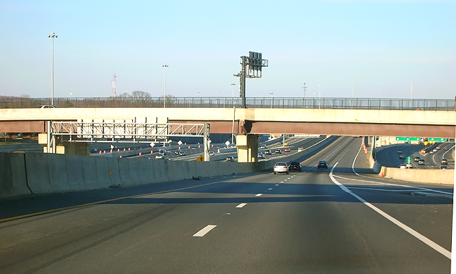
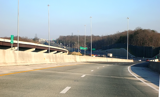
I-95 Shirley
Highway, the beginning of the I-95 express ramp highway is ahead, visible
where the highway divides around the overpass piers ahead -- NORTH 95 - EAST
495 - Baltimore.
Northbound I-395 (Shirley Highway to Washington), and northbound I-495 (Beltway Inner Loop to Tysons Corner), are signed as exits from I-95, in accordance with nationally recognized highway signing standards. |
 |
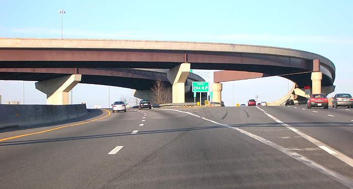
I-95 Shirley Highway, the beginning of the I-95 express ramp highway is ahead, visible where the highway divides around the overpass piers ahead. |
 |
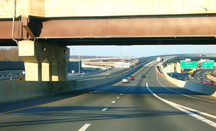
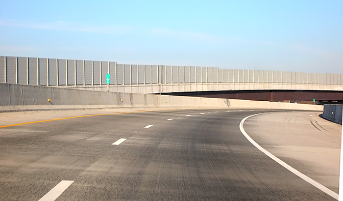
I-95 northbound express ramp highway, at the entrance of the 2-lane roadway. The overpass bridges ahead, are part of the ramps from eastbound VA-644 Old Keene Mill Road, to northbound I-95 and northbound I-395. |
 |
I-95 northbound express ramp highway, on the 2-lane roadway. The overpass bridges ahead, are part of the ramps from eastbound VA-644 Old Keene Mill Road, to northbound I-95 and northbound I-395. |
 |
I-95 northbound express ramp highway, on the 2-lane roadway. All of these photos are in driving sequence. |
 |
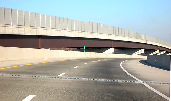
I-95 northbound express ramp highway, on the roadway. The first overpass bridge ahead is part of the ramp from westbound VA-644 Franconia Road to southbound I-95. The second overpass bridge ahead is the Commerce Street viaduct, part of a local 4-lane arterial in Springfield. |
 |
I-95 northbound express ramp highway, on the roadway. The overpass bridge ahead is the Commerce Street viaduct, part of a local 4-lane arterial in Springfield. |
 |
I-95 northbound express ramp highway, on the roadway. The third lane on the right merging into the roadway, is part of the ramp from eastbound VA-644 Old Keene Mill Road, to northbound I-95. The bridge overhead is the Commerce Street viaduct, part of a local 4-lane arterial in Springfield. The Springfield Interchange roadways connecting northbound I-95 to northbound I-395 and northbound I-495, are visible to the right. |
 |
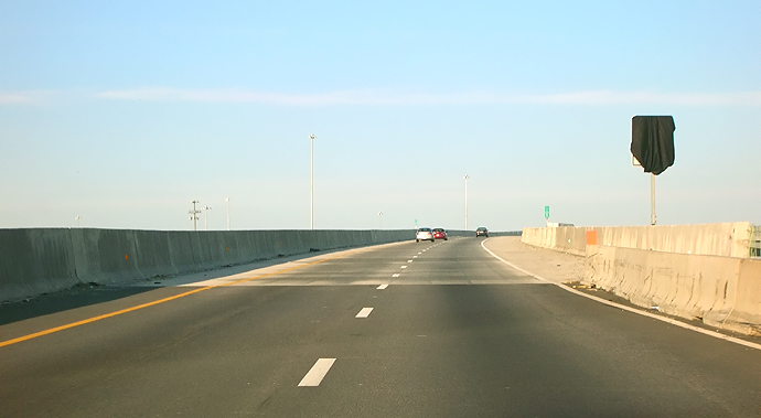
I-95 northbound express ramp highway, on the roadway. The concrete barricade on a section of the right shoulder ahead, is there temporarily to protect a sign assembly that is awaiting erection on the project. |
 |
I-95 northbound express ramp highway, on the roadway. The concrete barricade on a section of the right shoulder ahead, is there temporarily to protect a sign assembly that is awaiting erection on the project. The flyover bridge on the roadway, begins ahead. |
 |
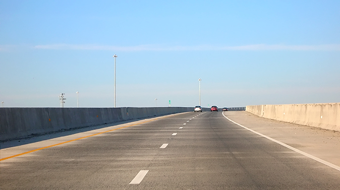
I-95 northbound express ramp highway, on the roadway. Approaching the beginning of the 3,448-foot-long flyover bridge, which begins a couple hundred feet ahead, visible where the dark grey asphalt pavement transitions to the light brown concrete bridge deck. |
 |
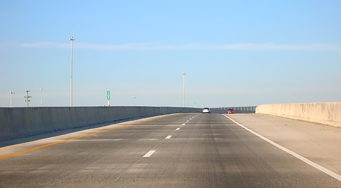
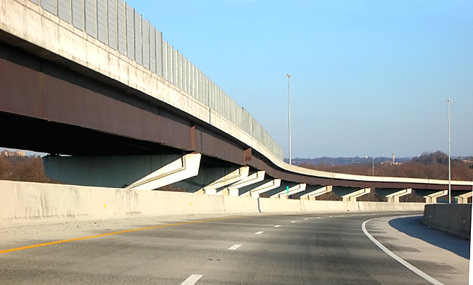
I-95 northbound
express ramp highway, on the roadway. This is on the beginning of the B-609
flyover bridge, which passes over northbound I-395, eastbound I-495 (the Outer
Loop of the Beltway), and 5 future HOV ramps (part of future Phase 8 of the
SIIP that will provide an HOV-to-HOV interchange between I-95/I-395 Shirley
Highway and I-95/I-495 Capital Beltway).
The B-609 flyover bridge is 3,448 feet long. The B-609 bridge is part of the 0095-029-F20,C-505 project, also referred to as Phase 6/7 of the Springfield Interchange Improvement Project (SIIP). |
 |
I-95 northbound express ramp highway, on the roadway of the B-609 flyover bridge. |
 |
I-95 northbound express ramp highway, on the roadway of the flyover bridge. The traffic lanes are each 12 feet wide (the standard for Interstate highways), and the typical right shoulder is 12 feet wide, but there is a section visible to the right where the right shoulder is 20 feet wide for about 600 feet length, and that extra width is to provide an emergency incident storage area for vehicles. The I-95 southbound express ramp highway flyover bridge has a similar feature. |
 |
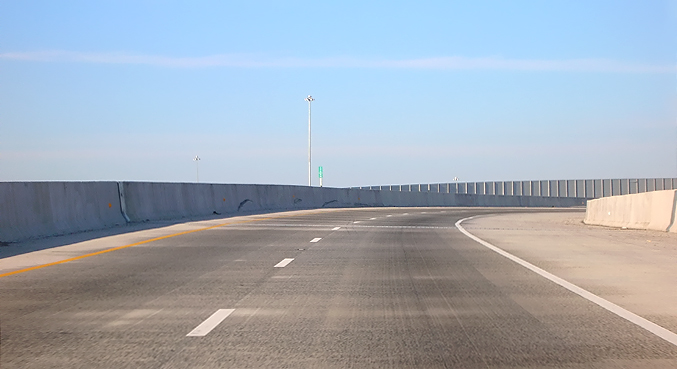
I-95 northbound express ramp highway, on the roadway of the flyover bridge. The roadway begins to curve to the right. |
 |
I-95 northbound express ramp highway, on the roadway of the flyover bridge. The roadway curves to the right. All photos were taken with a 2.2x telephoto lens setting. This ramp highway is an Interstate-standard 2-lane mainline roadway that is easily drivable at 60 mph. |
 |
I-95 northbound express ramp highway, on the roadway of the flyover bridge. The roadway curves to the right. Visible behind this bridge, is the 2-lane I-95 southbound flyover ramp highway from the Beltway Inner Loop (from Wilson Bridge) to I-95 south. |
 |
I-95 northbound
express ramp highway, on the roadway of the flyover bridge. Visible behind
this bridge, is the 2-lane I-95 southbound flyover ramp highway from the Beltway
Inner Loop (from Wilson Bridge) to I-95 south.
The reason for the considerably greater height of the I-95 southbound flyover bridge, compared to the height of the I-95 northbound flyover bridge, is because that 2 of the HOV ramps in future Phase 8 of the SIIP, will pass under the I-95 southbound flyover bridge and over a lower-level roadway, comprising a new middle level of roadway between the currently existing two levels at that point. Those future HOV ramps will not pass under the I-95 northbound flyover bridge. |
 |
I-95 northbound express ramp highway, on the roadway of the flyover bridge. |
 |
I-95 northbound express ramp highway, on the roadway of the flyover bridge, approaching the end of the 3,448-foot-long bridge, which ends a couple hundred feet ahead, visible where light brown concrete bridge deck transitions to the dark grey asphalt pavement. The mainline of the I-95/I-495 Capital Beltway is visible in the distance. |
 |
I-95 northbound express ramp highway, on the roadway, after end of the flyover bridge. |
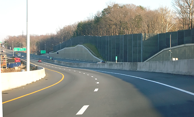 |
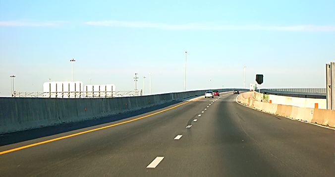
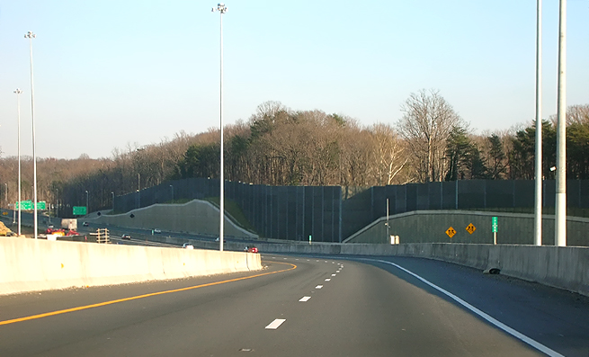
I-95 northbound express ramp highway, on the roadway, approaching the merge into the Outer Loop of the I-95/I-495 Capital Beltway. Notice the high concrete retaining walls to the right of the Outer Loop roadway, those walls were utilized in SIIP major earthwork cut sections to preserve homes near the highway. Notice the high sound barriers behind the concrete retaining walls. |
 |
I-95 northbound express ramp highway, on the roadway, approaching the merge into the Outer Loop of the I-95/I-495 Capital Beltway. Notice to the left, the beginning of the flyover bridge in the 2-lane I-95 southbound flyover ramp highway from the Beltway Inner Loop (from Wilson Bridge) to I-95 south. |
 |
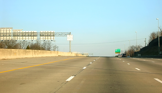
I-95 northbound express ramp highway, on the roadway, approaching the merge into the Outer Loop of the I-95/I-495 Capital Beltway. |
 |
I-95 northbound express ramp highway, on the roadway, approaching the merge into the Outer Loop of the I-95/I-495 Capital Beltway. |
 |
I-95 northbound express ramp highway, on the roadway, approaching the merge into the Outer Loop of the I-95/I-495 Capital Beltway. |
 |
I-95 northbound express ramp highway, on the roadway, approaching the merge into the Outer Loop of the I-95/I-495 Capital Beltway. |
 |
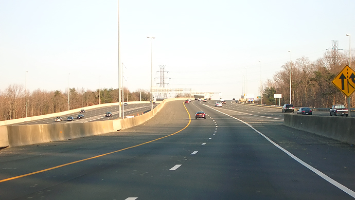
I-95 northbound express ramp highway, on the roadway, approaching the merge into the Outer Loop of the I-95/I-495 Capital Beltway. |
 |
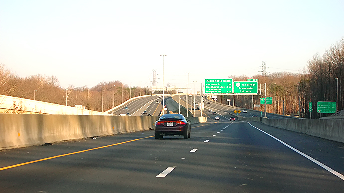
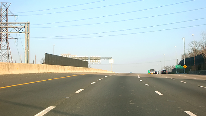
I-95/I-495 Capital Beltway, eastbound on Outer Loop heading toward the VA-613 Van Dorn Street interchange (Exit 173), and the Woodrow Wilson Bridge. |
 |
I-95/I-495 Capital Beltway, eastbound on Outer Loop. The bridge visible ahead in the mainline of the Beltway, passes over the CSXT railroad mainline (which carries freight trains, Amtrak trains, and Virginia Railway Express commuter trains), and passes over the WMATA Metrorail Franconia/Springfield route (Blue Line trains). |
 |
I-95/I-495 Capital Beltway, eastbound on Outer Loop. The bridge being ridden upon, passes over the CSXT railroad mainline, and the WMATA Metrorail line. |
 |
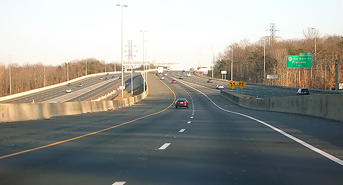
I-95/I-495 Capital Beltway, eastbound on Outer Loop, approaching the VA-613 Van Dorn Street interchange (Exit 173). The Woodrow Wilson Bridge is 5 miles ahead. |
Lead Capital Beltway
dot com article - Springfield Interchange
Project Photos
Lead Roads to the
Future article -
Springfield Interchange Project
All photos by Scott Kozel.
Copyright © 2007 by Scott Kozel. All rights reserved. Reproduction, reuse, or distribution without permission is prohibited.
By Scott M. Kozel, Capital Beltway dot com, Roads to the Future
(Created 1-1-2007, moved to capital-beltway.com on 3-16-2007)