
| Springfield Interchange Project Photos - April 2006 |
The following 13 photos show various aerial views of the Springfield Interchange Improvement Project construction.
These photos were taken on April 28, 2006 by the Virginia Department of Transportation, and are posted here with their permission. Roads to the Future utilized PhotoDeluxe Business Edition to sharpen and brighten all of the photos. Click on the photo to get a large version of the photo. In later versions of Netscape and Internet Explorer, you probably will need to use Full Screen mode (the F11 key can be utilized to swap back and forth between Full Screen and Regular) to see the full size of the large photo without browser-induced image shrinkage. The large photos have sizes ranging from 147 to 248 kilobytes, with most of them being under 223 kilobytes. The photos are in sequence as taken from a helicopter as it made a couple loops around the interchange area.
 |
I-95/I-395/I-495 interchange construction, looking northeast. |
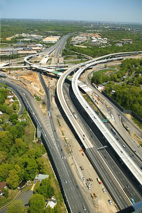 |
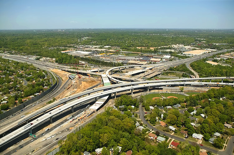
I-95/I-395/I-495 interchange construction, looking north. |
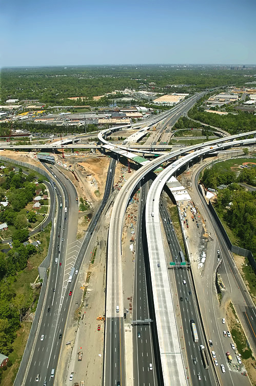 |
I-95/I-395/I-495 interchange construction, looking north. The Beltway (I-95/I-495 and I-495) runs left-right, and Shirley Highway (I-95 and I-395) runs bottom to top. The long elevated bridges are the 2-lane express flyover ramp from the Beltway Inner Loop (from Wilson Bridge) to I-95 south, and the 2-lane flyover ramp from I-95 north to the Beltway Outer Loop (to Wilson Bridge) which opened to traffic on January 19, 2006. |
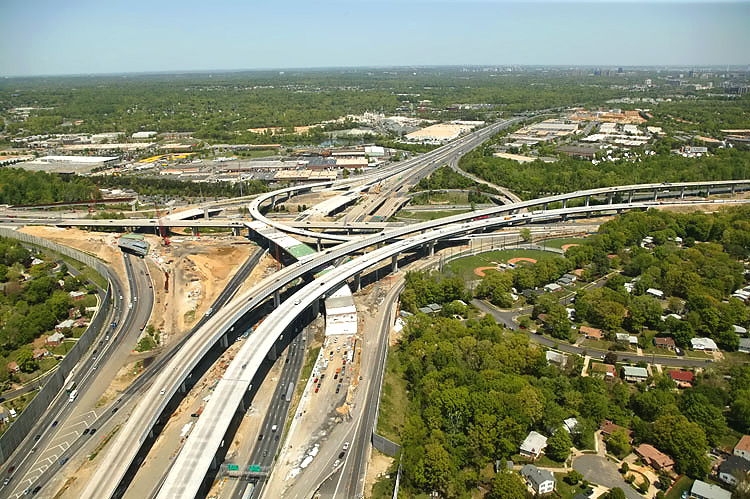 |
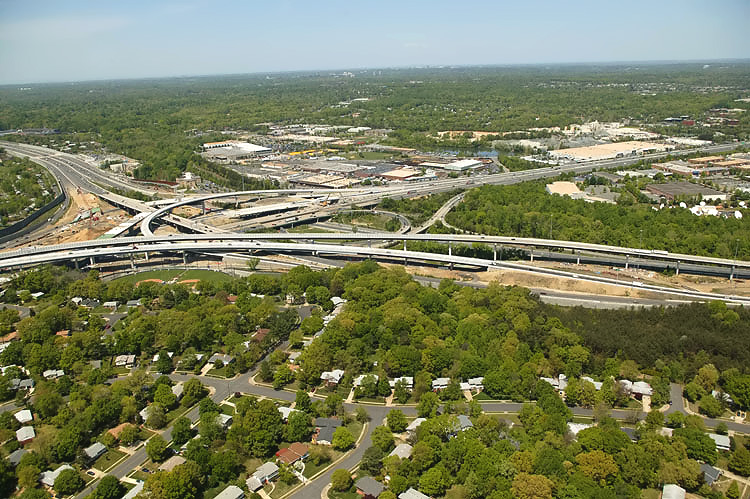
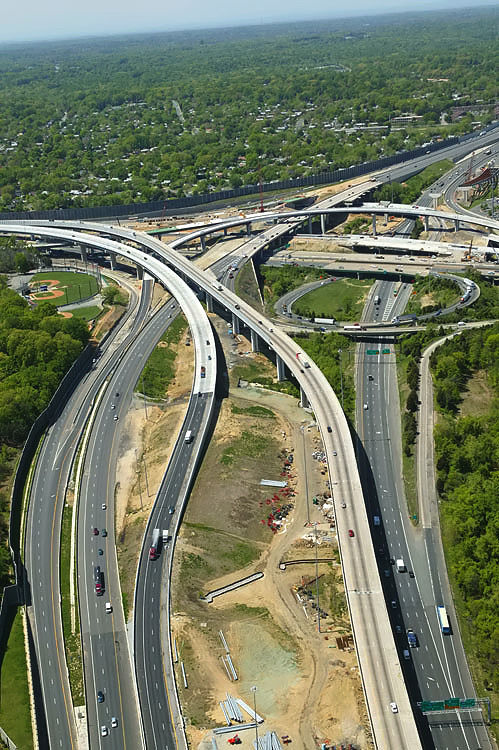
I-95/I-395/I-495 interchange construction, looking north. |
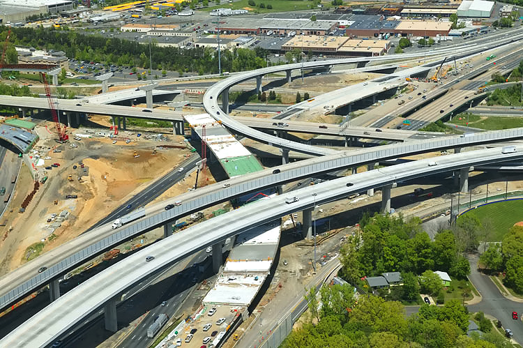 |
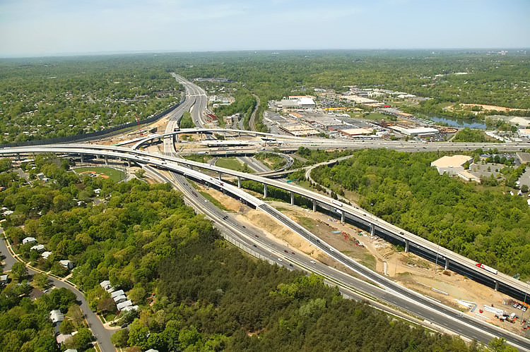
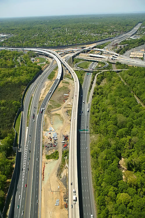
I-95/I-395/I-495 interchange construction, looking northwest. The new I-395 southbound roadway and bridge over the Beltway Inner Loop opened to traffic recently. Notice the under-construction and partially-completed 3-lane northbound flyover ramp from I-95 northbound to the Beltway Inner Loop (toward Tysons Corner). The row of bridge piers for this ramp is visible as they curve to the left. Steel girders will be placed across the tops of the piers and the reinforced concrete roadway deck will be constructed on top of the girders. |
 |
I-95/I-395/I-495 interchange construction, looking northwest. |
 |
I-95/I-395/I-495 interchange construction, looking west. |
 |
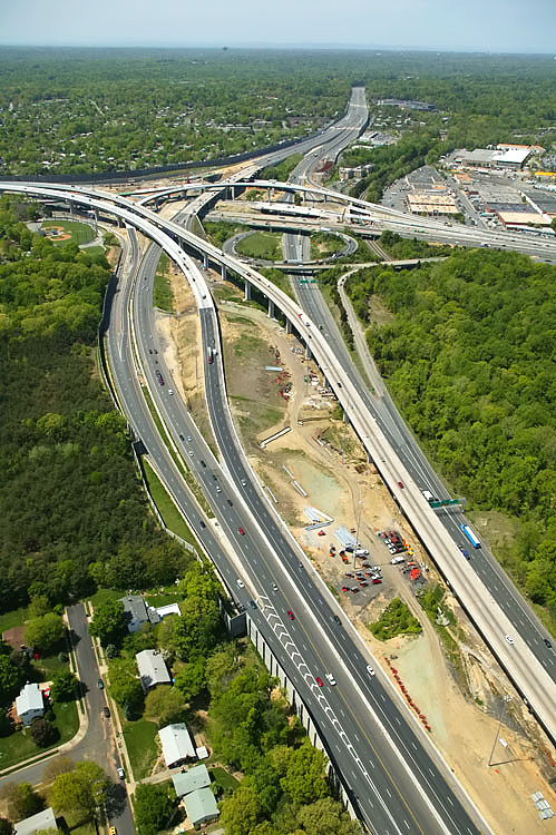
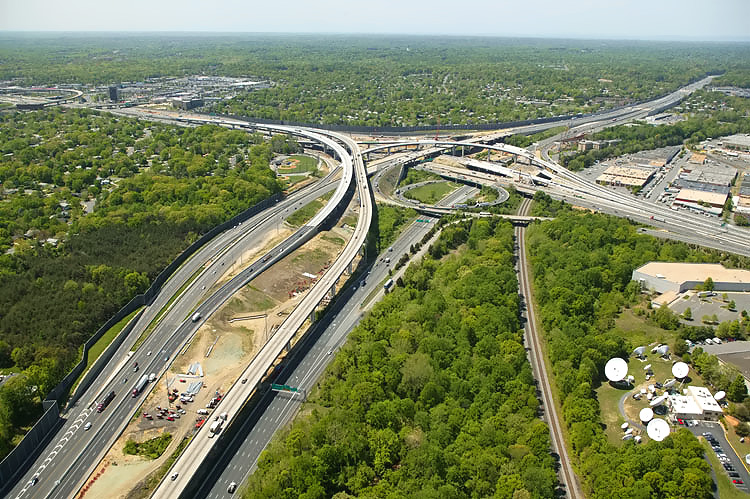
I-95/I-395/I-495 interchange construction, looking west along the Beltway toward Tysons Corner. The long elevated bridge is the 2-lane express flyover ramp from the Beltway Inner Loop (from Wilson Bridge) to I-95 south. The elevated bridge in the left of the photo, is the 2-lane express flyover ramp from I-95 northbound to the Beltway Outer Loop (to Wilson Bridge), which opened to traffic on January 19, 2006. |
 |
I-95/I-395/I-495 interchange construction, looking west. |
 |
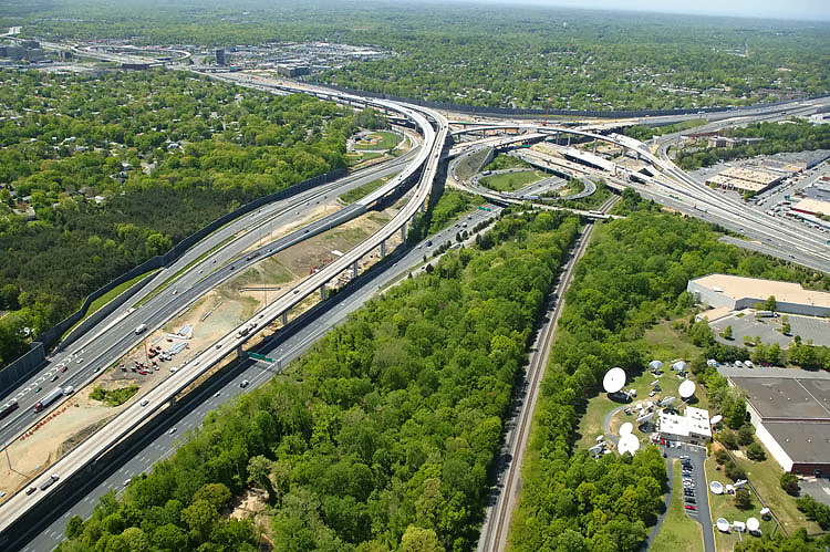
I-95/I-395/I-495 interchange construction, looking west. Notice the two flyover bridges that connect the I-95 through traffic movement between the Beltway and Shirley Highway. |
 |
I-95/I-395/I-495 interchange construction, looking southwest. |
 |
I-95/I-395/I-495 interchange construction, looking southwest. |
 |
I-95/I-395/I-495 interchange construction, looking southwest. The 2-track mainline of the Norfolk Southern Railroad can be seen, and in addition to freight trains it also carries Virginia Railway Express (VRE) commuter rail trains. The Springfield urban area and the I-95/VA-644 interchange is visible in the upper left of the photo. |
Lead article - Springfield Interchange Project Photos
Copyright © 2006 by Scott Kozel. All rights reserved. Reproduction, reuse, or distribution without permission is prohibited.By Scott M. Kozel, Capital Beltway dot com, Roads to the Future
(Created 5-1-2006, moved to capital-beltway.com on 3-16-2007)